Norway lakes. Rivers and lakes of Norway Norwegian lake 5 letters t
28-08-2015, 21:08
- Altevatn
Lake in Norway. Located in the county of Troms. The lake area is 79.7 km². Located at an altitude of 489 m above sea level. Nai great depth 99 m. It is the eleventh largest lake in the country. Lake Altevatn is 35 km long and on average about 2 km wide. The Barduelva River originates from the lake. - Bannack
Lake in Norway. Located in the municipalities of Kviteseid and Tokke. The lake area is 26.4 km². Located 72 m above sea level. The waters of the lake are used by a local hydroelectric power station for energy production. Maximum depth 325 m.Total length coastline- 60.16 km. - Bossoyavrre
Lake on the border of Norway and Russia in the Pasvik river valley. The Russian part of the lake belongs to the administrative part of the Pechenga district of the Murmansk region, the Norwegian part to the commune of Sør-Varanger fylke Finnmark. The area of the lake is 16.4 km², of which 8.11 km² is in Russia. Located 51.9 m above sea level. It is a backwater for the Skugfoss hydroelectric power station. - Braimsvatn
Lake. Located in Norway. Located in the municipality of Gloppen. The area is 22.52 km². Located at an altitude of 62 m above sea level. The maximum depth is 278 m. The total length of the coastline is 42.97 km. - Byugdin
Lake in Norway, in Oppland county. Located on the territory mountain range Yutunheimen. Its mirror area is 46 km². The lake stretches from east to west for 25 km, its width is small. Located at an altitude of 1048 m above sea level. The greatest depth is 215 m. - Byglansfjord
Lake. Located in Norway. Located in the municipality of Bygland. The area is 32.49 km². Located at an altitude of 203 m above sea level. The total length of the coastline is 87.57 km. - Vouvatusjärvi
Lake on the border of Norway and Russia in the Pasvik river valley. Administratively included in Murmansk region Russia and the commune of Sør-Varanger in Norway. The area is 33.87 km², of which 4.88 is in Russia. Located 51.9 m above sea level. - Grensevatn
Lake on the border of Norway and Russia in the Pasvik river valley. Administratively included in the Murmansk region of Russia and the commune of Sør-Varanger in Norway. Located at an altitude of 70.3 m above sea level. - Drevvatnet
A lake located in the commune of Vefsn, Nordland county in Norway. The area is 4.93 km². Located at an altitude of 48 m above sea level. The total length of the coastline is 11.74 km. - Yieshyavrre
Lake in the north of Norway in the county of Finnmark. The name of the lake is of Sami origin and means "high water". The lake lies at an altitude of 390 m above sea level on the Finnmarksvidda plateau (Finnmarken), 40 km southeast of the southern tip of the Altafjord and 50 km southwest of the southern tip of the Porsangerfjord. The lake area is 68.4 km². - Cattolampolo
Lake on the border of Norway and Russia in the Pasvik river valley. Administratively included in the Murmansk region of Russia and the commune of Sør-Varanger in Norway. The area is 5.49 km², of which 1.24 is in Russia. Located 51.9 m above sea level. The lake belongs to the Barents Sea basin and is connected with it by the Pasvik River. The lake is fed mainly by snow and rain. The coastal relief is flat. The woodlands on the banks are mainly birch and pine. On east coast the Vakkerstrykene mountains stand out. There are several islands on the lake, the largest: Grassholmen and Sauholmen. The lake is connected up the Pasvik river with Lake Vouvatusjärvi, and down the river with Lake Bossoyavrre. - Klistervatn
Lake on the border of Norway and Russia in the Pasvik river valley. Administratively included in the Murmansk region of Russia and the commune of Sør-Varanger in Norway. Area 17.2 km², of which 12.75 in Norway. Located at an altitude of 21 m above sea level. - Kontiojärvi
Lake on the border of Norway and Russia in the Pasvik river valley. Administratively included in the Murmansk region of Russia and the commune of Sør-Varanger in Norway. The area is 17.2 km², of which 4.45 in Russia. Located at an altitude of 21 m above sea level. - Kroederen
Lake located in the province of Buskerud, Norway. Located north of the village of the same name. Area 42 km². Located 132 m above sea level. The maximum depth is 119 m. The total length of the coastline is 113.81 km. The largest tributary is the Hallingdal, the largest outflow is the Snarumselva. - Langwatn
A lake located in the commune of Feuske, Nordland county in Norway. The area is 5.46 km². Located at an altitude of 127 m above sea level. The total length of the coastline is 25.82 km. - Lomivatn
A lake located in the commune of Feuske, Nordland county in Norway. The area is 11.43 km². Located at an altitude of 709 m above sea level. The total length of the coastline is 21.95 km. - Meswatn
One of the largest lakes in the southeast of Norway, with an area of over 78 sq. km. Located in the Telemark county. Several archaeological sites are scattered along the shores of the reservoir. ancient man the era of the stone age. The waters of the lake are used by a local hydroelectric power station for energy production. - Mjosa
The largest lake in Norway. Located in the southern part of Norway, about 100 km north of Oslo. The main river flowing into the lake is the Gudbrannsdalslogen in the north; the main outflowing river is the Worma (tributary of the Glomma) in the south. - Nedrevatn
A lake located in the commune of Feuske, Nordland county in Norway. Area 4.80 km². Located at 0 m above sea level. The total length of the coastline is 14.06 km. - Nisser
Alpine lake in the southwestern part of Norway. Located in the municipality of Nissedal, Telemark county. It is the 13th largest in the country in terms of a water surface area of 76.30 km², volume - 7.19 cubic meters. km, and the greatest depth is 234 m. - Rannsfjorden
The fourth largest lake in Norway. Located in the county (county) of Oppland and the borders of the municipalities of Gran, Eunaker. The lake area is 138 km². It is located 135 m above sea level. The volume of the lake's water is estimated at about 7 km². The maximum depth is 120 m. The total length of the coastline is 202.9 km. - Rössvatn
The second largest lake in Norway after Mjosa. Located in Nordland county, in the north of the country. The lake area is 219 km². It is located at an altitude of 374 m above sea level. The volume of the lake's water is estimated at about 15 km². The maximum depth is 240 m. The total length of the coastline is 256.3 km. - Rugen
Lake on the border between Sweden and Norway. Most are located in the Swedish county of Jämtland, a smaller part in the Norwegian county Hedmark and Sør-Tronnelag. The lake area is 35.12 km². The Norwegian part of the lake lies in national park Femunnsmark, Swedish is located in the Rugensky nature reserve. - Salmijärvi
Lake on the border of Norway and Russia in the Pasvik river valley. Administratively included in the Murmansk region of Russia and the commune of Sør-Varanger in Norway. The area is 32.51 km², of which 23.12 are in Russia. Located at an altitude of 21 m above sea level. It is a backwater for the Skugfoss hydroelectric power station. - Skugwatn
Lake on the border of Norway and Russia in the Pasvik river valley. Administratively included in the Murmansk region of Russia and the commune of Sør-Varanger in Norway. Located 31 m above sea level. The lake belongs to the Barents Sea basin and is connected with it by the Pasvik River. The lake is fed mainly by snow and rain. The coastal relief is mostly low-lying and marshy. The woodlands on the banks are mainly birch and pine. The lake is a backwater for the Melkefos hydroelectric station. - Skugsfjordvatnet
The lake, located in Norway, on the island of Ringvasøy in Troms county, has an area of 13.62 km², making it the largest island lake in Norway. The lake is about 10 kilometers long, surrounded by swamps and forests. It is located at an altitude of 20 meters above sea level. - Sperillen
Lake in Norway. Located in the municipality of Ringerike in the county of Buskerud. The area is 37 km². Located at an altitude of 150 m above sea level. The maximum depth is 123 m. The total length of the coastline is 68 km. - Tutak
Lake. Located in Norway. Located in the municipality of Vigne. The area is 36.59 km². Located at an altitude of 687 m above sea level. The maximum depth is 306 m. The total length of the coastline is 70.48 km. This lake is the 10th deepest lake in Norway. - Tyuin
Alpine lake in the southwestern part of Norway. Located in the mountains at an altitude of more than 1072 m above sea level in the commune of Wang fühlke Oppland. The surface area is 33.02 sq. km., and the volume of water is 0.313 cubic meters. km. - Tyrifjord
Lake in Norway. Located in Buskerud county. It is the fifth largest lake in the country. The area is 136 km². The volume of the lake is approximately 13.1 km². Located at an altitude of 62 m above sea level. The greatest depth is 295 m. - Femunn
The third largest lake in Norway after Mjøsa and the Rössvatn reservoir; before the reservoir was filled in the 1960s, it was the second lake in the country. It is located in the east of the country, near the border with Sweden, in a poorly populated area: there is not a single significant settlement on the lake. The lake area is divided between the municipality of Engerdal in the Hedmark county (southern part) and the commune of Røros in the district of Sør-Trøndelag (northern part). The Trysiljelv River flows out of the lake, which changes its name to Klarelv on the border with Sweden and then flows into Lake Venern. - Fossevatn
Lake on the border of Norway and Russia in the Pasvik river valley. Administratively included in the Murmansk region of Russia and the commune of Sør-Varanger in Norway. Located at an altitude of 21 m above sea level. The lake belongs to the Barents Sea basin and is connected with it by the Pasvik River. The lake is fed mainly by snow and rain. - Helin
Lake. Located in Norway. Located in the communes of Westre Slidre and Vang. The area of the lake is 9.47 km². Located at an altitude of 870 m above sea level. The waters of the lake are used by a local hydroelectric power station for energy production. - Heyuhenjärvi
Lake on the border of Norway and Russia in the Pasvik river valley. Administratively included in the Murmansk region of Russia and the commune of Sør-Varanger in Norway. The area is 7.29 km², of which 2.35 in Russia. Located at an altitude of 52.9 m above sea level. - Hornindalsvatnet
The deepest lake in Norway and throughout Europe, depth 514 m. The surface of the lake lies at an altitude of 53 m above sea level, therefore, its bottom is at around 461 m below sea level. In the 1990s, Telenor, Norway's former national telephone company, estimated the lake to be 612 meters deep when it laid an optical cable along the bottom of the lake. Thus, modern official data can significantly underestimate the true value of the maximum depth of the lake. The volume of the lake is approximately 12 km². - Everuman
A lake located in the north of Sweden, on the border with Norway, in Lapland. A small part of the lake, located in Norwegian territory, is called Umbukta in Norway. The area is 84.47 km², the average depth is 20.5 m.
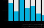
- a northern country with unique natural properties. Pristine forests, clean rivers and deep lakes flowing at the foot picturesque mountains, make it attractive for all categories of tourists. According to some estimates, more than 400 thousand freshwater lakes of different sizes are located on the territory of this country, and each of them deserves attention.
Origin and features of Norwegian lakesMost of the water bodies of this country have arisen as a result of the melting of glaciers. Despite their common origin, all lakes in Norway vary in shape, length, depth and biodiversity. The reservoirs flowing along the mountain range are characterized by great depth, uneven bottom and many branches. The lakes located in the southern plains of Norway are shallower but larger in area. As a rule, wide, full-flowing ones flow from them.
The largest lakes in Norway are located in the south - in Ostlan. Good drainage in flat areas has resulted in a large number of low-lying marshes and wetlands.
In terms of terminology, the following types of lakes are distinguished in Norway:

List of largest lakes in Norway
On the territory of this northern country scattered a huge number of closed reservoirs ranging from several tens to several hundred square kilometers... The list of the largest lakes in Norway includes:
- (365 sq. Km);
- Rossvatnet (218 sq. Km);
- Femund (203 sq. Km);
- Randsfjorden (139 sq. Km);
- Tirifjorden (138 sq. Km);
- Snasavatnet (121 sq. Km) and others.

The total area of all these reservoirs is approximately 17,100 sq. km, and their total volume reaches 1200 cubic meters. km. The most big lake Norway, Miesa, extends into three Norwegian counties at once - Akershus, Oppland and Hedmark. Along its coast are the towns of Jevik, and.
The list of the deepest bodies of water in the country includes (514 m), Salsvatnet (482 m), Tinn (460) and Miesa (444 m). The first, by the way, is the deepest not only in Norway, but throughout Europe.
The most picturesque lake in Norway can be safely called (Bondhus), located in. It was formed as a result of the melting of the glacier of the same name. The list of the longest lakes in Norway tops. With a width of 6 km, it stretches from east to west for a distance of 204 km.

Border lakes of Norway
In the north-west of the country there is a small reservoir Treriksröset. This lake is notable for being located on the border of Norway, Sweden and Finland. In the place where the borders of the three states converge, a stone memorial sign was erected in 1897. For 120 years, the monument has changed more than once. Now it is a domed artificial one, which often becomes the object of photo shoots among tourists.

There are many lakes in Norway and on the border with Russia. This category includes the reservoirs of Bossoyavrre, Vouvatusjärvi, Grensevatn, Cattolampolo, Klistervatn, etc.
Norway is a country in the west and extreme north of the Scandinavian Peninsula in Northern Europe... Its area is 385.2 thousand km, together with 50 thousand islands in the Atlantic and Arctic oceans. Most of the country is occupied by the Scandinavian mountains, as a result of which most of the rivers flowing through its territory are mountainous in nature, they are rapids, swift, deep, have a relatively short length, there are many waterfalls on them. About 5% of Norway's territory is occupied by lakes of medium or small size, located mainly in the south of the country, in total there are about four hundred thousand.
Major rivers of Norway
Norway is distinguished by the presence of a dense river network, rivers have a considerable depth, narrow valleys, they have many rapids and drops, they are deep all year round... Their high level falling makes them very promising for power generation. The largest rivers flow in the southeastern part of the country, they are Glomma, Klarelven, Tanaelv, Drammenselva, Logen (Numedalslogen), Otra, Altaelv.

It is the longest river in Norway, its length is 604 km, the catchment area is 42441 km 2 (13% of the territory of Norway). It flows in the east of the country, originates in Lake Eursund, and flows into the Oslofjord Bay of the Norwegian Sea. A number of power plants have been built on the river.

It flows from Lake Rugen, located on the border of Norway and Sweden at an altitude of 662 meters above sea level. Its length is 406 km, the catchment area is 11,820 km 2. It originates in Sweden, flows through the territory of Norway, then again turns to Sweden and flows there into Lake Venern, thus the Klar-Elven-Göta-Elv river system is the longest on the territory of the Scandinian Peninsula (more than 750 km). Previously, the river was used for timber rafting.

The river on the border of Norway and Finland is 348 km long and has a catchment area of 16374 km 2. Formed by the confluence of the rivers Inarijokka and Karasjokka 12 km east of the Norwegian city of Karasjok. It flows into the Tanafjord in the Barents Sea, forming a wide delta called the largest untouched river delta in Europe. The river is home to large Atlantic salmon, its commercial catch is of great economic importance in the country's economy.

One of the largest rivers in Norway, its length is 308 km, the catchment area is 17 thousand km 2. It flows from Lake Turyford in Norway and flows into the Drams-Elv rivers near the town of Drammen, located 40 km from the Norwegian capital Oslo.
Logen (Numedalslogen)

It flows in the southeast of the countries, has a length of 359 km, the catchment area is 5.5 thousand km 2. Its source is at the Hardangervidde mountain chamber in western Norway, flows from west to south, empties into the North Sea.

The most large river southern part of the country, length - 245 km, catchment area - 3.7 thousand km 2. It flows out of Lake Breidvatn and flows into the Skagerrak Strait, which connects the North Sea with the Baltic Sea. In the vicinity of the river, 12 power plants have been built, producing electricity for the entire southern part of Norway.

It flows in the north of the country, its length is 229 km, the basin area is 8.9 thousand km 2. It flows into the Alta Fjord near the town of Alta on the Norwegian Sea coast.
Major lakes in Norway
Norway can be safely called a country of lakes, on its territory there are about 400 thousand small, elongated lakes of glacial origin and occupying almost 5% of the entire area of the state. Largest lakes- Mjosa, Femund, Rössvatn, Rannfjorden, Tyrifjord.

The largest lake in the country, its area is 365.19 km 2, length - 117 km, maximum width - 15 km, depth - up to 468 meters. Located in the southern part of Norway, one hundred kilometers north of Oslo. The Gudbrannsdalslogen river flows into the north, flows out in the south - the Worma (a tributary of the Glomma).

The second largest lake in Norway after Mjosa, area - 219 km 2, length of the coastline - 256.3 km, maximum depth- 240 meters. Located in the northern part of the country.

The third largest lake in Norway after Mjosa and Rössvaten, an area of 203.5 km 2, the length of the coastline is 235 km, the maximum depth is 131 meters. Located in the east of the country, in uninhabited areas bordering Sweden. The Trysiljelv River flows out of the lake, and later flows into Lake Venern in Sweden. The lake is rich in valuable commercial fish species of the salmon family.

The fourth largest lake in Norway after the above-described lakes, the area is 138 km 2, the length of the coastline is 202 km, the maximum depth is 120 meters. Located in the east of the country.

The fifth largest lake in Norway, its area is 136 km 2, the maximum depth is 295 meters. Located in the province of Basquerud ( Eastern country).