Based on Outlander: Mystical Stone Circles in the Scottish Highlands. Standing stones of Craig-na-Doon
The Ring of Brodgar at Orkney is believed to date back to 2500 BC and 2000 BC. e., but the age is not accurate, because scientists have never accurately determined it.
Today, only 27 stones from the circular row have survived (earlier there were about 60). Megaliths are located in a circle and are buried up to 3 m deep and 9 m wide.
From the 18th century, huge stones gradually began to fall. So, in 1792 the ring consisted of only 18 megaliths, 8 - lay on the ground, a few years later two more stones fell. Some stones have survived only in fragments.
Scientists have not figured out the feasibility of this building. In the 70s, the last studies of the structure were carried out, and in the center of the Brodgar Circle they were not carried out at all.
There are many speculations about the meaning of the buildings. Some scientists believe that the megaliths were used as observatories, others - that this is a place for ritual procedures, and others suggest that the megalithic structures served as a place for meetings.
There are many assumptions, but which one is correct? Another mystery of the complex, of course, is the question of its origin. The Vikings were absolutely sure that the megaliths were set by the gods and heroes - giants.

Our researchers look at this issue more radically and agree only on one opinion: a large number of people and well-coordinated, long-term and strenuous work inherent in a highly organized society were required for a construction of this kind. Just to dig a ditch in the rock, 7 meters wide and 380 meters long, required more than 80 people, who had to work 100 hours and 100 days. The moat has survived to this day, although it is no longer as deep as it was before.

There are many legends around this place. In the old days, the monument was called the Temple of the Sun, and the male part of the betrothal ceremony was held here. Young people first went to the Temple of the Moon, and the bride took the oath of allegiance, then they went to the Temple of the Sun, where the young man had already taken a vow. Then the couple went to the Stone of Odin, and the two of them took the oaths. In the huge monolith there is a hole through which young people join their hands - this is Odin's oath. Violating it is considered a huge sin.

There is more than one belief associated with this stone. To see all this beauty, and to get acquainted with all the legends of the region, and maybe to perform a betrothal ceremony, you should definitely visit Scotland and the small village of Orkney.

However, not everyone liked such an increased attention to stones. local residents... So, shortly after Walter Scott's visit to a local attraction, the farmer Ferry-Looper (foreigner) decided to dismantle the stone and use it in the construction of a cowshed. One stone was dismantled and the other was simply destroyed. By his actions, the farmer caused enormous damage to the complex. Residents were outraged by this behavior and even wanted to burn down his house. The farmer apologized for what he had done, but the damage to the building was not covered.

Since 1906, the Brodgar Circle has been taken under state protection, and is also included in the UNESCO Heritage List. It is one of the four largest Neolithic Monuments in the Orkney Islands: Meishowe Burial Chamber, Stennes Stones, Skara Brae Settlement and Brodgar Circle.
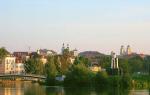
Besides Edinburgh, Glasgow and unique nature Highland, Scotland includes about 800 islands. Most of them are small coastal land plots that become islands during certain periods of ebb and flow, but there are also quite impressive territories covered from all sides. sea waters... Each of the islands of Scotland is unique small world in the north of Europe. But from the point of view of the history of megalithic civilizations, in this region it is worth looking atMainland.
It is the largest of the Shetland Islands. It is connected by bridges to the small, narrow islands of Trond, West Burr and East Burr. The Shetland Islands have been inhabited since time immemorial. One of the most important sites is located on this island. World heritage UNESCO - a group of monuments of the Neolithic era The Heart of Neolithic Orkney (literally "Heart of the Neolithic"). Their age is about 4-5 thousand years.
Lerwick - administrative center Shetland Islands, a thriving city located in a sheltered natural harbor. In the former capital, Skelloway, 10 km from Lerwick, there is Skelloway Castle, built in 1600. And in the western part of the island you can find Neolithic monuments of the Orkney Islands, prehistoric ruins, including a dolmen chamber and a well-preserved Neolithic settlement.
Megaliths of Stennes (English Standing Stones of Stenness) - Neolithic cromlech on Mainland, big island in the Orkney archipelago, Scotland.

Located on the southwestern promontory between Loch of Stenness and Loch of Harray. The monument is included in the UNESCO World Heritage List as one of four in the site of the Neolithic Monuments in the Orkney Islands.
Midhowe - a large tomb (type - chamber cairn) of the Neolithic era, located on the southern coast of Rousey Island in the Orkney Islands in Scotland. The name Midhau comes from a large Bronze Age broch to the west of the tomb. Together, the tomb and broch are part of a large complex of ancient structures on the banks of the Eynhallow Sound, which separates Rousey from Mainland, the largest of the Orkney Islands.

1.2 km to the north-west is the Brodgar Circle, a little to the east - the monuments of Midhow and Barnhouse, 3 km to the west - the tomb of Ansten, and 10 kilometers to the north-west - Skara Bray.
Barnhouse Settlement ) Is a recently discovered Neolithic settlement on the shores of Loch of Harray on Mainland Island in the Orkney Archipelago, not far from the Stennes megaliths. Foundations of at least 15 different houses have been found here. The houses are reminiscent of the design features of Skara Bray - they also have a stove in the center, beds against the walls and stone cabinets for accessories, however, they differ in that the houses are separate from each other, and not in groups. Also found here are fluted pottery similar to that found at the Stennes megaliths and at Skara Brae, as well as items made of flint and other stones and one obsidian tool, presumably from the Isle of Arran. The largest of the buildings had a square room, the side of which was 7 m long, and the walls were about 3 m thick.The entrance to the building was directed to the north-west, thus, in the middle of summer the sun was shining through it, which resembles the construction of some chamber cairns ...

Dwarfie Stane - letters. "Dwarf stone" in Scottish dialect in English- a megalithic burial ground at the turn of the 2-3 millennium BC. BC, carved from a giant solid block of red limestone. Located in a glacial valley on Hoy Island in the Orkney Archipelago in Scotland. Initially, a stone slab blocked the entrance to the tomb from the west, but now it lies on the ground in front of the burial ground. The burial ground consists of an entrance corridor with a chamber located in the north and south walls. The monument is unique for northern Europe, but it has analogues among the graves of the Neolithic or Bronze Age in the Mediterranean.


Ansten (Onsten, Onston), eng.Unstan (Onstan, Onston) - Neolithic cairn tomb on Mainland, Orkney, Scotland. Built on a promontory jutting into Loch of Stennes near Howe, northwest of Stromness. By design, Ansten is an unusual hybrid of two types of chamber cairns. In addition, Ansten ceramics were discovered for the first time in Ansten.Judging by finds from nearby graves, both they and Ansten were built between 3400 - 2800. BC e. In Ansten, human remains were found - two skeletons in a crumpled position in the side chamber, several more in the main chamber and several bones lying in disarray throughout the tomb. In addition, animal bones and coal have been found, and it is likely that Ansten continued to be used in the 2nd millennium BC. e. The arrowhead found in the tomb has a shape characteristic of the bell-beaker culture that existed during the late Neolithic and Bronze Age.


Stennes -

The name Stennes comes from the Old Norse language and means "stone border (fields)". The Watch Stone is outside the circle, next to the modern bridge leading to the Brodgar Circle. The stones are thin slabs about 300 mm thick. Four of them, up to 5 meters high, were originally elements of an elliptical cromlech made of 12 stones with a diameter of about 32 meters, built on a flat area with a diameter of 44 meters, surrounded by a moat. The moat goes deep into the rocky soil to a depth of 2 meters, its width is 7 meters, it was surrounded by an earthen embankment with one passage on the north side. The entrance faces the Neolithic settlement of Barnhouse, discovered not far from Loch of Harray.
The Watch Stone is located outside the circle, to the northwest. Its height is 5.6 meters. Other smaller stones include a square stone structure in the center of a circular platform, where cremated bones, coal and pottery were found, and animal bones were found in a moat around. The pottery found here is similar to the pottery found at Skara Brae and Midhau, thus the Stennes megaliths date back to at least 3000 BC. e.
Circle of Brodgar or Brogar (eng.Ring of brodgar , Brogar) is a Neolithic cromlech in Mainland, the largest island in the Orkney archipelago, Scotland. Located on a narrow isthmus between the Loch of Stennes and Loch of Harray, sometimes called the "Brodgar Bridge". The monument is included in the UNESCO World Heritage List as one of four in the site of the Neolithic Monuments in the Orkney Islands. 1.2 kilometers southeast of Brodgar Circle are the Stennes Megaliths, Meadhow and Barnhouse Monuments, and Skara Brae is 10 kilometers northwest. Probably built between 2500 and 2000 BC. e., but the exact age of this large-scale megalithic structure unknown, as it has not yet been investigated by archaeologists. Previously, 60 megaliths stood in a circle around the site with a diameter of 104 m. Only 27 of them have survived to this day. Brodgar's circle - the third largest cromlech British isles.


Skara Brae - a large and well-preserved Neolithic settlement discovered near the Bay of Skaill on west coast Mainland Islands, Orkney Islands, Scotland. Consists of 8 houses, combined in blocks, which were inhabited during the period from about 3100-2500. BC e.


Knap of Howar - exceptionally well-preserved Neolithic buildings on Papa Westray Island in the Orkney Archipelago in the north of Scotland. Considered one of the most ancient examples of surviving stone houses in northern Europe... According to radiocarbon analysis, they were used in the period 3500 - 3100 BC. e.


Carlin stone Witch stone

Clach an truiseil

Easter aquhorthies


Lewis and Harris is one of the largest British Isles, after Great Britain and Ireland. He regularly appears in the top or even in the first place in various ratings. best islands Europe. Here you will find the most picturesque landscapes and the spirit of true Scottish culture.

In Lewis, the northern part of the island, tourists admire the legendary stones of Callanish (Callanish), which is commonly called "Scottish Stonehenge".
Isle of Lewis is a fairly desolate place about 130 km north of Barra Isle. Callanish consists of a ring containing 13 stones, with one central stone, an alley and other ordered stones. It has been suggested that the direction of the alley coincides with the direction of the Capella rise point and that 4 stones to the east of the alley indicate the Pleiades rise point. But in fact, a star rising above the horizon at sea level, even under the most favorable atmospheric conditions, seems to be about 6 orders of magnitude fainter than it is in reality. And the Capella glows very faintly at sunrise (it is hard to see), and the Pleiades are not visible to the naked eye at all. In addition, it was believed that one of the directions could be associated with the Moon. If so, then Callanish is the first structure on the list of megalithic objects that could have been used in the same way as Stonehenge.

A little later, using a rectangular grid, measurements were made of the position of all Callanish stones. Then the calculations of the azimuths of all the lines connecting these stones in pairs were performed. In Callanish, 10 destinations were found related to extreme positions Sun and moon at sunrise and sunset.

Moreover, as can be seen from the plan, they are the main ones in the entire structure. The latitude at which Callanish is located is of interest in its own right.

It almost coincides with the "Arctic Circle" for the Moon, i.e. with a latitude at which the moon does not rise above the southern horizon at its southernmost declination. The megalithic edifice is 1.3 ° south of the critical latitude, and every 18 or 19 years during the summer solstice, the full moon stands 1 ° above the southern horizon. The row of stones (from the 24th to the 28th) indicates the points of rising, culminating and setting of the moon on days when it is lowest above the horizon line. On the day of the winter solstice, the moon sinks beyond the summit of Mount Klishema (the most high mountain Harris Peninsula) and the axis of the alley points to it. It is possible that the coincidence of the moon's setting and the top of the mountain was of great importance for the construction of Callanish.
Of greatest interest to scientists is the eastern triangle with the apex formed by stones 30, 33 and 35. If you look from point 35, the fluctuations in the declination of the winter moon from + 18.7 ° to + 29 ° are indicated by stones from the 30th to the 33rd. On average, the winter moon is three years in each of the intervals between these stones. Stone 35 together with the second stone represent three different lunar directions.

In general, most stones mark two lunar or solar directions. Therefore, a theory was put forward that the arrangement of stones in Callanish is not coincidental with astronomical directions. The height error when placing stones is only 0.5 °. This accuracy is much higher than at Stonehenge, but this is mainly due to the higher latitude.

Most puzzling is how the Stone Age British used Callanish. Most likely, it was used as a calendar, although it is possible that it could be used to predict eclipses. On closer inspection of Callanish, it turned out that he could be used as a machine for counting days. In this, the structure has a lot in common with Stonehenge - openaxiom.ru. Due to the fact that the stone ring at Callanish does not define any solar or lunar directions, it can be concluded that it plays the same role as the Aubrey holes and the Sarsen ring of Stonehenge. The Ring in Callanish contains 13 stones (12 large and 1 small). These numbers form the basis of the lunisolar calendar and could be used to count the so-called short years, containing 12 lunar months, and long years, consisting of 13 lunar months. A similar system is still used in the Hebrew calendar.
The clerics of Callanish were able to observe and predict eclipses, although the evidence for this is not as convincing as for Stonehenge. The rising of the winter moon over stone 34 would clearly indicate that an eclipse was imminent. Lines indicating directions to the points of sunrise and moonset during equinox periods also indicate interest in winter and summer eclipses. When the Sun rose from stone 20 to stone 23, and the Moon set in the direction from stone 30 to stone 33, an eclipse could occur during the summer or winter solstice. Thus, the priests of Callanish were able to predict eclipses from observations they made at different times throughout the year.

Still for the prediction of all lunar eclipses at a given time of year, a 56-year observation cycle would be required, consisting of intervals of 19, 19 and 18 years. The priests could well make such observations if they excluded stone 34 when going around every third circle, counted relative to the main direction. It is possible that the priests of Callanish knew the 56-year cycle, but they did not openly show their knowledge, as did the builders of Stonehenge, who erected a ring with 56 marked positions. Although Callanish also has an astronomical orientation of the lines, its use as a calculating machine is just an assumption. But the excavations at Callanish has not yet been completed and there is no certainty that only 19 stones were installed in the alley and that the ring consisted of 13. All that has been said indicates that when Callanish was created, its builders were as accurate as the authors of Stonehenge. but they clearly lacked scientific knowledge.

On November 30, 1996, in Edinburgh, 10,000 people welcomed the return of one of the main Scottish artifacts, the Skunk Stone. A procession of priests and soldiers accompanying the stone passed through the streets of the city. This stone was placed next to the Scottish royal regalia in Edinburgh Castle... This review has a fascinating history of a stone that has been greeted with such honors.

It may seem strange to some, but this unremarkable block of carved sandstone is one of the most significant historical artifacts. It is known by many names: Skun's Stone, Coronation Stone, Jacob's Stone Pillow and under its Celtic name “Lia Fail” (speaking stone). For centuries, this block of sandstone was used for the coronation of the rulers of Scotland, and later the kings and queens of the entire United Kingdom.
Interestingly, each name has its own history of the origin of this stone. Which version to believe is everyone's choice.

According to one of the most popular legends, the Stone of Destiny is associated with Fergus, the son of Laarne mac Erk, the first Scottish king in Scotland. He brought the stone from Ireland to Dal Riada (the area now called Argyll), where he was crowned. Some historians speculate that this stone, brought by Fergus, is associated with "Leah Fail" - the sacred stone on which the High Kings of Ireland were crowned.
Another legend connects the origin of the Stone of Destiny with biblical times. According to this theory, it was this stone that Jacob put instead of a pillow under his head. In the Jewish chronicles it is written that later it was this stone that became the pedestal on which the Ark of the Covenant was installed in the temple. Then he was taken from Syria and brought to Egypt by King Gatelus. One of the descendants of Gatelus transported the stone to Ireland and was crowned there. Finally, the Scots took him to Argyll.

In 841 A.D. Scottish King Kenneth I transported the Stone of Destiny to Skun, where the relic remained until the time of King Edward I (known by the nickname "Hammer of the Scots"), who took the stone from the Scots as a spoil of war. came and took her by force. Today, a replica of the Skunk Stone can be seen near the 19th century Presbyterian Chapel on Mut Hill. After the invasion of King Edward's army and the conquest of Scotland in 1296, the stone was taken to Westminster Abbey.
In 1301, the Stone of Destiny (Skunk Stone) was built into a wooden throne that became known as the “King Edward Chair”.

The throne was first used at the coronation of Edward II, and subsequently every English king or queen was crowned exactly “King Edward's Chair”, under the seat of which was the Skunk Stone.
While there is some historical evidence to support this story, its authenticity has been partially disputed. Some historians believe that when King Edward I came to take the stone with him, the monks from Skun Abbey hid it and replaced it with a fake one. Whatever the truth, one thing is certain: the geological study of the stone proved that the stone that was brought to Westminster Abbey is red sandstone, which was probably mined somewhere near Skoon.

The story of the Stone of Destiny does not end there. The relic was stolen again at Christmas in 1950, when four Scottish students decided to steal the stone from Westminster Abbey and bring him back to Scotland. When they tried to remove the stone from the coronation throne, it broke in two. In the end, they managed to take these pieces to Glasgow. There they were helped by a professional bricklayer, Robert Gray, who managed to glue the pieces together. On April 11, 1951, the stone was placed on the altar of Arbroath Abbey, but soon in London the police learned of the whereabouts of the stolen relic and took it back to Westminster.

More recently, the British government decided that it would be better to return the stone to Scotland and borrow it only for the coronation of future monarchs. So, after 700 years in England, the Stone of Destiny was returned to Scotland. On November 30, 1996, his triumphant return was greeted by 10,000 people who gathered on the Royal Mile in Edinburgh. Even taking into account all the formalities and facts, the question is still open as to whether this is the real Stone of Destiny, an ancient sacred relic, which, according to legends, could magically make a sound when the true king stood on it. In any case, the Skunk Stone is now on display at Edinburgh Castle, where it can be seen.
And in continuation of the theme, a story about one more Scottish artifact - about a kilt:.
Anyone who has seen the TV series "Outlander" or read the books of Diana Gabaldon wonders where the magic stones Craig-na-Doon are located, with the help of which the main character Claire got into the past.
I hasten to upset, the stones shown in the series are decorations, they were installed in the place of Rannoh Moore, where the scenes with time travel were filmed.
However, this does not mean that stone circles in Scotland have not survived. On the contrary, similar pre-history monuments are found in the Scottish Highlands, where the book and film are set, quite often. True, they are often not as monumental as those shown in the series. What all stones have in common is the following: the tallest one is in the southwest, and near the stones most often you can find burial mounds with tombstones made of stones. Today we will tell you about three curious pre-history monuments that can be called the prototypes of Craig-na-Doon.
CLAVA CARENS - CLAVA CAIRNS - STONES NEAR CALLODEN
Perhaps the most realistic prototype of Craig-na-Doon in terms of geographical location can be called the Clava Cairsn complex, it is located just 1.6 kilometers south-east of the very place where the Battle of Culloden, destructive for the Scottish army, took place.

True, they do not resemble Craig-na-Dun in their appearance. Here, the most remarkable are not vertical stones standing in a circle, but tombstones folded like stone circles, towering over the mounds - they are also sometimes called the Scottish pyramids. And already these pyramids are surrounded by stones standing upright.

The complex consists of three burial pyramids, together they form one common line, which runs in a dotted line along the southern valley of the Nairn River. The stone circles-gravestones located at the beginning and at the end of the line are not closed, they have a passage in the center, and through it you can get to the center of the structure. The central circle is solid. At the same time, the mound in the southeast of the complex is interesting in that its stones are decorated with the famous Celtic mystical symbols.

According to scientists, initially the tombstones were made of stones three meters in height. The central circle is surrounded by nine standing stones, the highest of which is directed towards the southwest. By the way, there is a version that after the defeat at Culloden, it was here that many Scottish highlanders hid from the British, but, unfortunately, there is no documentary evidence of this. If we compare the location of the complex's objects with the map of the starry sky, then one cannot fail to notice that the position of the Clava Cairsn circles and stones coincides with the astronomical map of the northern part of the northern hemisphere of the sky, so this pre-history monument is also considered an excellent example of ancient astrology and astronomy.

ANCIENT SANCTUARY AT KILMARTIN VILLAGE
Kilmartin Glen is one of the best preserved pre-history monuments in the Highlands. The complex is located near the village of Kilmartin and Argyll. The local sanctuary is about 3500 years old; there are burials in the form of circles-pyramids with vertically standing stones, and a separate circle of large stones.

The objects of the complex are located at a decent distance from each other, so it will take about an hour to inspect the entire Kilmartin Glen. In the old days, the ancient Gaelic kingdom of Dal Riada was located in this area, and the stones were discovered in 1864 by Canon William Greenwell.

The local circle of upright stones with Outlander inevitably evokes associations, since they are very impressive. The stones are installed in pairs, the distance between each pair is about 70 meters, and some scientists suggest that in ancient times the unusual structure was used as an observatory to predict eclipses.

What is especially nice, there are usually few tourists in this area of the Highlands, so extra people will not interfere with the contemplation of the place, and, perhaps, you will walk around the sanctuary and in pleasant solitude. It is allowed to climb the stones and touch them with your hands (just be careful! Otherwise, suddenly, too, move in time), and here, right in the middle of the stones, well-fed Scottish sheep graze. They calmly eat the grass that grows between the sacred stones, but they do not value the society of tourists - they flee when approached so that only their hooves sparkle.
CIRCLE OF STONES AT FREZEYR'S CASTLE
Since Jamie comes from the Fraser clan, I can't help but notice the circle of stones, which can be found one kilometer from the Fraser ancestral castle. The castle itself is located near the village of Kemnai, which is five kilometers south-west of the town of Iveruri, a circle of stones is in an open field and in the old days it also belonged to the Frazers.

The inner part of the circle is about 20 meters in diameter, the tallest stone, as is customary, looks to the south-west, and inside the circle you can find traces of the Scottish pyramid. In the nineteenth century, excavations were carried out here, during which the stones began to collapse, and after that it was pleasant to decide not to touch the circle. Yes, when the moon rises in the sky, it moves strictly between the two tallest stones in the circle.
Did you like the material? Follow us on facebook
Yulia Malkova- Yulia Malkova - founder of the site project. In the past, the chief editor of the internet project elle.ru and the chief editor of the website cosmo.ru. I'm talking about travel for my own pleasure and the pleasure of my readers. If you are a representative of hotels, tourism office, but we are not familiar, you can contact me by email: [email protected]
Megaliths are ancient structures made of huge boulders created by people. In our time, many such structures have already been found around the world, but their true origin and purpose still remains a mystery to scientists.
Scottish Stonehenge
Scottish Stonehenge, or as it is also called Callanish, is located on the Isle of Lewis, which is part of the outer Hebrides... It is located in a desolate gloomy place near the town of Stornoway. Callanish is a cromlech of thirteen vertically set huge stones. Twelve of them form a ring with a stone pyramid in the middle. Around this structure there is an alley and other stones that may have formed concentric circles before.
Scientists who studied this architectural monument, believe that it is an ancient observatory where our ancestors monitored the position of heavenly bodies. By the location of these stones, they could determine the days of the lunar and solar eclipses, and on the days of the summer and winter solstices, various rituals were performed here. Callanish could also serve as a kind of calendar by which our ancestors calculated the time.
Standing Stenness Stones

The standing stones of Stenness are located in the Orkney Islands near Lake Harray on a flat platform that is forty-four meters in diameter. They are twelve huge stone slabs up to five meters high and thirty centimeters thick, set vertically in the form of a ring with a diameter of about thirty-two meters. In the center of this circle is a monolithic slab. The entrance to the circle faces the ancient village of Barnhouse. Outside the circle there is another stone, which, according to scientists, is a viewing stone. Around the stones is a ditch seven meters wide and two meters deep. The age of this structure dates back to 3000 BC. This magnificent sight still looks mystical.
According to scientists, the Standing Stones of Stenness could be a temple of the sun or the so-called ancient observatory, in which people watched the movement of celestial bodies. The stone slab in the center of the circle appears to have played the role of an altar for the sacrifices that took place on the days of the summer and winter solstices. This conclusion was made after burnt animal bones were found at this place.
Ring of Brodgar

Brodgar's Ring is located on Mainland Island, the largest of the Orkney Islands. It is located on a narrow strip of land that connects the two lakes Harray and Stennes. Brodgar's ring is a circle with a diameter of one hundred and four meters made of vertically standing stones, with a height of two to five meters. This is one of the largest stone circles in the UK. Scientists assume that there were at least sixty stones in total, but only twenty-seven of them have survived to this day. The stones are surrounded by a moat nine meters wide and three and a half meters deep, two passages were made to them.
Some speculate that the Ring of Brodgar, together with the Standing Stones of Stenness, form the so-called Orkney complex. In this case, the Ring of Brodgar should play the role of the Temple of the Moon. By the location of the stones, the position of the moon was determined and the lunar calendar was calculated. Brodgar's Ring has been little studied, but research work are still underway. Scientists managed to find out the position of forty of them, as well as put forward several hypotheses of their origin and purpose.
Tomb of Meishowe

Maeshow's tomb is located in the Orkney Islands near Standing stones Stenness. This is a well-preserved corridor-type tomb and burial cairn, which have no analogues anywhere in the world. The tomb of Meishau is a mound, inside of which is hidden a whole system of corridors and rooms formed by worked slabs of mica sandstone. The mass of one such plate reaches thirty tons. The tomb is built in such a way that its central chamber is illuminated on the day of the winter solstice. This principle was used in the construction of other similar tombs.
Despite the fact that the tomb itself is a unique monument of ancient archeology, unfortunately, it has not preserved any important artifacts and finds to this day. This happened due to the fact that in the twelfth century the tomb was plundered by the Vikings, but after themselves they left runic records interesting for historians. In addition, the careless archaeologists who were engaged in excavations at the beginning destroyed the roof of the tomb.