On what continent are the Himalayan mountains located? Where are the Himalayas located? About the most inaccessible mountains on the planet
The most majestic and mysterious mountain range on our planet is the Himalayas. This massif, whose name translates as the abode of snow, conventionally separates Central and South Asia, and the height of its individual peaks reaches more than 8,000 meters. The Himalayas are rightfully considered the highest mountains in the world. Let’s look at the Himalayas on the map and find out why these mountains are so unusual.
Location of the Himalayas mountain system on the world map
“Where are the Himalayas, in which country?” - this question often arises among novice travelers who have heard about the beauty of the most inaccessible mountains on the planet and decided to go there in search of adventure. Looking at the world map, you can see that the Himalayas are located in the northern hemisphere between the Tibetan Plateau and the Indo-Gangetic Plain. India, Nepal, China, Pakistan, Bhutan and Bangladesh are the countries whose territories cover the Himalayas. The most visited country in the Himalayas is India. There are many attractions and resorts here. The massif is 2900 km long and about 350 km wide. There are 83 peaks in the mountain system, the highest of which is Everest, the height of the mountain is 8848 m.
The Himalayan mountains on the map consist of three main stages:
- Siwalik Range. This is the most South part mountain range. The ridge is located in Nepal and affects several states of India. Here the height of the Himalayan mountains does not exceed 2 km.
- Small Himalayas. This ridge runs parallel to the Siwalik Range. Average height here is 2.5 km.
- Great Himalayas. This is the highest and ancient part mountain range. The height of the ridge exceeds 8 km, and it is here that the highest peaks of the planet are located.
Highest Peaks
The mountain range contains 9 of the 10 highest peaks in the world. Here are the highest ones:
- Chomolungma – 8848 m.
- Kanchenjunga – 8586 m.
- Lhotse – 8516 m.
- Makalu – 8463 m.
- Cho Oyu – 8201 m.
Most of them are located on the territory of Tibet, and this is where mountain conquerors from all over the planet flock, because climbing the highest peaks is the life’s work of a real climber.
Flora and fauna
 The flora of the Himalayas changes with changes in altitude. The natural features of the Himalayas at different levels surprise with the change of landscapes, animals and flora. In the foothills of the small Himalayas, terai or swampy jungles predominate, above them they are replaced by tropical forests, then mixed, coniferous, and finally, alpine meadows appear. On northern slopes Deserts and semi-deserts predominate. Animal world The Himalayas are as diverse as their vegetation. Here you can still find wild tigers, rhinoceroses, elephants and monkeys, and when you rise higher, the risk of encountering a bear, mountain yak and snow leopard increases.
In the mountains that captivate Nepal, there is a unique nature reserve, where endangered species of animals still exist. The zone is under the protection of UNESCO. Mount Everest is located within this reserve.
Rivers and lakes
It is in the Himalayas that the three largest rivers in South Asia originate. These include, Brahmaputra and Indus. Moreover, there are many beautiful and clean lakes in the mountain range. The highest mountain is Lake Tilicho, located at an altitude of 4919 m.
The special pride of the Himalayas is, of course, the glaciers. In terms of the amount of fresh water reserves, the mountain range is surpassed only by the Arctic and Antarctic. The largest glacier here is the Gantotri formation, which reaches a length of 26 km.
When is it nice to be in the Himalayas?
According to travelers, it is always good in the Himalayas. Each season gives the slopes of this ridge unique landscapes, the beauty of which is simply impossible to describe in words. In spring, the slopes are strewn with beautiful flowers, the aroma of which spreads for many kilometers; in summer, during the rainy season, lush greenery breaks through the light fog and gives freshness and coolness; autumn is a riot of colors; and in winter, when snow falls, there is no cleaner and whiter place in the world.
The main tourist season is in the autumn months, but even in winter there are many skiing enthusiasts, because in the Himalayas there are many ski resorts of global significance.
The Himalayas are undoubtedly the highest mountain structure in the world. It stretches over a distance of 2,400 meters from the northwest towards the southeast. Its western part reaches a width of 400 kilometers, and the eastern part is approximately 150 kilometers wide.
In the article we will look at where the Himalayas are located, in which states the mountain range is located and who lives in this territory.
Kingdom of the Snows
The pictures of the Himalayan peaks are mesmerizing. Many can easily answer the question of where on our planet these giants are located.
The map shows that they are located over a vast territory: starting from the northern hemisphere and ending along the way, they cross South Asia and the Indo-Gangetic Plain. Then they gradually develop into other mountain systems.
The unusual location of the mountains lies in the fact that they are located on the territory of 5 countries. The Himalayas can be boasted by the Indians, the Nepalese, the Chinese, the residents of Bhutan, and Pakistan, and the northern side of Bangladesh.
How the Himalayas appeared and developed
This mountain system, from a geological point of view, is quite young. It was assigned to the Himalaya coordinates: 27°59′17″ N latitude and 86°55′31″ E longitude
There are two phenomena that influenced the appearance of mountains:
- The system was formed mainly from sediments and rocks interacting in the earth's crust. At first they folded into peculiar folds, and then rose to a certain height.
- The formation of the Himalayas was influenced by the merger of two lithospheric plates, which began about 50 million years ago. Because of this, the ancient Tethys ocean disappeared.
Dimensions of the Himalayan peaks
This mountain system includes 10 of the 14 highest mountains on Earth, which have exceeded the 8 km mark. The highest of them is Mount Chomolungma (Everest) - 8,848 meters up. On average, all Himalayan mountains exceed 6 km.
In the table you can see which peaks the mountain system includes, their height and the location of the Himalayas by country.

Three main steps
The Himalaya mountains have formed 3 main levels, each of which is higher than the previous one.
Description of the Himalayan steps, starting with the lowest height:
- The Siwalik Range is the southernmost, lowest and youngest level. Its length is 1 km 700 meters between the lowlands of the Indus and Brahmaputra, and its width is from 10 to 50 km. The height of the Siwalik hill does not exceed 2 km. This mountain range is located mainly on the soil of Nepal, capturing the Indian states of Himachal Pradesh and Uttarakhand.
- The Lesser Himalayas are the second stage, going in the same direction as the Siwalik, only closer to the north. On average, their height is approximately 2.5 km and only in the west they reach 4 km. These two Himalayan steps have many river valleys that divide the massif into isolated areas.
- The Greater Himalayas are the third level, which is much further north and higher than the previous two. Some peaks here are much more than 8 km in height. And the depressions in the mountain ridges are more than 4 km. Multiple glacial accumulations are located over an area of more than 33 thousand km 2. They contain fresh water in a volume of about 12 thousand km 3. The largest and most famous glacier is Gangotri - the beginning of the Indian Ganges River.
Himalayan water system
The three largest South Asian rivers - the Indus, Brahmaputra and Ganges - begin their journey in the Himalayas. The western Himalayan rivers are part of the Indus River catchment, while all others are adjacent to the Brahmaputra-Gangetic basin. The easternmost side of the Himalayas belongs to the system Also in this mountain structure there are many naturally occurring reservoirs that do not have connections with other rivers, seas and oceans. For example, lakes Bangong Tso and Yamjoyum Tso (700 and 621 km 2, respectively). And then there is Lake Tilicho, which is located very high in the mountains - at around 1919 m, and is considered one of the highest in the world.
Extensive glaciers are another feature of the mountain system. They cover an area of 33 thousand km 2 and store about 7 km 3 of snow. The largest and longest glaciers are Zema, Gangotri and Rongbuk.

Weather
The weather in the mountains is changeable, it is influenced by the geographical location of the Himalayas and their vast territory.
- On the southern side, under the influence of the monsoon, a lot of precipitation falls in summer - up to 4 meters in the east, up to 1 meter per year in the west, and almost none in winter.
- In the north, on the contrary, there is almost no rain at all; a continental climate, cold and dry, prevails here. High in the mountains there are severe frosts and strong winds. The air temperature is below -40 o C.
Temperature in summer time reaches -25 °C, and in winter - up to -40 °C. In mountainous areas, wind speeds of up to 150 km/h are often encountered. In the Himalayas, the weather changes quite often.
The Himalayan mountain structure also influences the weather of the entire region. The mountains act as protection from the freezing dry gusts of wind that blow from the north, so the climate in India is warmer than in Asian countries, which, by the way, are located in the same latitudes.
The weather in Tibet is very dry, as all the monsoon winds blowing from south side and bringing a lot of rainfall, cannot cross the high mountains. All moisture-containing air volumes settle in them.
There is an assumption that the Himalayas also took part in the formation of the deserts of Asia, since they prevented the passage of rainfall.

Flora and fauna
Flora directly depends on the height of the Himalayas.
- The base of the Siwalik range is covered with swampy forests and terai (a kind of undergrowth).
- A little higher up, green, dense forests with tall stands begin; there are deciduous and coniferous plants. Further on there are mountain meadows covered with thick grass.
- Forests, which consist of deciduous trees and small shrubs, predominate at altitudes greater than 2 km. And coniferous forests are more than 2 km 600 meters.
- Above 3 km 500 meters the kingdom of bushes begins.
- On the northern slopes the weather is drier, so there is much less vegetation. Mostly mountainous deserts and steppes predominate.
The fauna is very diverse and depends on where the Himalayas are located and their position above sea level.
- The southern tropics are home to wild elephants, antelopes, tigers, rhinoceroses and leopards, and a very large number of monkeys.
- A little higher live the famous Himalayan bears, mountain sheep and goats, and yaks.
- And even higher up, snow leopards are sometimes found.
There are many nature reserves in the Himalayas. For example, national park Sagarmatha.

Population
A significant part of people live in the southern Himalayas, whose height does not reach 5 km. For example, in the Kashirskaya and Kathmandu basins. These areas are quite densely populated, land almost all are cultivated
In the Himalayas, the population is divided into ethnic groups. It so happened that it was difficult to get to these places; people lived for a long time in isolated tribes with little contact with their neighbors. Often in winter, the inhabitants of a certain basin found themselves completely isolated from others, because it was impossible to get to their neighbors due to snow piles in the mountains.
It is known where the Himalayas are located - on the territory of five countries. Residents of the region communicate in two languages: Indo-Aryan and Tibeto-Burman.
Religious views also vary: some extol Buddha, while others worship Hinduism.
The Himalayan Sherpas live high in the mountains of Eastern Nepal, including the Everest region. They often work as assistants on expeditions: they show the way and carry things. They have adapted perfectly to the altitude, so even at the highest points of this mountain system they do not suffer from a lack of oxygen. Apparently, this is inherited at the genetic level.
The inhabitants of the Himalayas are mainly engaged in agricultural work. If the land is relatively flat and there is a sufficient amount of water in reserve, then peasants successfully grow potatoes, rice, peas, oats and barley. Where the climate is warmer, for example in depressions, lemons, oranges, apricots, tea and grapes grow. High in the mountains, residents keep yaks, sheep and goats. Yaks carry cargo, but they are also kept for meat, wool and milk.

Special values of the Himalayas
There are many attractions in the Himalayas: Buddhist and Hindu monasteries, temples, relics. At the foot of the mountains is the city of Rishikesh, a sacred place for Hindus. It was in this city that yoga was born; this city is considered the capital of harmony of body and soul.
The city of Hardwar or "Gateway to God" is another sacred place for local residents. It is located on the descent from the mountain of the Ganges River, which flows out onto the plain.
You can walk around national park"Valley of Flowers", which is located on west side Himalayas. This area strewn with beautiful flowers is national heritage UNESCO.

Tourist travel
In the Himalaya mountain system, sports such as climbing peaks and hiking along mountain trails are very popular.
The most popular tracks include:
- The famous Annapurna Path passes the slopes of the mountain range of the same name in northern Nepal. The length of the journey is about 211 km. In height it varies from 800 m to 5 km 416 meters. Along the way, tourists can admire the high-mountain Lake Tilicho.
- You can see the area near Manaslu, which is located around the Mansiri Himal mountains. It partially coincides with the first route.
The travel time of these routes is influenced by the tourist’s preparation, time of year and weather. It is dangerous for an unprepared person to immediately climb to a height, as “mountain sickness” may begin. Besides, it's not safe. You need to be well prepared and purchase special equipment for mountaineering.
Almost every person knows where the Himalayas are and dreams of visiting there. Travel to the mountains attracts tourists from different countries, including from Russia. Remember that it is better to climb in the warm season, preferably in autumn or spring. In the Himalayas it rains in summer, and in winter it is very cold and impassable.
The Himalayas are the great mountain system of Asia, forming a barrier between the plateau of Tibet in the north and the plains of the Indian subcontinent in the south. The Himalayas include the world's highest mountains, with more than 110 peaks rising to 7,300 meters or more above sea level. One of these peaks is Everest. Another name for the mountain in the Tibetan version is Qomolangma, in the Chinese version - Komolangma Feng, in Nepalese - Sagamata. It is the highest mountain in the World, with a height of 8,850 meters.
Geographical location of the Himalayas
Everyone who is interested in these mountains first of all searches on what continent, in what country and where are the Himalayas located. The geographical position of the Himalayas extends over 2550 kilometers from North Africa to the Pacific coast South-East Asia in the northern hemisphere of the Earth. The Himalayas stretch from west to east between Nanga Parbat, in Pakistan they include parts of Kashmir and Namzhagbarwa Pike, and in the Tibet Autonomous Region of China.
Between the western and eastern edges are two Himalayan countries - Nepal and Bhutan. The Himalayas border in the northwest with mountain ranges Hindu Kush and Karakoram, and in the north with the high and vast plateau of Tibet. The width of the Himalayas from south to north varies between 200 and 400 km. Their total area is 595,000 square kilometers.
On physical map it can be seen that India, Nepal and Bhutan have sovereignty over most of the Himalayas, Pakistan and China also occupy parts of them. In the disputed Kashmir region, Pakistan has administrative control over approximately 36,000 sq. km in the Ladakh region of Kashmir and claims territory at the eastern end of the Himalayas in the Indian state of Arunachal Pradesh. These disputes highlight the border issues facing India and neighboring countries in the land where the Himalayas are located.
Physical Features
The most characteristic features of the Himalayas are their high, steep, jagged peaks, valleys and alpine glaciers. Complex geological structure complemented by river gorges deeply cut by erosion. A number of elevated belts are distinguished by different ecological types of flora, fauna and climate. Viewed from the south, the Himalayas appear on a map as a giant crescent moon with its main axis rising above the snow line, where snowfields, alpine glaciers and avalanches feed the lower valleys.
Most of the Himalayas lie below the snow line. The Himalayan ranges are grouped into four parallel longitudinal mountain belts of varying widths, each of which has different physical and geographical features and its own geological history. They range from south to north as the outer sub-Himalayas (also called the Siwalik Range), the lesser or lower Himalayas, the Greater Himalayan Range (Great Himalayas) and the Tethys or Tibetan Himalayas. Further north in Tibet lie the Trans-Himalaya.
Geological history
It is believed that the Himalayas owe their origin to the movement of the Indo-Australian plate, which is constantly moving north, where it collides with the Eurasian plate. The force of the plate movement is such that it bends the layers of rock and creates faults into which masses of granites and basalts invade. This is how the Tibetan plateau was formed. The Trans-Himalayan ranges became the region's watershed and rose so high that they became a climate barrier. The more rain falls on the southern slopes, the more the southern rivers tend to move north along transverse faults.
The northern shores of the Arabian Sea and the Bay of Bengal are quickly filled with debris brought from the mountains by the Indus, Ganges and Brahmaputra rivers. About 20 million years ago, the rate of pressure between the two plates increased sharply. As the Indian subcontinental plate continued to subduct, the uppermost layers were thrown back a large horizontal distance to the south, forming boulders.

Wave after wave of boulders rushed south over Indian land at a distance of up to 100 km. Over time, these boulders rolled up, shortening the former trench by 400-800 km. All this time, the falling rivers matched the rate of rise, carrying a huge amount of stones and rocks. Once the Himalayas rose high enough, they became a climate barrier: the extreme mountains in the north lost their rain and became as parched as the Tibetan Plateau.
On the contrary, on wet southern shores the rivers rose with such energy that they forced the ridge line to slowly move north. However, changes in the landscape forced all but the major rivers to change the direction of their lower reaches, because as the northern ridges rose, so did southern edge extensive plateau. Where the Kashmir Valley is located, as well as the Kathmandu Valley of Nepal, temporary lakes were formed, which were then filled with sediments.
Population of the Himalayas
The Indian subcontinent is home to four language families - Indo-Aryan, Tibetan-Burman, Austro-Asiatic and Dravidian. They have a long history of infiltration by Iranian groups from the west, Indian peoples from the south, and Asian peoples from the east and north. In the hilly regions of the lesser Himalayas live the Gaddis and Gujaris. They are traditional mountain people, owning large herds of sheep and goats and descending with them from their snowy abode into the outer Himalayas only in winter and returning to the highest pastures only in June.
These pastoral people are in constant migration, living off their herds of sheep, goats and a few cows, for which they seek pasture at various altitudes. To the north of the Great Himalayan Range live the Champa, Ladak, Balti and Darda peoples. The Champas traditionally lead a nomadic pastoral life in the upper Indus. The Ladakhis settled on the terraces and stone fans that flank the Indus in the northeastern region of Kashmir.
The Balti settled further along the Indus Valley and converted to Islam.
In Himachal Pradesh, most people are descendants of Tibetan migrants who speak Tibetan-Burmese. In Nepal, Paharis, who speak an Indo-Aryan language, constitute the majority of the population. Peoples such as Newar, Tamang, Gurung, Magar and Sherpa speak Tibeto-Burman. Of all these nationalities inhabiting the Himalayas, the famous long-living mountaineers, the Sherpas, stand out.
Economy of the Himalayas
The economy of the Himalayas depends on the resources available in different parts of this vast region with different ecological zones. The main activity is livestock farming, but forestry, trade and tourism are also important. The Himalayas have abundant economic resources. These include rich arable land, extensive meadows and forests, workable mineral deposits, easy water power and magnificent natural beauty.
In the central Himalayas of Nepal, two-thirds of the arable land is in the foothills and adjacent plains. The land in this country produces most of the world's total rice production. The region also produces large crops of corn, wheat, potatoes and sugar cane. The Kashmir Valley produces fruits such as apples, peaches, pears and cherries, which are in great demand in Indian cities. There are rich vineyards on the shores of Dal Lake in Kashmir, and the grapes are used to make wine and brandy.

Walnut and almond trees grow on the hills surrounding the Kashmir valley. A country like Bhutan also has orchards and exports oranges to India. Tea plantations are located on the hills and plains at the foot of the mountains in the Darjeeling region. There is a spice cardamom plantation in Sikkim. Since 1940, the Himalayas have experienced an explosion of population growth. As a result, deforestation to clear land for planting and construction, supplying firewood and paper moved up the steep and higher slopes of the small Himalayas. Only in Sikkim and Bhutan are large areas still covered with dense forest.
The Himalayas are rich in mineral resources, although exploitation is limited to accessible areas. Sapphires are found on the Zaskar Range, and gold is mined in the bed of the Indus River. Baltistan has copper ore deposits and iron ore is found in the Kashmir valley. In Ladakh there are deposits of borax and sulfur. Coal seams are found in the hills of Jammu. Bauxite is found in Kashmir. Nepal, Bhutan and Sikkim have extensive deposits of coal, mica, gypsum, graphite and iron, copper, lead and zinc ores.
Conquerors of the Himalayas
The earliest travels in the Himalayas were made by traders, shepherds and pilgrims. The pilgrims believed that the more difficult the journey, the closer it brought them to enlightenment. For shepherds and traders, trekking at altitudes between 5,500 and 5,800 meters was a way of life. However, for everyone else, the Himalayas presented a huge and terrible barrier.
The Himalayas first appeared on the map in 1590 with the participation of a Spanish missionary to the court of the Mughal emperor, Antonio Monserrate. In 1773, French geographer Jean-Baptiste Bourguignon d'Harville compiled the first map of the Himalayan range based on systematic research. In 1865, Everest was renamed after Sir George Everest, Surveyor General of India.

By 1862, it became known that Everest was the tallest mountain in the world. After World War II, India produced several large-scale maps based on aerial photographs. Himalayan mountaineering began in 1880 with Briton W. W. Graham, who claimed to have climbed several peaks. Although his claims were met with skepticism, they sparked interest in the Himalayas among other European climbers.
Attempts to conquer Everest began in 1921 and about a dozen of them were made before it was conquered in May 1953 by New Zealand climber Edmund Hillary and his Tibetan guide Tenzing Norgay. That same year, an Austro-German team led by Karl Maria Herrligkoffer reached the summit of Nanka Parbat. Over time, climbers began to find easier ways to reach the peaks.
Easier access to the mountains brought everything large quantity climbers and tourists to the region. Every year hundreds of people attempt to climb Everest. By the beginning of the 21st century, the annual number of tourists had increased so much that in some regions expedition participants began to threaten the ecological balance of the mountains, destroying flora and fauna and leaving behind mountains of garbage. In addition, large expeditions increased the likelihood of loss of life. In 2014, more than 40 foreign tourists died in a snowstorm near Annapurna.
From May 22, 2019 until today, a search has been underway for eight conquerors of India’s second highest mountain, Nada Devi. There are fears that they were carried away by an avalanche. These were four British, two Americans, one Australian and an Indian guide who were supposed to climb the eastern ridge at Nada Devi and return to base on May 26th. Her ascent began on May 13 and, after their departure, the team showed no signs of life. Heavy snowfall that lasted a week complicated the search.
Hundreds of climbers from all over the world come every year to climb the peaks of the mountains. Not everyone makes it, some return. Many remain in the mountains forever, frozen in permafrost. Their names are written on the slab and everyone who has gathered to this peak must become familiar with their names. Everyone should know that their name can also be written on this plate. There's still a lot of free space there.
Solarshakti / flickr.com View of the snow-capped Himalayas (Saurabh Kumar_ / flickr.com) The Great Himalayas - view on the way to Leh from Delhi (Karunakar Rayker / flickr.com) You will have to cross this bridge if you are going to Everest Base Camp (ilker ender / flickr.com) The Great Himalayas (Christopher Michel / flickr.com) Christopher Michel / flickr.com Christopher Michel / flickr.com Sunset on Everest (旅者河童 / flickr.com) The Himalayas from a plane (Partha S. Sahana / flickr.com) Lukla Airport, Patan, Kathmandu. (Chris Marquardt / flickr.com) Valley of Flowers, Himalayas (Alosh Bennett / flickr.com) Himalayan Landscape (Jan / flickr.com) Bridge over the Ganges (Asis K. Chatterjee / flickr.com) Kanchenjunga, Indian Himalayas (A.Ostrovsky / flickr.com) Climber at sunset, Nepal Himalayas (Dmitry Sumin / flickr.com) Manaslu - 26,758 feet (David Wilkinson / flickr.com) Himalayan wildlife (Chris Walker / flickr.com) Annapurna (Mike Behnken / flickr.com) ) On the India-Tibet border in Kinnaur Himachal Pradesh (Partha Chowdhury / flickr.com) A nice place in Kashmir (Kashmir Pictures / flickr.com) Abhishek Shirali / flickr.com Parfen Rogozhin / flickr.com Koshy Koshy / flickr.com valcker / flickr.com Annapurna Base Camp, Nepal (Matt Zimmerman / flickr.com) Annapurna Base Camp, Nepal (Matt Zimmerman / flickr.com)
Where are the Himalaya mountains, the photos of which are so amazing? For most people, this question is unlikely to cause difficulty, at least they will answer exactly on which continent these mountains stretch.

If you look at geographical map, then you can see that they are located in the northern hemisphere, in South Asia, between the Indo-Gangetic Plain (in the south) and the Tibetan Plateau (in the north).
In the west they pass into the Karakoram and Hindu Kush mountain systems.
Peculiarity geographical location The Himalayas are located in five countries: India, Nepal, China (Tibet Autonomous Region), Bhutan and Pakistan. The foothills also cross the northern edge of Bangladesh. The name of the mountain system can be translated from Sanskrit as “abode of snow.”
Height of the Himalayas
The Himalayas are home to 9 of the 10 highest peaks on our planet, including the highest high point in the world - Chomolungma, whose height reaches 8848 m above sea level. Her geographical coordinates: 27°59′17″ north latitude 86°55′31″ east longitude. The average height of the entire mountain system exceeds 6000 meters.
Highest peaks of the Himalayas
Geographical description: 3 main stages
The Himalayas form three main stages: the Siwalik Range, the Lesser Himalayas and the Greater Himalayas, each higher than the previous one.
- Siwalik Range– the southernmost, lowest and geologically youngest step. It stretches for approximately 1,700 km from the Indus Valley to the Brahmaputra Valley with a width ranging from 10 to 50 km. The height of the ridge does not exceed 2000 m. Siwalik is located mainly in Nepal, as well as in the Indian states of Uttarakhand and Himachal Pradesh.
- The next step is the Lesser Himalayas, they run north of the Siwalik ridge, parallel to it. The average height of the ridge is about 2500 m, and in the western part it reaches 4000 m. The Siwalik Range and the Lesser Himalayas are strongly cut by river valleys, breaking up into separate massifs.
- Greater Himalayas- the northernmost and highest step. The height of individual peaks here exceeds 8000 m, and the height of the passes is more than 4000 m. Glaciers are widely developed. Their total area exceeds 33,000 square kilometers, and their total fresh water reserves are about 12,000 cubic kilometers. One of the largest and most famous glaciers, Gangotri, is the source of the Ganges River.
Rivers and lakes of the Himalayas
Three begin in the Himalayas largest rivers South Asia - Indus, Ganges and Brahmaputra. The rivers of the western tip of the Himalayas belong to the Indus basin, and almost all other rivers belong to the Ganges-Brahmaputra basin. The easternmost edge of the mountain system belongs to the Irrawaddy basin.
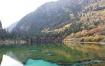
There are many lakes in the Himalayas. The largest of them are Lake Bangong Tso (700 km²) and Yamjo-Yumtso (621 km²). Lake Tilicho is located at an absolute elevation of 4919 m, which makes it one of the highest in the world.
Climate
The climate in the Himalayas is quite varied. The southern slopes are strongly influenced by the monsoons. The amount of precipitation here increases from west to east from less than 1000 mm to more than 4000 mm.

On the India-Tibet border in Kinnaur Himachal Pradesh (Partha Chowdhury / flickr.com)
The northern slopes, on the contrary, are in the rain shadow. The climate here is arid and cold.
In the highlands there are severe frosts and winds. In winter, temperatures can drop to minus 40 °C or even lower.
The Himalayas have a strong influence on the climate of the entire region. They act as a barrier to cold, dry winds blowing from the north, making the climate of the Indian subcontinent much warmer than neighboring regions of Asia at the same latitudes. In addition, the Himalayas are a barrier to the monsoons, which blow from the south and bring huge amounts of rainfall.
High mountains prevent these moist air masses from flowing further north, making Tibet's climate very dry.
There is an opinion that the Himalayas played a significant role in the formation of deserts Central Asia, such as Taklamakan and Gobi, which is also explained by the rain shadow effect.
Origin and geology
Geologically, the Himalayas are one of the youngest mountain systems peace; refers to the Alpine folding. It is composed mainly of sedimentary and metamorphic rocks, folded and raised to a considerable height.
The Himalayas were formed as a result of the collision of the Indian and Eurasian lithospheric plates, which began approximately 50-55 million years ago. This collision closed the ancient Tethys Ocean and formed an orogenic belt.
Flora and fauna
The flora of the Himalayas is subject to altitudinal zonation. At the foot of the Siwalik range, the vegetation consists of swampy forests and thickets, locally known as “terai”.

Himalayan Landscape (Jan / flickr.com)
Higher up they are replaced by evergreen tropical, deciduous and coniferous forests, and even higher by alpine meadows.
Deciduous forests begin to prevail at absolute elevations of more than 2000 m, and coniferous forests – above 2600 m.
At an altitude of more than 3500 m, shrubby vegetation predominates.
On the northern slopes, where the climate is much drier, the vegetation is much poorer. Mountain deserts and steppes are common here. The height of the snow line varies from 4500 (southern slopes) to 6000 m (northern slopes).

Wildlife of the Himalayas (Chris Walker / flickr.com)
The local fauna is quite diverse and, like vegetation, depends mainly on the altitude above sea level. The fauna of tropical forests on the southern slopes is characteristic of the tropics. Elephants, rhinoceroses, tigers, leopards, and antelopes are still found here in the wild; monkeys are numerous.
Higher up you can find Himalayan bears, mountain goats and sheep, yaks, etc. In the highlands you can also find such a rare animal as the snow leopard.
There are many different protected areas located in the Himalayas. Among them, it is worth noting the Sagarmatha National Park, within which Everest is partially located.
Population
Most of the population of the Himalayas lives in the southern foothills and intermountain basins. The largest basins are Kashmir and Kathmandu; these regions are very densely populated, and almost all the land here is cultivated.

Bridge over the Ganges (Asis K. Chatterjee / flickr.com)
Like many other mountain regions, the Himalayas have great ethnic and linguistic diversity.
This is explained by the inaccessibility of these places, due to which the population of almost every valley or basin lived very separately.
Contacts even with neighboring areas were minimal, since in order to get to them, it is necessary to overcome high mountain passes, which in winter are often covered with snow, and they become completely impassable. In this case, some intermountain basin could be completely isolated until next summer.
Almost the entire population of the region speaks either Indo-Aryan languages, which belong to the Indo-European family, or Tibeto-Burman languages, which belong to the Sino-Tibetan family. Most of the population professes Buddhism or Hinduism.
The most famous people of the Himalayas are the Sherpas, who live in the highlands of Eastern Nepal, including the Everest region. They often work as guides and porters on expeditions to Chomolungma and other peaks.

Annapurna Base Camp, Nepal (Matt Zimmerman / flickr.com)
Sherpas have hereditary altitude adaptation, thanks to which even at very high altitudes they do not suffer from altitude sickness and do not need additional oxygen.
Most of the Himalayan population is employed in agriculture. If there is a sufficiently flat surface and water, people cultivate rice, barley, oats, potatoes, peas, etc.
In the foothills and in some intermountain basins, more heat-loving crops are grown - citrus fruits, apricots, grapes, tea, etc. In the highlands, breeding of goats, sheep and yaks is common. The latter are used as a beast of burden, as well as for meat, milk and wool.
Sights of the Himalayas
The Himalayas are home to a wide variety of attractions. This region has a huge number of Buddhist monasteries and Hindu temples, as well as simply places considered sacred in Buddhism and Hinduism.

Valley of Flowers, Himalayas (Alosh Bennett / flickr.com)
Located in the foothills of the Himalayas Indian city Rishikesh, which is sacred to Hindus and is also popularly known as world capital yoga
Another sacred Hindu city is Hardwar, located at the point where the Ganges descends from the Himalayas to the plain. In Hindi, its name can be translated as “gateway to God.”
Among the natural attractions, it is worth mentioning the Valley of Flowers National Park, located in the Western Himalayas, in the Indian state of Uttarkhand.
The valley fully lives up to its name: it is a continuous carpet of flowers, completely different from ordinary alpine meadows. Together with the Nanda Devi National Park, it is a UNESCO heritage site.
Tourism
Mountaineering and mountain hiking are popular in the Himalayas. From walking routes The best known trek is the Annapurna Circuit, which runs along the slopes of the mountain range of the same name in north-central Nepal.

Climber at sunset, Nepal Himalayas (Dmitry Sumin / flickr.com)
The length of the route is 211 km, and its altitude varies from 800 to 5416 m.
Sometimes tourists combine this trek with a hike to Lake Tilicho, located at an absolute elevation of 4919 m.
Another popular route is the Manaslu Trek, which runs around the Mansiri Himal mountain range and overlaps with the Annapurna Circuit.
How long it will take to complete these routes depends on the person’s physical fitness, time of year, weather conditions and other factors. In high altitude areas, you should not gain altitude too quickly to avoid symptoms of altitude sickness.
Conquering the Himalayan peaks is quite difficult and dangerous. It requires good preparation, equipment and requires mountaineering experience.
Himalayas: the highest mountains in the world
5 (100%) 2 votesThe Himalayas consist of approximately 30 mountains, nine of which are the highest peaks planets, including Everest. Extreme lovers from all over the planet consider this place as a mountaineering center. We will tell you the most Interesting Facts about the Himalayas.
Geographical location

The Himalayas are located on the territory of five countries:
- India;
- Nepal;
- Bhutan;
- China;
- Pakistan
The mountains have total area in 153,295,000 sq. km, occupy 0.4% of the entire earth's surface.
The Himalayan mountain range is the most inaccessible region on Earth.

If you do not take into account Antarctica and the Arctic, the Himalayas lead in ice and snow deposits. A great number of glaciers contain enough water for rivers and lakes, which are found here in considerable quantities.
Huge rivers originate in the Himalayas and highlands of Tibet:
- Ganges;
- Yamuna.

The tops of the mountains are unsuitable for human life due to the harsh climate: cold, lack of oxygen, and strong winds. In the valleys between the mountains there are a small number of settlements with few inhabitants.
The local population lives off tourism and accompanying climbers who want to see or conquer mountain peaks.
Local religions and beliefs

The main religions of the Himalayan people are:
- Islam;
- Buddhism;
- Hinduism.
The story of Bigfoot living somewhere in the mountains has become the most popular myth in the Himalayas.
According to Hindu mythology, this place is considered the refuge of God Shiva.
The highest mountains of the Himalayas:

- Chomolungma, altitude 8,848 km.
- Kanchenjunga, altitude 8,586 km.
- Lhotse, altitude 8,516 km.
- Makalu, altitude 8,463 km.
- Cho Oyu, altitude 8,201 km.
- Dhaulagiri, altitude 8,167 km.
- Manaslu, altitude 8,156 km.
- Nanga Parbat, altitude 8,126 km.
- Annapurna, altitude 8,091 km.
- Shishabangma, altitude 8,027 km.
Many people die every year trying to conquer the peaks of the Himalayas. But danger does not stop true extreme sports enthusiasts and travelers who cannot live without risk.
Mountains are fraught with many dangerous surprises, for example - rapidly changing weather with gusty winds, or lack of oxygen.
Vegetation

Vegetation in the Himalayas varies depending on altitude:
- the valleys are dominated by swampy forests;
- green tropical jungles, coniferous and deciduous forests grow a little higher;
- further on there are alpine meadows;
- at a level of 3,500 m only shrubs grow.
The purest plants for medicine grow exclusively in the foothills.

There are quite a few Hindu temples and Buddhist monasteries in the Himalayas.
Valley of Flowers is a national park. It is located in the western Himalayas and is listed as a UNESCO heritage site.