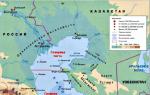
How many states are washed by the Caspian Sea. Why the Caspian Sea is considered a lake
V. N. MIKHAILOVThe Caspian Sea is the largest closed lake on the planet. This body of water is called the sea for its huge size, brackish water and a regime similar to the sea. The level of the Caspian Sea-Lake is much lower than the level of the World Ocean. At the beginning of 2000, he had a mark of about - 27 abs. m. At this level, the area of the Caspian Sea is ~ 393 thousand km2 and the volume of water is 78 600 km3. Average and maximum depths are 208 and 1025 m, respectively.
The Caspian Sea stretches from south to north (Fig. 1). The Caspian washes the shores of Russia, Kazakhstan, Turkmenistan, Azerbaijan and Iran. The reservoir is rich in fish, its bottom and shores - in oil and gas. The Caspian Sea has been studied quite well, but many mysteries remain in its regime. The most characteristic feature of the reservoir is the instability of the level with sharp drops and rises. The last rise in the level of the Caspian took place before our eyes from 1978 to 1995. It gave rise to a lot of rumors and speculation. Numerous publications appeared in the press, which spoke of catastrophic floods and an environmental disaster. It was often written that the rise in the level of the Caspian led to the flooding of almost the entire delta of the Volga. What is true in the statements made? What is the reason for this behavior of the Caspian Sea?
WHAT HAPPENED TO CASPIUS IN THE XX CENTURY

Systematic observations over the level of the Caspian Sea began in 1837. In the second half of the 19th century, the average annual values of the Caspian Sea level were in the range of marks from - 26 to - 25.5 abs. m and had some downward trend. This trend continued in the 20th century (Fig. 2). In the period from 1929 to 1941, the sea level dropped sharply (by almost 2 m - from - 25.88 to - 27.84 abs. M). In subsequent years, the level continued to fall and, having decreased by approximately 1.2 m, reached in 1977 the lowest mark for the observation period - 29.01 abs. m. Then the sea level began to rise rapidly and, having risen by 1995 by 2.35 m, reached the level of 26.66 abs. m. In the next four years, the average sea level dropped by almost 30 cm. Its average marks were - 26.80 in 1996, - 26.95 in 1997, - 26.94 in 1998 and - 27.00 abs. m in 1999.
The decline in sea level in 1930-1970 led to the shallowing of coastal waters, the extension of the coastline towards the sea, and the formation of wide beaches. The latter was, perhaps, the only positive consequence of the drop in the level. There were much more negative consequences. With a decrease in the level, the area of fodder lands for fish stocks in the northern Caspian decreased. The shallow estuary seaside of the Volga began to quickly overgrow with aquatic vegetation, which worsened the conditions for the passage of fish to spawn in the Volga. Fish catches, especially of valuable species: sturgeon and sterlet, have sharply decreased. Shipping began to suffer damage due to the fact that the depths in the approach channels decreased, especially near the Volga delta.
The rise in the level from 1978 to 1995 was not only unexpected, but also led to even greater negative consequences. After all, both the economy and the population of the coastal regions have already adapted to the low level.
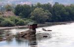
Many sectors of the economy began to suffer damage. Significant territories were found in the zone of flooding and flooding, especially in the northern (flat) part of Dagestan, in Kalmykia and the Astrakhan region. The rise in water level affected the cities of Derbent, Kaspiysk, Makhachkala, Sulak, Caspian (Lagan) and dozens of other smaller settlements. Significant areas of agricultural land have been flooded and flooded. Roads and power lines, engineering structures of industrial enterprises and public utilities are being destroyed. A threatening situation has developed with fish breeding enterprises. The abrasion processes in the coastal zone and the influence of seawater surges have intensified. In recent years, the flora and fauna of the seaside and the coastal zone of the Volga delta have suffered significant damage.
In connection with the increase in depths in the shallow waters of the Northern Caspian and the reduction in the areas occupied in these places by aquatic vegetation, the conditions for the reproduction of stocks of anadromous and semi-anadromous fish and the conditions for their migration to the delta for spawning have improved somewhat. However, the prevalence of negative consequences from the rising sea level made us talk about an environmental disaster. The development of measures to protect national economic facilities and settlements from the advancing sea began.
HOW UNUSUALLY IS THE CASPIAN'S MODERN BEHAVIOR?
Studies of the life history of the Caspian Sea can help answer this question. Of course, there are no direct observations of the past regime of the Caspian, but there is archaeological, cartographic and other evidence for the historical time and the results of paleogeographic studies covering a longer period.

It is proved that during the Pleistocene (last 700-500 thousand years) the level of the Caspian Sea underwent large-scale fluctuations in the range of about 200 m: from -140 to + 50 abs. m. During this period of time in the history of the Caspian Sea, four stages are distinguished: Baku, Khazar, Khvalynsk and Novo-Caspian (Fig. 3). Each stage included several transgressions and regressions. The Baku transgression took place 400-500 thousand years ago, the sea level rose to 5 abs. m. During the Khazar stage, there were two transgressions: the early Khazar (250-300 thousand years ago, the maximum level of 10 abs. m) and the Late Khazar (100-200 thousand years ago, the highest level -15 abs. m). The Khvalynsky stage in the history of the Caspian included two transgressions: the largest during the Pleistocene, the Early Khvalynian (40-70 thousand years ago, the maximum level of 47 absolute m, which is 74 m higher than the present) and the Late Khvalynian (10-20 thousand years ago, the rise level up to 0 abs. m). These transgressions were separated by a deep Enotai regression (22-17 thousand years ago), when the sea level dropped to -64 abs. m and was 37 m lower than the modern one.

Rice. 4. Fluctuations in the level of the Caspian Sea over the past 10 thousand years. P is the natural range of fluctuations in the level of the Caspian Sea under climatic conditions typical of the Subatlantic Holocene epoch (risk zone). I-IV - stages of the New Caspian transgression; M - Mangyshlak, D - Derbent regression
Significant fluctuations in the level of the Caspian also occurred during the New Caspian stage of its history, which coincided with the Holocene (the last 10 thousand years). After the Mangyshlak regression (10 thousand years ago, a decrease in the level to –50 abs. M), five stages of the Novo-Caspian transgression were noted, separated by small regressions (Fig. 4). Following the sea level fluctuations - its transgressions and regressions - the outline of the reservoir also changed (Fig. 5).

Over the historical time (2000 years), the range of changes in the average level of the Caspian Sea was 7 m - from - 32 to - 25 abs. m (see Fig. 4). The minimum level in the last 2000 years was during the Derbent regression (VI-VII centuries AD), when it decreased to - 32 abs. m. During the time elapsed after the Derbent regression, the mean sea level changed in an even narrower range - from –30 to –25 abs. m. This range of changes in the level is called the risk zone.
Thus, the level of the Caspian Sea experienced fluctuations before, and in the past they were more significant than in the 20th century. Such periodic fluctuations are a normal manifestation of the unstable state of a closed reservoir with variable conditions at the outer boundaries. Therefore, it is not unusual for the Caspian Sea to rise and fall.
Fluctuations in the Caspian Sea level in the past, apparently, did not lead to irreversible degradation of its biota. Of course, the sharp drop in sea level created temporary unfavorable conditions, for example, for the fish stock. However, with the rise in the level, the situation corrected itself. The natural conditions of the coastal zone (vegetation, benthic animals, fish) experience periodic changes along with fluctuations in sea level and, apparently, have a certain margin of stability and resistance to external influences. Indeed, the most valuable sturgeon herd has always been in the Caspian basin, regardless of fluctuations in sea level, quickly overcoming a temporary deterioration in living conditions.
Rumors that the rise in sea level caused floods throughout the Volga delta were not confirmed. Moreover, it turned out that the rise in water levels even in the lower part of the delta is inadequate to the magnitude of the rise in sea level. The increase in the water level in the lower part of the delta did not exceed 0.2-0.3 m during the low-water period, and almost did not manifest itself at all during the flood. At the maximum level of the Caspian in 1995, the backwater from the sea side spread along the deepest branch of the Bakhtemir delta by no more than 90 km, and along other branches by no more than 30 km. Therefore, only islands on the seashore and a narrow coastal strip of the delta were flooded. Inundations in the upper and middle parts of the delta were associated with high floods in 1991 and 1995 (which is normal for the Volga delta) and with the unsatisfactory condition of the protective dams. The reason for the weak influence of sea level rise on the Volga delta regime is the presence of a huge shallow seashore zone, which dampens the effect of the sea on the delta.
As for the negative impact of sea level rise on the economy and life of the population in the coastal zone, the following should be recalled. At the end of the last century, the sea level was higher than at the present time, and this was in no way perceived as an ecological disaster. And before the level was even higher. Meanwhile, Astrakhan has been known since the middle of the XIII century, here in the XIII - the middle of the XVI century the capital of the Golden Horde, Saray-Batu, was located. These and many other settlements on the coast of the Caspian did not suffer from the high standing of the level, as they were located on elevated places and at abnormal flood levels or surges, people temporarily moved from low places to higher ones.
Why are the consequences of a rise in sea level even at lower levels now perceived as a catastrophe? The reason for the enormous damage to the national economy is not a rise in the level, but the thoughtless and short-sighted development of a strip of land within the aforementioned risk zone, freed (as it turned out, temporarily!) From the sea level after 1929, that is, with a decrease in the level below the mark - 26 abs. m. The buildings erected in the risk zone, naturally, turned out to be flooded and partially destroyed. Now, when the territory developed and polluted by man is flooded, a dangerous ecological situation is really created, the source of which is not natural processes, but unreasonable economic activity.
ABOUT THE REASONS OF THE CASPIAN LEVEL VIBRATIONS
Considering the question of the causes of fluctuations in the level of the Caspian, it is necessary to pay attention to the opposition in this area of two concepts: geological and climatic. Significant contradictions in these approaches were revealed, for example, at the international conference "Caspian-95".
According to the geological concept, the processes of two groups are attributed to the reasons for the change in the level of the Caspian. The processes of the first group, according to geologists, lead to a change in the volume of the Caspian depression and, as a consequence, to changes in sea level. These processes include vertical and horizontal tectonic movements of the earth's crust, the accumulation of bottom sediments, and seismic events. The second group includes processes that, as geologists believe, affect the underground runoff in the sea, either increasing it or decreasing it. Such processes are called periodic squeezing out or absorption of waters that saturate bottom sediments under the influence of changing tectonic stresses (changes in periods of compression and extension), as well as technogenic destabilization of the subsoil caused by oil and gas production or underground nuclear explosions. It is impossible to deny the fundamental possibility of the influence of geological processes on the morphology and morphometry of the Caspian depression and groundwater runoff. However, at present, the quantitative relationship of geological factors with fluctuations in the level of the Caspian has not been proven.
There is no doubt that tectonic movements played a decisive role in the initial stages of the formation of the Caspian depression. However, if we take into account that the basin of the Caspian Sea is located within a geologically heterogeneous territory, which results in a periodic rather than linear character of tectonic movements with repeated sign changes, then one should hardly expect a noticeable change in the capacity of the basin. Not in favor of the tectonic hypothesis is also evidenced by the fact that the coastlines of the New Caspian transgressions in all parts of the Caspian coast (with the exception of certain areas within the Apsheron archipelago) are at the same level.
There is no reason to believe that the reason for the fluctuations in the level of the Caspian is the change in the capacity of its basin due to the accumulation of precipitation. The rate of filling the basin with bottom sediments, among which the main role is played by the outflow of rivers, is estimated, according to modern data, at about 1 mm / year or less, which is two orders of magnitude less than the currently observed changes in sea level. Seismic deformations, which are noted only near the epicenter and decay at close distances from it, cannot significantly affect the volume of the Caspian basin.
As for the periodic large-scale discharge of groundwater into the Caspian, its mechanism is still unclear. At the same time, this hypothesis is contradicted, according to E.G. Maev, firstly, the undisturbed stratification of silt waters, indicating the absence of noticeable migrations of water through the stratum of bottom sediments, and secondly, the absence of proven powerful hydrological, hydrochemical and sedimentation anomalies in the sea, which should have accompanied the large-scale discharge of groundwater capable of influence changes in the level of the reservoir.
The main proof of the insignificant role of geological factors at present is a convincing quantitative confirmation of the plausibility of the second, climatic, or rather, water-balance concept of fluctuations in the Caspian Sea level.
CHANGE IN THE CASPIAN WATER BALANCE COMPONENTS AS THE MAIN CAUSE OF ITS LEVEL VIBRATIONS
For the first time, fluctuations in the level of the Caspian were explained by changes in climatic conditions (more specifically, river runoff, evaporation and atmospheric precipitation on the sea surface) by E.Kh. Lenz (1836) and A.I. Voeikov (1884). Later, the leading role of changes in the components of the water balance in sea level fluctuations was again and again proven by hydrologists, oceanologists, physicogeographers and geomorphologists.
The key to most of the studies mentioned is the compilation of the water balance equation and the analysis of its components. The meaning of this equation is as follows: the change in the volume of water in the sea is the difference between the input (river and underground runoff, atmospheric precipitation to the sea surface) and consumption (evaporation from the sea surface and outflow of water into the Kara-Bogaz-Gol Bay) components of the water balance. The change in the level of the Caspian is the quotient of the change in the volume of its waters by the area of the sea. The analysis showed that the leading role in the water balance of the sea belongs to the ratio of the runoff of the rivers Volga, Ural, Terek, Sulak, Samur, Kura and visible or effective evaporation, the difference between evaporation and precipitation on the sea surface. The analysis of the components of the water balance revealed that the greatest contribution (up to 72% of the variance) to the level variability comes from the inflow of river waters, and more specifically, the zone of flow formation in the Volga basin. As for the reasons for the change in the Volga runoff itself, they are associated, as many researchers believe, with the variability of atmospheric precipitation (mainly winter) in the river basin. And the precipitation regime, in turn, is determined by the circulation of the atmosphere. It has long been proven that the increase in precipitation in the Volga basin is facilitated by the latitudinal type of atmospheric circulation, while the decrease is facilitated by the meridional type.
V.N. Malinin revealed that the root cause of moisture entering the Volga basin should be sought in the North Atlantic, and specifically in the Norwegian Sea. It is there that an increase in evaporation from the sea surface leads to an increase in the amount of moisture transferred to the continent, and, accordingly, to an increase in atmospheric precipitation in the Volga basin. The latest data on the water balance of the Caspian Sea, obtained by the staff of the State Oceanographic Institute R.E. Nikonova and V.N. Bortnik, are given with the author's clarifications in table. 1. These data convincingly prove that the main reasons for both the rapid drop in sea level in the 1930s and the sharp rise in 1978-1995 were changes in river flow, as well as visible evaporation.
Bearing in mind that river runoff is one of the main factors affecting the water balance and, as a consequence, the level of the Caspian Sea (and the Volga runoff gives at least 80% of the total river runoff in the sea and about 70% of the incoming part of the Caspian water balance), it would be interesting to find a relationship between sea level and the runoff of the Volga alone, which is measured most accurately. Direct correlation of these values does not give satisfactory results.

However, the relationship between the sea level and the Volga runoff is well traced if the river runoff is not taken into account for every year, but the ordinates of the differential integral runoff curve are taken, that is, the sequential sum of the normalized deviations of the annual runoff values from the mean long-term value (norm). Even a visual comparison of the course of the average annual levels of the Caspian Sea and the differential integral curve of the Volga runoff (see Fig. 2) reveals their similarity.
Over the entire 98-year period of observations of the Volga runoff (Verkhnee Lebyazhye village at the top of the delta) and sea level (Makhachkala), the correlation coefficient of the relationship between sea level and ordinates of the differential integral runoff curve was 0.73. If we discard the years with small level changes (1900-1928), then the correlation coefficient rises to 0.85. If for the analysis we take a period with a rapid decline (1929-1941) and a rise in the level (1978-1995), then the overall correlation coefficient will be 0.987, and separately for both periods, 0.990 and 0.979, respectively.
The above calculation results fully confirm the conclusion that during periods of a sharp decrease or increase in sea level, the levels themselves are closely related to the runoff (more precisely, with the sum of its annual deviations from the norm).
A special task is to assess the role of anthropogenic factors in fluctuations in the level of the Caspian Sea, and first of all, a reduction in river runoff due to its irreversible losses for filling reservoirs, evaporation from the surface of artificial reservoirs, and water intake for irrigation. It is believed that since the 1940s, irreversible water consumption has steadily increased, which has led to a reduction in the inflow of river waters to the Caspian Sea and an additional decrease in its level compared to natural. According to V.N. Malinin, by the end of the 80s, the difference between the actual sea level and the restored (natural) level reached almost 1.5 m.At the same time, the total irretrievable water consumption in the Caspian basin was estimated in those years at 36-45 km3 / year (of which the Volga accounted for about 26 km3 / year). If not for the withdrawal of river flow, the rise in sea level would not have begun in the late 70s, but in the late 50s.
The increase in water consumption in the Caspian basin by 2000 was forecasted first up to 65 km3 / year, and then up to 55 km3 / year (36 of them fell on the Volga). Such an increase in irrecoverable losses of river flow should have reduced the level of the Caspian by more than 0.5 m by 2000. In connection with the assessment of the impact of irreversible water consumption on the level of the Caspian, we note the following. First, the estimates of water intake and evaporation losses from the surface of reservoirs in the Volga basin found in the literature seem to be significantly overestimated. Secondly, forecasts of water consumption growth turned out to be erroneous. The forecasts laid down the rates of development of water-consuming sectors of the economy (especially irrigation), which not only turned out to be unrealistic, but were also replaced by a decline in production in recent years. In fact, as A.E. Asarin (1997), by 1990 water consumption in the Caspian basin was about 40 km3 / year, and now it has decreased to 30-35 km3 / year (in the Volga basin to 24 km3 / year). Therefore, the "anthropogenic" difference between natural and actual sea level is currently not as great as predicted.
ON POSSIBLE VIBRATIONS OF THE CASPIAN LEVEL IN THE FUTURE
The author does not aim to analyze in detail the numerous forecasts of fluctuations in the level of the Caspian Sea (this is an independent and difficult task). The main conclusion from the assessment of the results of forecasting fluctuations in the level of the Caspian Sea can be made as follows. Although the predictions were based on completely different approaches (both deterministic and probabilistic), there was not a single reliable prediction. The main difficulty in using deterministic forecasts based on the sea water balance equation is the lack of development of the theory and practice of ultra-long-term forecasts of climate change over large areas.
When sea level declined in the 1930s and 1970s, most researchers predicted a further drop. In the last two decades, when the sea level began to rise, most forecasts predicted an almost linear and even accelerating growth of the level to - 25 and even - 20 abs. m and higher at the beginning of the XXI century. At the same time, three circumstances were not taken into account. First, the periodic nature of fluctuations in the level of all closed water bodies. The instability of the Caspian Sea level and its periodic nature are confirmed by the analysis of its current and past fluctuations. Secondly, at sea level close to - 26 abs. m, the flooding of large litter bays on the northeastern coast of the Caspian - Dead Kultuk and Kaidak, dried out at a low level, will begin, as well as low-lying areas in other parts of the coast. This would lead to an increase in the area of shallow waters and, as a consequence, to an increase in evaporation (up to 10 km3 / year). At a higher sea level, the outflow of water to Kara-Bogaz-Gol will increase. All this should stabilize or at least slow down the growth of the level. Third, fluctuations in the level under the conditions of the modern climatic epoch (last 2000 years), as shown above, are limited by the risk zone (from - 30 to - 25 abs. M). Taking into account the anthropogenic decrease in runoff, the level is unlikely to exceed the mark - 26-26.5 abs. m.
A decrease in average annual levels in the last four years by a total of 0.34 m, possibly indicates that in 1995 the level reached its maximum (-26.66 abs. M), and a change in the trend of the Caspian level. In any case, the prediction that the sea level is unlikely to exceed the mark - 26 abs. m seems to be justified.
In the 20th century, the level of the Caspian Sea varied within 3.5 m, first dropping and then rising sharply. This behavior of the Caspian Sea is the normal state of a closed reservoir as an open dynamic system with variable conditions at its inlet.
Each combination of input (river runoff, precipitation on the sea surface) and consumption (evaporation from the surface of the reservoir, outflow into the Kara-Bogaz-Gol Bay) components of the Caspian water balance corresponds to its own level of equilibrium. Since the components of the water balance of the sea also change under the influence of climatic conditions, the level of the reservoir fluctuates, striving to achieve an equilibrium state, but never reaches it. Ultimately, the tendency of changes in the level of the Caspian Sea at a given time depends on the ratio of precipitation minus evaporation in the catchment (in the basins of the rivers feeding it) and evaporation minus precipitation over the reservoir itself. The recent 2.3 m rise in the Caspian Sea level is not really unusual. Such level changes have occurred many times in the past and did not cause irreparable damage to the natural resources of the Caspian. The current rise in sea level has become a disaster for the economy of the coastal zone only due to the unreasonable development of this risk zone by man.
Vadim Nikolaevich Mikhailov, Doctor of Geography, Professor of the Department of Land Hydrology, Faculty of Geography, Moscow State University, Honored Scientist of the Russian Federation, full member of the Academy of Water Management Sciences. Research interests - hydrology and water resources, interaction of rivers and seas, delta and estuary, hydroecology. Author and co-author of about 250 scientific works, including 11 monographs, two textbooks, four scientific and methodological manuals.
Caspian Sea - the largest lake on Earth, an endless lake, located at the junction of Europe and Asia, called the sea because of its size, and also because its bed is composed of an oceanic type of crust. The water in the Caspian is salty, - from 0.05 ‰ near the mouth of the Volga to 11-13 ‰ in the southeast. The water level is subject to fluctuations, according to 2009 data was 27.16 m below sea level. The area of the Caspian Sea is currently about 371,000 km², the maximum depth is 1025 m.
Geographical position
The Caspian Sea is located at the junction of two parts of the Eurasian continent - Europe and Asia. The length of the Caspian Sea from north to south is about 1200 kilometers (36 ° 34 "-47 ° 13" N), from west to east - from 195 to 435 kilometers, on average 310-320 kilometers (46 ° -56 ° c. d.). The Caspian Sea is conventionally divided by physical and geographical conditions into 3 parts - the North Caspian, the Middle Caspian and the South Caspian. The conditional border between the North and Middle Caspian runs along the line about. Chechnya - Cape Tyub-Karagan, between the Middle and South Caspian - along the line of about. Residential - Cape Gan-Gulu. The area of the North, Middle and South Caspian Sea is 25, 36, 39 percent, respectively.
The length of the coastline of the Caspian Sea is estimated at about 6500-6700 kilometers, with islands up to 7000 kilometers. The shores of the Caspian Sea in most of its territory are low and smooth. In the northern part, the coastline is cut by water channels and islands of the Volga and Ural deltas, the shores are low and swampy, and the water surface is covered with thickets in many places. The eastern coast is dominated by limestone shores adjacent to semi-deserts and deserts. The most winding shores are on the western coast in the area of the Absheron Peninsula and on the eastern coast in the area of the Kazakh Bay and Kara-Bogaz-Gol. The territory adjacent to the Caspian Sea is called the Caspian region.
Peninsulas of the Caspian Sea
Major peninsulas of the Caspian Sea:
- Agrakhan Peninsula
- Absheron Peninsula, located on the western coast of the Caspian Sea on the territory of Azerbaijan, at the northeastern end of the Greater Caucasus, on its territory are the cities of Baku and Sumgait
- Buzachi
- Mangyshlak, located on the eastern coast of the Caspian Sea, on the territory of Kazakhstan, on its territory there is the city of Aktau
- Miancale
- Tyub-Karagan
Islands of the Caspian Sea
There are about 50 large and medium-sized islands in the Caspian Sea with a total area of about 350 square kilometers. The largest islands:
- Ashur-Ada
- Garasu
- Boyuk-Zira
- Zyanbil
- Kur Dashi
- Hara-Zira
- Ogurchinsky
- Sengi-Mugan
- Seal
- Seal Islands
- Chechen
- Chygyl
Bays of the Caspian Sea
Large bays of the Caspian Sea:
- Agrakhan Gulf
- Kizlyar Bay
- Dead Kultuk (former Komsomolets, former Gulf of Tsesarevich)
- Kaydak
- Mangyshlak
- Kazakh
- Kenderli
- Turkmenbashi (bay) (former Krasnovodsk)
- Turkmen (bay)
- Gizilagach (former Kirov Bay)
- Astrakhan (bay)
- Hasan-kuli
- Gyzlar
- Hyrcanus (formerly Astarabad)
- Anzali (formerly Pahlavi)
- Kara-Bogaz-Gol
Rivers flowing into the Caspian Sea- 130 rivers flow into the Caspian Sea, of which 9 rivers have delta-shaped estuaries. Large rivers flowing into the Caspian Sea are Volga, Terek, Sulak, Samur (Russia), Ural, Emba (Kazakhstan), Kura (Azerbaijan), Atrek (Turkmenistan), Sefidrud (Iran) and others. The largest river flowing into the Caspian Sea is the Volga, its average annual runoff is 215-224 cubic kilometers. The Volga, Ural, Terek, Sulak and Emba provide up to 88-90% of the annual runoff into the Caspian Sea.
Physiography
Area, depth, volume of water- the area and volume of water in the Caspian Sea varies significantly depending on fluctuations in the water level. With a water level of -26.75 m, the area is approximately 371,000 square kilometers, the volume of water is 78,648 cubic kilometers, which is approximately 44% of the world's lake water reserves. The maximum depth of the Caspian Sea is in the South Caspian depression, 1025 meters above its surface. In terms of maximum depth, the Caspian Sea is second only to Baikal (1620 m) and Tanganyika (1435 m). The average depth of the Caspian Sea, calculated according to the bathygraphic curve, is 208 meters. At the same time, the northern part of the Caspian is shallow, its maximum depth does not exceed 25 meters, and the average depth is 4 meters.
Water level fluctuations- the water level in the Caspian Sea is subject to significant fluctuations. According to modern science, over the past three thousand years, the magnitude of the change in the water level of the Caspian Sea has reached 15 meters. According to archeology and written sources, a high level of the Caspian Sea is recorded at the beginning of the XIV century. Instrumental measurement of the level of the Caspian Sea and systematic observations of its fluctuation have been conducted since 1837, during this time the highest water level was recorded in 1882 (-25.2 m), the lowest - in 1977 (-29.0 m), with In 1978, the water level increased and in 1995 reached the level of -26.7 m; since 1996, a downward trend has been observed again. Scientists associate the reasons for the change in the water level of the Caspian Sea with climatic, geological and anthropogenic factors. But in 2001, the sea level began to rise again, and reached -26.3 m.
Water temperature- the water temperature is subject to significant latitudinal changes, most clearly expressed in winter, when the temperature changes from 0-0.5 ° C at the ice edge in the north of the sea to 10-11 ° C in the south, that is, the difference in water temperature is about 10 ° C. For shallow areas with depths less than 25 m, the annual amplitude can reach 25-26 ° C. On average, the water temperature near the western coast is 1-2 ° C higher than that of the eastern one, and in the open sea the water temperature is 2-4 ° C higher than near the coasts.
Water composition- the salt composition of the waters of the enclosed Caspian Sea differs from that of the ocean. There are significant differences in the ratios of the concentrations of salt-forming ions, especially for the waters of areas under the direct influence of continental runoff. The process of metamorphization of sea waters under the influence of continental runoff leads to a decrease in the relative content of chlorides in the total amount of salts of sea waters, an increase in the relative amount of carbonates, sulfates, calcium, which are the main components in the chemical composition of river waters. The most conserved ions are potassium, sodium, chlorine and magnesium. The least conservative are calcium and bicarbonate ions. In the Caspian, the content of calcium and magnesium cations is almost two times higher than in the Sea of Azov, and the content of sulfate anions is three times higher.
Bottom relief- the relief of the northern part of the Caspian is a shallow undulating plain with banks and accumulative islands, the average depth of the North Caspian is 4-8 meters, the maximum depth does not exceed 25 meters. The Mangyshlak sill separates the North Caspian from the Middle. The Middle Caspian is quite deep, the water depth in the Derbent depression reaches 788 meters. The Absheron sill separates the Middle and South Caspian. The South Caspian Sea is considered to be deep water, the depth of water in the South Caspian depression reaches 1025 meters from the surface of the Caspian Sea. Shell sands are widespread on the Caspian shelf, deep-water areas are covered with silty sediments, in some areas there is an outcrop of bedrocks.
Climate- The climate of the Caspian Sea is continental in the northern part, temperate in the middle and subtropical in the southern part. In winter, the average monthly air temperature varies from -8 ... -10 in the northern part to + 8 ... + 10 in the southern part, in summer - from + 24 ... + 25 in the northern part to + 26 ... + 27 in the southern part. The maximum temperature of +44 degrees was recorded on the east coast. Average annual rainfall is 200 millimeters, ranging from 90-100 millimeters in the arid eastern part to 1,700 millimeters off the southwestern subtropical coast. Evaporation of water from the surface of the Caspian Sea is about 1000 millimeters per year, the most intense evaporation is in the area of the Absheron Peninsula and in the eastern part of the South Caspian - up to 1400 millimeters per year. The average annual wind speed is 3-7 meters per second, northern winds prevail in the wind rose. In the autumn and winter months, the winds increase, the speed of the winds often reaches 35-40 meters per second. The most windy areas are the Apsheron Peninsula, the vicinity of Makhachkala and Derbent, where the highest wave with a height of 11 meters was also recorded.
Currents- the circulation of waters in the Caspian Sea is associated with runoff and winds. Since most of the runoff is in the North Caspian, northern currents prevail. The intense northern current carries water from the North Caspian along the western coast to the Absheron Peninsula, where the current splits into two branches, one of which moves further along the western coast, the other goes to the Eastern Caspian.
Economic development of the Caspian Sea
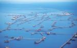
Mining of oil and gas- Many oil and gas fields are being developed in the Caspian Sea. The proven oil resources in the Caspian Sea are about 10 billion tons, the total oil and gas condensate resources are estimated at 18-20 billion tons. Oil production in the Caspian Sea began in 1820, when the first oil well was drilled on the Absheron shelf near Baku. In the second half of the 19th century, oil production began in industrial volumes on the Apsheron Peninsula, then in other territories. In 1949, at Oil Rocks, for the first time, they began to extract oil from the bottom of the Caspian Sea. So, on August 24 of this year, Mikhail Kaverochkin's team began drilling a well, which gave the long-awaited oil on November 7 of the same year. In addition to oil and gas production, salt, limestone, stone, sand and clay are also mined on the coast of the Caspian Sea and the Caspian shelf.
Shipping- shipping is well developed in the Caspian Sea. Ferry services operate on the Caspian Sea, in particular, Baku - Turkmenbashi, Baku - Aktau, Makhachkala - Aktau. The Caspian Sea has a navigable connection with the Azov Sea through the Volga, Don and Volga-Don Canal.
Fishing and seafood production-fishing (sturgeon, bream, carp, pike perch, sprat), caviar production, as well as seal fishing. More than 90 percent of the world's sturgeon catch is carried out in the Caspian Sea. In addition to industrial production, illegal production of sturgeon and their caviar is flourishing in the Caspian Sea.
Legal status of the Caspian Sea- after the collapse of the USSR, the division of the Caspian Sea for a long time was and still remains the subject of unresolved disagreements related to the division of the resources of the Caspian shelf - oil and gas, as well as biological resources. For a long time, negotiations were going on between the Caspian states on the status of the Caspian Sea - Azerbaijan, Kazakhstan and Turkmenistan insisted on dividing the Caspian along the median line, Iran on dividing the Caspian by one fifth between all Caspian states. The current legal regime of the Caspian was established by the Soviet-Iranian treaties of 1921 and 1940. These treaties provide for freedom of navigation throughout the sea, freedom of fishing with the exception of ten-mile national fishing zones and a ban on ships flying the flag of non-Caspian states in its waters. Negotiations on the legal status of the Caspian are ongoing.
The Caspian Sea is one of the most amazing enclosed bodies of water on Earth.
Over the centuries, the sea has changed more than 70 names. The modern originated from the Caspians - tribes inhabiting the central and southeastern part of Transcaucasia 2 thousand years BC.
Geography of the Caspian Sea
The Caspian Sea is located at the junction of Europe with Asia and is geographically divided into the South, North and Middle Caspian. The middle and northern part of the sea belongs to Russia, the southern part belongs to Iran, the eastern part belongs to Turkmenistan and Kazakhstan, and the south-western part belongs to Azerbaijan. For many years, the Caspian states have been dividing the Caspian waters among themselves, and quite sharply at that.

Lake or sea?
In fact, the Caspian Sea is the world's largest lake, but it has a number of marine features. These include: large body of water, strong storms with high waves, ebbs and flows. But the Caspian does not have a natural connection with the World Ocean, which makes it impossible to call it a sea. At the same time, thanks to the Volga and artificially created channels, such a connection appeared. The salinity of the Caspian Sea is 3 times lower than the usual sea salt, which does not allow attributing the reservoir to the seas.
There were times when the Caspian Sea was indeed part of the World Ocean. Several tens of thousands of years ago, the Caspian was connected with the Sea of Azov, and through it with the Black and Mediterranean. As a result of long-term processes taking place in the earth's crust, the Caucasus Mountains were formed, which isolated the reservoir. For a long time, the connection between the Caspian and Black Seas was carried out through the strait (Kumo-Manych depression) and gradually ceased.
Physical quantities
Area, volume, depth
The area, volume and depth of the Caspian Sea are not constant and directly depend on the water level. On average, the area of the reservoir is 371,000 km², the volume is 78 648 km³ (44% of all world reserves of lake waters).

(Depth of the Caspian Sea in comparison with lakes Baikal and Tanganyika)
The average depth of the Caspian Sea is 208 m, the northern part of the sea is considered to be the shallowest. The maximum depth is 1025 m, noted in the South Caspian depression. In terms of depth, the Caspian is second only to Baikal and Tanganyika.
The length of the lake from north to south is about 1200 km, from west to east on average 315 km. The length of the coastline is 6600 km, with the islands - about 7 thousand km.
The shores

Basically, the coast of the Caspian Sea is low and smooth. In the northern part, it is heavily indented by the river channels of the Urals and Volga. The swampy local shores are very low. The eastern shores are adjacent to semi-desert zones and deserts, covered with limestone deposits. The most winding shores are in the west in the area of the Absheron Peninsula, and in the east in the area of the Kazakh Bay and Kara-Bogaz-Gol.
Sea water temperature

(The temperature of the Caspian Sea at different times of the year)
The average water temperature in winter in the Caspian Sea ranges from 0 ° С in the northern part to + 10 ° С in the south. In the water area of Iran, the temperature does not drop below +13 ° C. With the onset of cold weather, the shallow northern part of the lake is covered with ice, which lasts for 2-3 months. The thickness of the ice cover is 25-60 cm, at especially low temperatures it can reach 130 cm. In late autumn and winter, drifting ice floes can be observed in the north.
In summer, the average sea surface temperature is + 24 ° C. Most of the sea warms up to + 25 ° C ... + 30 ° C. Warm water and beautiful sandy, occasionally shell and pebble beaches create excellent conditions for a good beach holiday. In the eastern part of the Caspian Sea, near the town of Begdash, anomalously low water temperature remains in the summer months.
The nature of the Caspian Sea
Islands, peninsulas, bays, rivers
The Caspian Sea includes about 50 large and medium-sized islands with a total area of 350 km ². The largest of them are Ashur-Ada, Garasu, Gum, Dash and Boyuk-Zira. The largest peninsulas are: Agrakhansky, Apsheronsky, Buzachi, Mangyshlak, Miankale and Tyub-Karagan.

(Tyuleniy Island in the Caspian Sea, which is part of the Dagestan Nature Reserve)
The largest bays of the Caspian include: Agrakhanskiy, Kazakhskiy, Kizlyarskiy, Dead Kultuk and Mangyshlakskiy. In the east is the salt lake Kara-Bogaz-Gol, which was previously a lagoon connected to the sea by a strait. In 1980, a dam was built on it, through which water from the Caspian goes to Kara-Bogaz-Gol, where it then evaporates.
130 rivers flow into the Caspian Sea, located mainly in its northern part. The largest of them are: Volga, Terek, Sulak, Samur and Ural. The average annual runoff of the Volga is 220 km ³. 9 rivers have delta-shaped mouths.
Flora and fauna
The Caspian Sea is home to about 450 species of phytoplankton, including algae, aquatic and flowering plants. Of the 400 species of invertebrates, worms, crustaceans and molluscs predominate. There are many small shrimps in the sea, which are the object of the fishery.

More than 120 fish species live in the Caspian Sea and the delta. The objects of fishing are sprat ("Kilkin fleet"), catfish, pike, bream, pike perch, kutum, mullet, roach, rudd, herring, white fish, goby, grass carp, burbot, asp. Stocks of sturgeon and salmon are depleted today, but the sea is the largest supplier of black caviar in the world.
Fishing in the Caspian Sea is allowed all year round, except for the period from late April to late June. There are many fishing bases along the coast with all the amenities. Fishing in the Caspian Sea is a great pleasure. In any part of it, including in large cities, the catch is unusually rich.

The lake is famous for a wide variety of waterfowl. Geese, ducks, loons, gulls, waders, eagles, geese, swans and many others arrive in the Caspian during the migration or nesting period. The largest number of birds - over 600 thousand individuals - is observed in the mouths of the Volga and the Urals, in the bays of Turkmenbashi and Kyzylagach. During the hunting season, a huge number of fishermen come here not only from Russia, but also from countries of near and far abroad.

There is only one mammal living in the Caspian Sea. This is the Caspian seal or seal. Until recently, seals swam close to the beaches, everyone could admire the amazing animal with round black eyes, the seals behaved very friendly. Now the seal is on the verge of extinction.
Cities on the Caspian Sea
The largest city on the coast of the Caspian Sea is Baku. The population of one of the most beautiful cities in the world is over 2.5 million people. Baku is located on the picturesque Absheron Peninsula and is surrounded on three sides by the waters of the warm and oil-rich Caspian Sea. Smaller cities: the capital of Dagestan - Makhachkala, Kazakh Aktau, Turkmen Turkmenbashi and Iranian Bandar-Anzeli.

(Baku Bay, Baku - a city on the Caspian Sea)
Interesting Facts
Scientists are still debating whether to call a body of water a sea or a lake. The level of the Caspian Sea is gradually decreasing. The Volga delivers most of the water to the Caspian. 90% of black caviar is mined in the Caspian Sea. Among them, the most expensive is the albino beluga caviar "Almas" ($ 2,000 per 100 g).
Companies from 21 countries are taking part in the development of oil fields in the Caspian Sea. According to Russian estimates, offshore hydrocarbon reserves amount to 12 billion tons. American scientists argue that a fifth of the world's hydrocarbon reserves are concentrated in the depths of the Caspian. This is more than the combined reserves of oil producing countries such as Kuwait and Iraq.
, Kazakhstan, Turkmenistan, Iran, Azerbaijan
Geographical position

Caspian Sea - view from space.
The Caspian Sea is located at the junction of two parts of the Eurasian continent - Europe and Asia. The length of the Caspian Sea from north to south is about 1200 kilometers (36 ° 34 "-47 ° 13" N), from west to east - from 195 to 435 kilometers, on average 310-320 kilometers (46 ° -56 ° c. d.).
The Caspian Sea is conventionally divided by physical and geographical conditions into 3 parts - the North Caspian, the Middle Caspian and the South Caspian. The conditional border between the North and Middle Caspian runs along the line about. Chechnya - Cape Tyub-Karagan, between the Middle and South Caspian - along the line of about. Residential - Cape Gan-Gulu. The area of the North, Middle and South Caspian Sea is 25, 36, 39 percent, respectively.
Caspian Sea coast

Coast of the Caspian Sea in Turkmenistan
The territory adjacent to the Caspian Sea is called the Caspian region.
Peninsulas of the Caspian Sea
- Ashur-Ada
- Garasu
- Zyanbil
- Hara-Zira
- Sengi-Mugan
- Chygyl
Bays of the Caspian Sea
- Russia (Dagestan, Kalmykia and the Astrakhan region) - in the west and north-west, the length of the coastline is about 1930 kilometers
- Kazakhstan - in the north, north-east and east, the length of the coastline is about 2320 kilometers
- Turkmenistan - in the southeast, the length of the coastline is about 650 kilometers
- Iran - in the south, the length of the coastline is about 1000 kilometers
- Azerbaijan - in the south-west, the length of the coastline is about 800 kilometers
Cities on the coast of the Caspian Sea
On the Russian coast there are cities - Lagan, Makhachkala, Kaspiysk, Izberbash and the southernmost city of Russia Derbent. Astrakhan is also considered a port city of the Caspian Sea, which, however, is not located on the shores of the Caspian Sea, but in the Volga delta, 60 kilometers from the northern coast of the Caspian Sea.
Physiography
Area, depth, volume of water
The area and volume of water in the Caspian Sea varies significantly depending on the fluctuations in the water level. With a water level of -26.75 m, the area is approximately 371,000 square kilometers, the volume of water is 78,648 cubic kilometers, which is approximately 44% of the world's lake water reserves. The maximum depth of the Caspian Sea is in the South Caspian depression, 1025 meters above its surface. In terms of maximum depth, the Caspian Sea is second only to Baikal (1620 m) and Tanganyika (1435 m). The average depth of the Caspian Sea, calculated according to the bathygraphic curve, is 208 meters. At the same time, the northern part of the Caspian is shallow, its maximum depth does not exceed 25 meters, and the average depth is 4 meters.
Water level fluctuations
Vegetable world
The flora of the Caspian Sea and its coast is represented by 728 species. Of the plants in the Caspian Sea, algae predominate - blue-green, diatoms, red, brown, charovy and others, from flowering plants - zostera and ruppia. By origin, the flora belongs mainly to the Neogene age, however, some plants were introduced into the Caspian Sea by humans deliberately or on the bottoms of ships.
History of the Caspian Sea
Origin of the Caspian Sea
Anthropological and cultural history of the Caspian Sea
Finds in the Khuto cave off the southern coast of the Caspian Sea indicate that people lived in these parts about 75 thousand years ago. The first mentions of the Caspian Sea and tribes living on its coast are found at Herodotus. Approximately in the V-II centuries. BC NS. the tribes of the Saks lived on the coast of the Caspian. Later, during the period of the settlement of the Turks, during the IV-V centuries. n. NS. Talysh tribes (Talysh) lived here. According to ancient Armenian and Iranian manuscripts, Russians sailed in the Caspian Sea from the 9th-10th centuries.
Exploration of the Caspian Sea
The exploration of the Caspian Sea was started by Peter the Great, when, on his order, in 1714-1715, an expedition was organized under the leadership of A. Bekovich-Cherkassky. In the 1720s, hydrographic research was continued by the expedition of Karl von Verden and F.I.Soimonov, and later by I.V. Tokmachev, M.I.Voinovich and other researchers. At the beginning of the 19th century, instrumental survey of the coast was carried out by I.F.Kolodkin, in the middle of the 19th century. - instrumental geographic survey under the direction of N. A. Ivashintsev. Since 1866, for more than 50 years, expeditionary research on the hydrology and hydrobiology of the Caspian has been conducted under the leadership of N.M. Knipovich. In 1897, the Astrakhan Research Station was founded. In the first decades of Soviet power in the Caspian Sea, geological research by I. M. Gubkin and other Soviet geologists was actively carried out, mainly aimed at finding oil, as well as research to study the water balance and fluctuations in the level of the Caspian Sea.
Economy of the Caspian Sea
Mining of oil and gas
Many oil and gas fields are being developed in the Caspian Sea. The proven oil resources in the Caspian Sea are about 10 billion tons, the total oil and gas condensate resources are estimated at 18-20 billion tons.
Oil production in the Caspian Sea began in 1820, when the first oil well was drilled on the Absheron shelf near Baku. In the second half of the 19th century, oil production began in industrial volumes on the Apsheron Peninsula, then in other territories.
Shipping
Shipping is well developed in the Caspian Sea. Ferry services operate on the Caspian Sea, in particular, Baku - Turkmenbashi, Baku - Aktau, Makhachkala - Aktau. The Caspian Sea has a navigable connection with the Azov Sea through the Volga, Don and Volga-Don Canal.
Fishing and seafood production
Fishing (sturgeon, bream, carp, pike perch, sprat), caviar and seal fishing. More than 90 percent of the world's sturgeon catch is carried out in the Caspian Sea. In addition to industrial production, illegal production of sturgeon and their caviar is flourishing in the Caspian Sea.
Recreational resources
The natural environment of the Caspian coast with sandy beaches, mineral waters and curative mud in the coastal area creates good conditions for recreation and treatment. At the same time, in terms of the development of resorts and tourism industry, the Caspian coast is noticeably inferior to the Black Sea coast of the Caucasus. At the same time, in recent years, the tourism industry has been actively developing on the coast of Azerbaijan, Iran, Turkmenistan and Russian Dagestan. A resort area in the Baku region is actively developing in Azerbaijan. At the moment, a world-class resort has been created in Amburan, another modern tourist complex is being built in the area of the village of Nardaran, recreation in the sanatoriums of the villages of Bilgah and Zagulba is very popular. A resort area is also developing in Nabran, in the north of Azerbaijan. However, high prices, generally low level of service and lack of advertising lead to the fact that there are almost no foreign tourists in the Caspian resorts. The development of the tourism industry in Turkmenistan is hindered by a long-term policy of isolation, in Iran - by Sharia law, which makes it impossible for foreign tourists to spend mass vacations on the Caspian coast of Iran.
Ecological problems
Environmental problems of the Caspian Sea are associated with water pollution as a result of oil production and transportation on the continental shelf, the influx of pollutants from the Volga and other rivers flowing into the Caspian Sea, the life of coastal cities, as well as flooding of certain objects due to the rise in the level of the Caspian Sea. Predatory hunting of sturgeon and their caviar, rampant poaching lead to a decrease in the number of sturgeon and to forced restrictions on their production and export.
International status of the Caspian Sea
Legal status of the Caspian Sea
After the collapse of the USSR, the division of the Caspian Sea for a long time was and still remains the subject of unresolved disagreements related to the division of the Caspian shelf resources - oil and gas, as well as biological resources. For a long time, negotiations were going on between the Caspian states on the status of the Caspian Sea - Azerbaijan, Kazakhstan and Turkmenistan insisted on dividing the Caspian along the median line, Iran - on dividing the Caspian by one fifth between all the Caspian states.
With regard to the Caspian, the key is the physical and geographical circumstance that it is a closed inland water body that does not have a natural connection with the World Ocean. Accordingly, the norms and concepts of international maritime law should not be automatically applied to the Caspian Sea, in particular, the provisions of the 1982 UN Convention on the Law of the Sea. economic zone "," continental shelf ", etc.
The current legal regime of the Caspian Sea was established by the Soviet-Iranian treaties of 1921 and 1940. These treaties provide for freedom of navigation throughout the sea, freedom of fishing with the exception of ten-mile national fishing zones and a ban on ships flying the flag of non-Caspian states in its waters.
Negotiations on the legal status of the Caspian are ongoing.
Delimitation of sections of the seabed of the Caspian Sea for the purpose of subsoil use
The Russian Federation signed an agreement with Kazakhstan on delimiting the bottom of the northern part of the Caspian Sea in order to exercise sovereign rights to subsoil use (dated July 6, 1998 and the Protocol to it dated May 13, 2002), an agreement with Azerbaijan on delimiting adjacent sections of the bottom of the northern part of the Caspian Sea (dated September 23, 2002), as well as the trilateral Russian-Azerbaijani-Kazakh agreement on the junction point of the delimitation lines of adjacent sections of the seabed of the Caspian Sea (dated May 14, 2003), which established the geographic coordinates of the dividing lines delimiting the sections of the seabed, within which the parties exercise their sovereign rights in the field of exploration and production of mineral resources.