Cape of Good Hope. Where is the Cape of Good Hope? — city on the world map, coordinates and photos
HGIOHe is not the most southern point Africa, since the southernmost point of the continent is Cape Agulhas, which is located 155 km from the cape Good Hope. But the coastline of the African continent here turns east for the first time, opening a passage from the Atlantic Ocean towards the Indian Ocean. The Cape of Good Hope is the most extreme southwestern point of Africa, which is confirmed by the inscription with exact coordinates installed on the site in front of the cape. The Cape Peninsula, having reached its southernmost point at this point, then bends slightly to the north and breaks into the ocean with a high and steep rocky cape - Cape Point, the coordinates of which give its position at 45 meters (1.5") north of the cape and Good Hope, although it is on Cape Point that a lighthouse called the “Cape of Good Hope” is installed. This gives rise to a well-known misunderstanding, which is easily explained when looking at the area, where it is clear that the ships “go around” Cape Point, behind which Falsbay Bay opens (English), where the warm current enters from Indian Ocean. For this reason, the water temperature on the eastern shore of the Cape Peninsula is always several degrees higher than on its west coast, washed by the waters of the cold Benguela Current from Antarctica.
Story
Travels of Eudoxus
First time trying to commit trip around the world within the African continent, the navigator Eudoxus of Cyzicus (130 BC-?). And it all started with the fact that when Eudoxus was returning from his second expedition from India, the wind threw his ship to the eastern coast of Africa, where he discovered the wreckage of the ship. From the stories of the local population, he concluded that the ship sailed from Hades (now this city is called Cadiz, Spain), namely, that it sailed counterclockwise around Africa, past the cape and entered the Indian Ocean. This prompted him to repeat the journey and make circumnavigation on the continent. Having organized an expedition at his own expense, he sailed from Hades and began sailing along the east coast of Africa. However, the difficulties were too great, and he had to return to Europe.
After this failure, Eudoxus again set off on a trip around the world in Africa. His further fate unknown, but some, such as Pliny, argued that Eudoxus actually achieved his goal. However, the most likely conclusion is that he died on his journey.
Fra Mauro and his map
Fra Mauro Map (reversed)
“About 1420, a ship from India crossed the Indian Sea towards the island of men and women, off Cape Diab, between the green islands and the shadows. He sailed for 40 days in a southwesterly direction, finding nothing but wind and water. According to the crew members, the ship sailed about 2,000 miles ahead and their luck deserted them. When the storm subsided, they returned to Cape Diab within seventy days."
“Ships called 'junks' navigate these seas, carry four masts or more, some of which can be raised or lowered, and have 40-60 cabins for merchants and only one tiller. They can navigate without a compass because they have an astrologer who, with an astrolabe in his hand, gives orders to the navigator." (Text from Fra Mauro's map)
Expedition of Vasco da Gama
Geologically, the sandstone rocks that make up the Cape of Good Hope, Cape Point and Table Mountain are the same.
The Cape of Good Hope is one of the most famous places in Africa. For a long time it was considered the extreme southern point of the continent, until it turned out that the neighboring Cape Agulhas is several meters further south. But by that time, the Cape of Good Hope had become famous throughout the world, and is still popular among tourists.
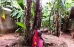
In the first part of the post I will talk about him, and in the second - about the most unusual inhabitants of Africa. Oddly enough, penguins live on the black continent and we went to the coast, where their colonies nest (or rather, even burrow)...

These stones in the water are the end of the Cape of Good Hope:
3. 
There is a parking lot nearby on the shore where you can drive your car. What we did:
4. 
After it was discovered that there was a mistake with the southern point, the Cape of Good Hope was given another honorary category, calling it the most southwestern point of the continent. This is what the inscription on the sign says, next to which everyone takes pictures.
It was the first time I saw someone taking pictures large group tourists: everyone puts their cameras in a line in front of the guide and he takes pictures in turn with each camera. It turns out this photographic conveyor belt lasts about fifteen minutes:
5. 
Nearby there is a walking path to the cape itself:
6. 
Somewhere the path goes along the ground, and somewhere there are wooden stairs. There are many black lizards on them that look like miniature crocodiles:
View from Cape of Hope on the South African coast:
8. 
The most fearless tourists take pictures with their feet dangling from the cliff:
9. 
And I just filmed my legs against the background of the cliff to show how steep it is:
10. 
Regular readers know that I love to take photos in different places with a star jump. The Cape of Good Hope was no exception:
11. 
The neighboring mountain, Cape Point, is significantly higher than the Cape of Good Hope and can be reached by cable car. Our random fellow travelers in the carriage also turned out to be Russian speakers:
12. 
There are three lighthouses on this mountain - at the highest point, somewhere in the middle and below by the sea. Only the last one works, since both top ones are hard to see in foggy weather:
13. 
However, the tall lighthouse is popular with tourists as it offers great view to the Cape of Good Hope:
14. 
On the observation deck there is a traditional indicator of distances to major cities of the world. I didn’t find Moscow there:
15. 
A beautiful view of the meeting of two oceans - the Atlantic (right) and Indian (left). Their currents are so strong that not far from the shore they collide with each other and form a white seething seam on the calm water surface. Before the Cape was given the name of Good Hope, the first European navigator called it the Cape of Streams:
16. 
The water element is also raging at the foot:
17. 
I took this photo of the Cape and Cape Point a day later from Table Mountain, another famous hill in South Africa (I’ll talk about it in detail in one of the following posts):
18. 
After the Cape of Good Hope we went for lunch near Penguin Beach. Street performers danced near its entrance:
19. 
On the coast where penguins live, there is something like a small nature reserve. Having paid five euros for the entrance, you find yourself on long bridges, behind which birds walk:
20. 
There are enough people who want to see African penguins:
21. 
However, there are also a lot of penguins. They live in burrows, go to sea for fish and come back to feed their offspring:
22. 
This type of penguin is called spectacled or donkey. Why the donkey is clear: it makes sounds similar to the mooing of a donkey. Why spectacled is not clear:
23. 
Spectacled penguins are listed in the International Red Book and the South African Red Book. This is due to the uncontrolled consumption of penguin eggs by African residents. Initially, the population of the species numbered two million individuals, but during the twentieth century, when 450 thousand eggs per year were collected for scrambled eggs, about twenty thousand remained:
24. 
Bartolomeo Dias, a Portuguese navigator, was the first to round the cape in 1488. When he returned, he stopped at the southwestern tip of Africa and called it Cape of Storms. But King John II of Portugal renamed it, calling it the Cape of Good Hope. Vasco da Gama's ship rounded this cape in 1497 on its way to India. The bold voyages of the Portuguese navigators made it possible to establish a sea route around the cape, then regular voyages began, but due to the deceptive coastline and dangerous fogs, these places have seen many shipwrecks.
In order to reduce the risk of possible disasters, it was decided to build a lighthouse on the cape. The first lighthouse was built in 1857 at 238 m above sea level, but it turned out to be so high that fog and clouds obscure it for more than 900 hours a year. After the Portuguese liner Lusitania sank in 1911, the lighthouse was moved to another location and built only 87 meters above sea level. Construction work began in 1913 and continued for almost six years due to the difficulty of shipping here building materials and adverse weather conditions. The lighthouse is the most powerful on the coast of South Africa. Visible at a distance of 63 km, it emits three flashes of light every 30 seconds with a power of 10 million candles.
The area around the lighthouse
On the shore around the lighthouse, today you can see the remains of 26 ships that failed to round the cape. One of the most famous shipwrecks was the sinking of the USS Thomas T. Tucker, one of hundreds of ships built by the United States to help the Allies transport supplies during World War II. On its first voyage, the ship lost its course due to fog and collided with rocks.
The picturesque area around the lighthouse consists of green hills through which trails lead down to secluded beaches where elan antelopes, baboons, ostriches and bonteboks, brightly colored antelopes, are found. From this side of the cape, it’s hard to even imagine how many tragedies happened so close by.
It is the embodiment of the hopes of Portuguese sailors who were looking for a way to India in the 15th century. Initially it was nicknamed the Cape of Storms, but King Juan II was very superstitious and issued a decree to rename it.
Today, the cape is the most important strategic site in the region. It used to be a landmark for merchant ships traveling from Europe to countries Far East. Now it's popular tourist place, whose landscapes are visited annually by millions of travelers from different parts of the planet.
Cape of Good Hope: description, photo, video
Despite the euphonious name, this area The African coastal zone cannot be called calm. The Cape of Good Hope in South Africa often experiences strong sea storms and hurricanes, which is facilitated by two deep-sea currents that collide in the vicinity of the peninsula. For many centuries, these places were dangerous for navigation, just like in the area; even modern ships have a very difficult time passing this area. Only experienced sailors could cope with the power of the elements.
Quite often the Cape of Good Hope is called extreme point Africa in the south, but this is not entirely true. Geographically, a similar status belongs to Cape Agulhas, located 200 kilometers towards the southeast. The Cape of Good Hope is more of a “psychological” mark, after crossing which the traveler moves more in an eastern direction rather than a southern one. It rises 250 meters above sea level, making it one of the largest coastal cliffs in the world.
Territory of the Cape of Good Hope in South Africa has dense vegetation with low bushes. Its entire territory, as well as the main part of the Cape Peninsula, are components National Park"Table Mountain". The climate here is harsh, wild and practically untouched by man. It is this feature that attracts tourists.
The total area of the protected area covers more than 7 thousand hectares. There are fantastic deserted beaches and majestic rocks, looking into the endless expanses of the ocean. The amazing landscapes of Cape Dobraya Nadezhny are just as mesmerizing in photos, but it’s better to see them in reality. The coast is home to simply a huge number of seabirds, among which penguins are especially interesting. As for vegetation, among great variety, is full of endemics that are found nowhere else in the world.
Where is the Cape of Good Hope

This attraction is located on the territory of the Republic of South Africa in the Western Cape. To be more precise, where the Cape of Good Hope is located, it is located 50 kilometers from Cape Town, in the area of another cape called Cape Point. This territory is notable for the fact that there is a so-called passage between two oceans - the Indian and Atlantic.
Distance from major cities:
- Pretoria - 1340 kilometers;
- Johannesburg – 1397 kilometers.
Coordinates of the Cape of Good Hope on the map:
- Latitude – 34° 21′ 32″
- Longitude — 18° 28′ 21″
Cape of Good Hope on the map
How to get to the Cape of Good Hope

The natural attraction is quite remote from civilization. You can get here from Cape Town, where there are many flights from Johannesburg and other cities. It is worth noting that different airlines operate flights only on certain days. The cost of a ticket depends on the distance - from major cities in South Africa it varies between 50-200 dollars, from other countries it is correspondingly more expensive.
How to get from Cape Town to the Cape of Good Hope:
The first option is suitable for those who have a driver’s license; in the city you can rent a car for up to $120 per day, travel time is about 1.5 hours. You can also get there by bus; two flights depart to the cape daily – in the morning and at lunchtime. The landing point in Cape Town is Green Market Square, return buses leave at 13:00 and 17:15, the price of a one-way ticket is 7-8 dollars.
When is the best time to visit

Since the territory is under protection, the Cape of Good Hope has a specific work schedule. In summer it is open to visitors until 6 pm, in winter – until 5 pm. There are practically no days off. There are several beaches on the coast where you can come to relax and sunbathe. Many beaches are wild, so you can get away from tourists here. The cape is great for a family holiday.
The swimming season here begins in September and lasts until May. At this time the weather is warm and sunny. In winter, which here lasts from June to the end of July, it is cool here and strong winds blow. This time is suitable only for true extreme sports enthusiasts who are not scared by huge waves.
Features of visiting the Cape of Good Hope
Has an official website where you can learn a lot useful information. The cost to enter the park is approximately $11. For children under 11 years old there is a 50% discount. The Flying Dutchman funicular operates on site. It received this name due to the fact that the mysterious ship of the same name is most often visible from it.
According to legend, in the 17th century, a captain sold his soul to the devil to get out of a storm. As a result, the ship and crew members were cursed and forced to float forever in the ocean, appearing before the sailors who were about to suffer a misfortune. The cost of a one-way ride on the funicular is 4 dollars, and for children under 16 years old - 1.5.

 How to get to the Cape of Good Hope on your own

Vehicles that do not leave the parking lot before the park closes will be fined. It is also prohibited to litter within the park. The park has a restaurant where you can eat local dishes, as well as several retail outlets where you can buy souvenirs and other products. However, it is better to stock up on food and water in advance. You should also definitely take a camera with you - beautiful pictures are guaranteed.
What to see in the area
One of the main attractions of the cape is the lighthouse. It was built in the second half of the 19th century. The lighthouse rises 240 meters, so it can be seen from almost anywhere in the area. It is the largest in South Africa. Today it is not functioning and is more valuable from an aesthetic point of view, being an excellent observation deck. You can get here on foot or by cable car.
From the observation deck you can simultaneously admire the waters of two oceans, which, by the way, differ from each other in color. On the coast of False Bay in the mountains there is a winding path along which you can walk to the small town of Simon's Town. The British Royal Navy was once stationed here.
Another place that is definitely worth seeing is the island of fur seals. At 4 square kilometers there is a closed military base and prison where Nelson Mandela served his sentence. Now there is a museum where you can learn the history of South Africa. Tourists also have the opportunity to visit the prison cells and courtyard.
There is no place on the world map more mysterious than the Cape of Good Hope: shipwrecks, exotic animals and plants, unusual nature and climate - all this attracts thousands of tourists from all over the world like a magnet every year.
The Cape of Good Hope is located in the South-West of the African continent and is the southern part of the Cape Peninsula. 45 m to the north, the Cape of Good Hope meets another cape, Cape Point. Geographically, the Cape of Good Hope belongs to the Atlantic basin, but is washed by two oceans from different sides: the Atlantic and Indian.
The eastern part of the Cape is always colder due to the Antarctic Current. The opposite coast of the cape is washed by the warm waters of Fels Bay, formed by the Indian Ocean. Due to the collision of cold and warm waters, strong air currents form around the cape, giving rise to strong winds and storms in the sea.
Highest point Cape is Mount Table (Table Mountain), its height is 1086 m. Near the Table there are the mountains Devil's Peak (height - 1000 m), Lion's Head (670 m), 12 Apostles and Signal Hill (350 m).
Table Mountain near the Cape of Good Hope
Table Mountain is listed world heritage UNESCO and is a symbol of the nearby city of Cape Town.
The mountain owes its name to its unusually flat peak. Thanks to which, the Table resembles a table. Not every tourist is able to see the mountain, as it is often covered with clouds. Locals They call this phenomenon “tablecloth.”
In good weather the mountain is visible from Cape Town. From the city you can climb to the top of the mountain along cable car, or on foot. At the top there is an observation deck and telescopes. This gives you a bird's eye view of Cape Town and the ocean. The mountain is composed of sandstones, it has steep slopes covered with vegetation.
History of the formation of the Cape of Good Hope
The Cape of Good Hope is located on the African Plate and is part of the coastal spit of the Cape Peninsula. The history of the appearance of the Cape of Good Hope is inextricably linked with the formation of the African continent. The Cape took shape during the Triassic period, after the separation of Africa from Pangea. 
At that time, this land was not a cape at all, but a small island. Over a long period of time, the ocean deposited sand between the island and the mainland, slowly connecting them.
Locals call this phenomenon "Africa's Helping Hand." During the Ice Age, the Cape of Good Hope, like the entire southern part of Africa, was covered with ice.
People began to settle southern part Africa during the Stone Age, as evidenced by numerous cave paintings. Rock carvings of the cape were discovered nearby in Cape Town.
Explorations of the Cape of Good Hope
The Cape of Good Hope appeared on the world map during the Age of Discovery. Interest in the cape stems from the East India Company, which required a sea trade route from Europe to India. Like all the greats geographical discoveries The Cape of Good Hope was discovered by accident.
The discoverer of the cape is considered to be the navigator of Portuguese origin Bartolomeu Dias. All the men in the Dias family were engaged in navigation, so Bartolomeu was well acquainted with navigation and ship control; already at the age of 30 he became a ship captain on state pay. 
In 1487, the Portuguese king Juan II ordered to equip a naval expedition of three ships, two of which were military sailing ships. The goal was to find a new route to India through Africa. A year later, they reached the southern hemisphere of the Earth and began their journey along the shores of the African continent.
Unbearable heat and a storm raging off the coast of Africa forced Dias to change course and set sail for 2 weeks open sea. After the storm subsided, the ships returned to their usual course and reached the southern part of the continent. Ahead was the Indian Ocean and a direct path to the shores of India.
However, Dias failed to reach its shores. The crew began to demand to return home due to dwindling supplies, scurvy and very hot weather. The captain decided to return in 3 days.
During these three days, the ship managed to reach Cape Agulhas and go around it. On the last day of their journey, Dias and his team rounded an unknown cape and turned back. Dias named it the Cape of Storms because strong winds blew around it. The Cape of Good Hope appeared on the world map thanks to Juan II. Upon returning to his homeland, Dias presented a report to the king, who did not like the name Cape of Storms.
It was decided to rename the cape His Majesty the Cape of Good Hope. The name, which was too long, did not catch on and was changed to the Cape of Good Hope. This name was supposed to give hope to sailors heading to the shores of India. 
For 5 long years, no one searched the coast of India. Interest in it awoke only after the discovery of America by Christopher Columbus. King Juan II again orders an expedition through Africa. In 1498, Vasco da Gama rounded the Cape of Good Hope and headed for the shores of India.
Dias later made attempts to reach the Cape of Good Hope, but whether he succeeded in his plans is unknown. Dias's ship went missing southern shores Africa. After which a legend was born that the ship forever wanders off the coast of the cape it discovered. Perhaps this story served as the prototype for the famous tale of the Flying Dutchman, a ghost ship.
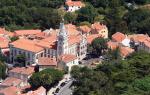
The path to India past the coast of Africa was laid, but the Portuguese were not interested in exploring it. The first European settlements in these areas were organized by the Dutch in 1652. It was they who began to study the cape, the population living in these parts and nature.
The pilgrims managed to find out that historically the area of the cape belonged to the Hottentot tribe, a relative of the Bushmen tribe. It was the Dutch pioneers who founded the city of Cape Town near the cape, the name of which can be translated as “proud on the cape.”
Cape Town began to prosper as all the ships rounding the Cape of Good Hope docked at the port to resupply. The cape became an outpost of the East India Company on its way to India.
In 1657, the Hottentots, dissatisfied with slavery and the taking of land by Europeans, started a war. The excitement was suppressed by the Europeans. In 1795, the settlement could not resist the onslaught of Napoleon and the territory, along with the cape, went to France. 
The Cape of Good Hope disappeared from the world map in 1796. That year, Great Britain ousted the French, and the Cape became known as the “Provincial Colony of Good Hope.” These territories would later become part of the Union of South Africa.
The British managed to find gold deposits near the cape and organize diamond mines, to which adventurers from all over the world flocked. Cape Town has become the main city in Africa. Only in 1961, the Cape of Good Hope, as part of the Union, became the independent Republic of South Africa (RSA) and regained its name.
Climatic conditions
The climate at the Cape of Good Hope is marine subtropical. It’s not for nothing that the peninsula got its name Cape of Storms. The wind blows strong here and does not stop throughout the year. In summer the wind has a south-easterly direction, and in winter – northwest. The best time Spring is considered the best time for tourists to explore the Cape of Good Hope.
In the southern hemisphere it occurs in September-November. In spring, the cape begins to become covered with greenery, there is little precipitation and the temperature allows you to enjoy a walk along the cape.
In summer, the Cape of Good Hope is heated by the warm currents of the Indian Ocean. This is a hot and dry season with little rainfall. Summer on the Cape lasts from December to March. average temperature V summer period 25 °C, but in some years the temperature exceeded 40 °C - this is the absolute temperature maximum. 
Autumn at the Cape of Good Hope occurs between April and May. This is a pleasant and not hot time to travel. At this time you can fully appreciate the beauty of the local nature.
The greatest amount of precipitation on the cape falls in winter in June-August. In June last year, 122 mm Hg fell. Art.
This is the rainiest and cloudiest month of the year. The wind, which constantly blows on the cape during the rainy season, intensifies, remaining warm.
Average temperature for the last 3 years:
| Month | January | February | March | April | May | June | July | August | September | October | November | December |
| Average temperature during the day, 0 C | 26 | 26 | 24 | 22 | 19 | 16 | 16 | 17 | 19 | 21 | 22 | 24 |
| Average temperature at night, 0C | 18 | 18 | 17 | 15 | 14 | 11 | 10 | 11 | 12 | 14 | 15 | 17 |
| Cloudiness, % | 13 | 13 | 18 | 24 | 27 | 33 | 28 | 31 | 29 | 23 | 20 | 17 |
Flora and fauna
The Cape of Good Hope on the world map does not have the best location. But from the point of view natural map world, this area is unique.
Only here there are signs warning car owners: “When starting the car, make sure there are no penguins under it.”
It’s hard to believe, but on such a small piece of land, animals whose habitats are hundreds of kilometers apart coexist peacefully. Only at the Cape of Good Hope you can meet monkeys, zebras, penguins and ostriches in one place in just a few hours of walking. 5% of all animal and plant species on the planet can be seen in South Africa.
The most frequent guests of the cape are: Marine life. Off the coast of the Cape of Good Hope you can meet entire colonies of fur seals, and see sharks and whales swimming past. Since the cape goes deep into the sea, its shore becomes an excellent viewing platform for observing these amazing sea creatures. 
One of the symbols of the cape are fur seals. These are small pinnipeds that are black or brown in color. Not far from Cape Town you can see the island of fur seals. According to various estimates, from 50 to 70 thousand seals live on it. The island looks more like flat rocks with water sticking out on them, on which fur seals live. Previously, poachers caught seals for the production of fur coats; now this is officially prohibited and the animals are under the protection of the South African authorities. 
The monkey family on the island is represented by baboons, who are so accustomed to living among people that they are not afraid of their presence. Tourists often try to feed the animals, so the South African authorities were forced to put up signs with the following content: “Baboons are wild and dangerous animals.”
There are even employees on the island who drive animals away from tourists with sticks. Baboons belong to the monkey family and are very similar in appearance. The height of baboons reaches 75 cm. The usual habitat of baboons is East and Central Africa.
On the way to the cape, you can meet elephants and herds of antelope, which still live in the Republic of South Africa. African ostriches can be found not only on special farms, but also in the wild. They are the only remaining members of the ostrich family in South Africa. The height of birds can reach more than 2.5 m, and their weight exceeds 150 kg. 
An encounter with an ostrich can be dangerous for a tourist. In total, about 850 bird species live permanently in South Africa and the Cape of Good Hope. On the cape you can easily find the nests of some of them.
Penguins are a favorite among tourists. Their population on the Indian Ocean coast is large. They scurry around everywhere, their main habitat is Boulders Beach.
Local authorities decided to give the beach to the penguins. The cape is home to spectacled penguins, which are listed in the International Red Book. These penguins are also called donkey penguins because of their ability to make sounds similar to the “ey” of a donkey. 
2/3 of the flora of the Cape of Good Hope consists of rare plant species that cannot be found in any other corner of the world. Much of the headland is occupied by the Fynbos biome, which consists primarily of rare bush species. There are about 9 thousand species here.
Good Hope Reserve
The reserve is considered not only the main attraction of the cape, but also of South Africa itself. Its area is more than 7 hectares of land. You can get to the reserve from Cape Town by car or rent a bicycle. The journey by car will take about 1.5 hours. The road to the Cape of Good Hope is laid through the territory of the reserve. There is an ostrich farm nearby. 
The Cape of Good Hope remains the most unique point on the world map in terms of the number of unique animal species. Not so long ago, scientists from the UK proved this. The reserve presents all animals and plants living on the Cape Peninsula and in South Africa.
The history of the reserve began recently, in 1938. By that time, more than 1,000 different species of animals and several thousand plants already lived on the territory of the reserve. 
This place contains rare species of animals that are found only on the territory of the reserve and animals brought from all over South Africa. Hyenas, rhinoceroses, ostriches, crocodiles, penguins, giraffes, zebras, antelopes, elephants - all of them can be found in the reserve. 
The reserve is open daily for tourists, the only restriction is bad weather. During storms and storms, tourists are prohibited from visiting the park and the Cape of Good Hope. The most popular among tourists are fur seals and penguins, who are happy to be photographed and are not afraid of humans.
Cape Beaches
During the swimming season, when on the coast good weather tourists are allowed to swim on the beaches of the cape and sunbathe. The swimming season lasts from September to May.
It is worth remembering that the cape is washed on both sides by different oceans, so the temperature in the western part is always a little lower, but there are sandy entries into the water and the waves are calm.
 Eastern Bank warmer, but at the same time gusty winds constantly blow there and formations big waves. The beaches in this part are more suitable for walking and contemplating the ocean.


There are no blank spots left on the world map thanks to people like Bartolomeu Dias, who spent their entire lives for one discovery. Cape of Good Hope - extraordinary a nice place, filled with the romance of wanderings. The edge of the earth that everyone should see.
Article format: Mila Friedan
Video about the Cape of Good Hope
Penguins in Africa: