Sources of geographic information. List of references in geography
Land. The whole world. Countries of the world.
The following significant events have taken place around the world since the beginning of the 20th century:
- Two devastating world wars;
- the Great Depression of the 1930s;
- Huge colonial empires collapsed;
- There is rapid progress in science and technology;
- Cold War between Western Alliance and Warsaw Pact countries;
- The sharp rise in living standards in North America, Europe and Japan;
- Global environmental problems have emerged, including deforestation, lack of energy and water, loss of biodiversity and air pollution;
- The AIDS epidemic has begun;
The world population continues to increase dramatically: from 1 billion in 1820 to 2 billion in 1930, 3 billion in 1960, 4 billion in 1974, 5 billion in 1987, 6 billion in 1999 to 7 billion in 2012.
In the 21st century, the continued exponential growth of science and technology inspires new hopes (such as advances in medicine) and creates fears (such as the development of even deadlier weapons for warfare).
Geographic overview of the world:
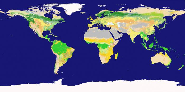
The Earth's surface is made up of approximately 70.9% water and 29.1% land. The water surface is conditionally divided into large groups, called oceans, in descending order of area: the Pacific Ocean, Atlantic Ocean, Indian Ocean, the Southern Ocean (a new term that has appeared in world geography) and the Arctic Ocean.
The land is divided into large parts, which are called continents.
Depending on the classification, the number of continents can vary from five to seven. In Russia, it is customary to separate parts of the world and continents.
In the most common world classification, seven continents are distinguished (from largest to smallest):
Asia,
Africa,
North America,
South America,
Antarctica,
Europe,
Australia.
Asia and Europe are sometimes combined into one continent, which is called Eurasia, in which case six continents are obtained.
In addition, North America and South America are sometimes also combined into one continent - North and South America, resulting in a total of six or five continents, if the term Eurasia is also used.
North America usually includes the island of Greenland, the islands of the Caribbean, and ends in the south with the Panama Canal.
Eastern Europe is generally bounded to the east Ural mountains and the Ural River, in the southeast by the Caspian Sea, in the south by the Caucasus, the Black Sea and mediterranean sea.
Country: Azerbaijan, Georgia, Kazakhstan, Russia and Turkey are located simultaneously in Europe and Asia, but in any case, most of their territory is in Asia.
These countries are considered part of both continents. Armenia and Cyprus, which lie entirely in Western Asia, are geopolitically European countries.
Asia includes all the islands of the Philippines, Malaysia and Indonesia. The Pacific Islands are often combined with Australia and are called Australia and Oceania.
Africa from the northeast is limited by the Suez Canal, but for geopolitical purposes, the Egyptian Sinai peninsula often regarded as part of Africa.
Although the above classifications are the most common, this division is based on cultural sphere, and not on physical-geographical calculations.
A group of articles on geography, sociology, demography and economics of the countries of the world:
| No. p.p. | Name of information |
| 1. | |
| 2. | |
| 3. | |
| 4. | |
| 5. |
A fascinating subject, geography is a scientific discipline that studies the earth's surface, oceans and seas, the environment and ecosystems, and the interaction between human society and the environment. The word geography literally translated from ancient Greek means "description of the earth." The following is a general definition of the term geography:
"Geography is a system of scientific knowledge that studies the physical features of the Earth and the environment, including the influence of human activities on these factors, and vice versa. The subject also covers patterns of population distribution, land use, availability and production."
Scholars who study geography are known as geographers. These people are engaged in the study of the natural environment of our planet and human society. Although the cartographers of the ancient world were known as geographers, today it is a relatively independent specialty. Geographers tend to focus on two main areas of geographical study: physical geography and human geography.
History of the development of geography
The term "geography" was coined by the ancient Greeks, who not only created detailed maps the surrounding area, and also explained the difference between people and natural landscapes in different places on the Earth. Over time, the rich heritage of geography has taken a fateful journey into the bright Islamic minds. The golden age of Islam witnessed astonishing achievements in the field of geographical sciences. Islamic geographers became famous for their pioneering discoveries. New lands were explored and the first base grid for the map system was developed. Chinese civilization also instrumentally contributed to the development of early geography. The compass developed by the Chinese was used by explorers to explore the unknown.
A new chapter in the history of science begins with a period of great geographical discoveries, a period coinciding with the European Renaissance. V European world awakened a fresh interest in geography. Marco Polo - Venetian merchant and traveler led this new era of exploration. Commercial interests in establishing trade contacts with the rich civilizations of Asia, such as China and India, became the main incentive for travel at that time. Europeans have moved forward in all directions, discovering new lands, unique cultures and. The enormous potential of geography for shaping the future of human civilization was recognized, and in the 18th century, it was introduced as a major discipline at the university level. Based on geographical knowledge, people began to discover new ways and means to overcome the difficulties generated by nature, which led to the prosperity of human civilization in all corners of the world. In the 20th century, aerial photography, satellite technology, computerized systems, and sophisticated software revolutionized science and made the study of geography more complete and detailed.
Branches of geography
Geography can be considered as an interdisciplinary science. The subject includes a transdisciplinary approach, which allows you to observe and analyze objects in the space of the Earth, as well as develop solutions to problems based on this analysis. The discipline of geography can be divided into several areas of scientific research. The primary classification geography divides the approach to the subject into two broad categories: physical geography and socio-economic geography.
Physical geography

Defined as the branch of geography that includes the study natural objects and phenomena (or processes) on the Earth.
Physical geography is further subdivided into the following branches:
- Geomorphology: engaged in the study of topographic and bathymetric features of the Earth's surface. Science helps to elucidate various aspects related to landforms, such as their history and dynamics. Geomorphology also attempts to predict future changes in the physical characteristics of the Earth's appearance.
- Glaciology: a branch of physical geography that studies the relationship between the dynamics of glaciers and their impact on the ecology of the planet. Thus, glaciology involves the study of the cryosphere, including alpine and continental glaciers. Glacial geology, snow hydrology, etc. are some subdisciplines of glaciological research.
- Oceanography: Since the oceans contain 96.5% of all water on Earth, the specialized discipline of oceanography is dedicated to their study. The science of oceanography includes geological oceanography (the study of the geological aspects of the ocean floor, seamounts, volcanoes, etc.), biological oceanography (the study of marine life, fauna and ecosystems of the ocean), chemical oceanography (the study of the chemical composition sea waters and their impact on marine forms life), physical oceanography (the study of ocean movements such as waves, currents, tides).
- Hydrology: another important branch of physical geography, dealing with the study of the properties and dynamics of the movement of water in relation to land. It explores the rivers, lakes, glaciers and underground aquifers of the planet. Hydrology studies the continuous movement of water from one source to another, above and below the surface of the Earth, through.
- Soil science: the branch of science that studies the different types of soils in their natural environment on the earth's surface. Helps to collect information and knowledge about the process of formation (pedogenesis), composition, texture and classification of soils.
- : an indispensable discipline of physical geography that studies the dispersal of living organisms in the geographic space of the planet. It also studies the distribution of species over geological time periods. Each geographic region has its own unique ecosystems, and biogeography explores and explains their relationship to physical geographic features. There are various branches of biogeography: zoogeography (the geographical distribution of animals), phytogeography (the geographical distribution of plants), island biogeography (the study of factors affecting individual ecosystems), etc.
- Paleogeography: the branch of physical geography that studies geographic features at various points in time in the earth's geological history. Science helps geographers gain information about continental positions and plate tectonics as determined by studying paleomagnetism and fossil records.
- Climatology: scientific study of climate, as well as the most important section of geographical research in modern world. Considers all aspects related to micro or local climate as well as macro or global climate. Climatology also includes the study of the influence of human society on climate, and vice versa.
- Meteorology: studies weather conditions, atmospheric processes and phenomena that affect local and global weather.
- Ecological geography: explores the interaction between people (individuals or society) and their natural environment from a spatial perspective.
- Coastal geography: a specialized field of physical geography that also includes the study of socio-economic geography. It is devoted to the study of the dynamic interaction between the coastal zone and the sea. Physical processes that form the coasts and the influence of the sea on landscape change. The study also involves understanding the impacts of coastal dwellers on the topography and ecosystem of the coast.
- Quaternary geology: a highly specialized branch of physical geography dealing with the study of the Quaternary period of the Earth ( geographical history Earth spanning the last 2.6 million years). This allows geographers to learn about the environmental changes that have taken place in the recent past of the planet. Knowledge is used as a tool to predict future changes in the world's environment.
- Geomatics: the technical branch of physical geography that involves the collection, analysis, interpretation, and storage of data about the earth's surface.
- landscape ecology: a science that studies the influence of various landscapes of the Earth on the ecological processes and ecosystems of the planet.
Human geography

Human geography, or socio-economic geography, is a branch of geography that studies the impact of the environment on human society and the earth's surface, as well as the impact of anthropogenic activities on the planet. Socio-economic geography is focused on the study of the most developed creatures in the world from an evolutionary point of view - people and their environment.
This branch of geography is divided into various disciplines depending on the direction of research:
- Geography population: deals with the study of how nature determines the distribution, growth, composition, lifestyle and migration of human populations.
- Historical geography: explains the change and development of geographical phenomena over time. While this section is seen as a branch of human geography, it also focuses on certain aspects of physical geography. Historical geography tries to understand why, how and when places and regions on the Earth change, and what impact they have on human society.
- Cultural geography: explores how and why cultural preferences and norms change across spaces and places. Thus, it is concerned with the study of the spatial variations of human cultures, including religion, language, livelihood choices, politics, and so on.
- Economical geography: the most important section of socio-economic geography, covering the study of the location, distribution and organization of human economic activity in geographic space.
- Political geography: considers the political boundaries of the countries of the world and the division between countries. She also studies how spatial structures influence political functions, and vice versa. Military geography, electoral geography, geopolitics are some of the sub-disciplines of political geography.
- Geography of health: explores the impact of geographic location on the health and well-being of people.
- Social geography: studies the quality and standard of living of the human population of the world and tries to understand how and why such standards change depending on place and space.
- Geography settlements: deals with the study of urban and rural settlements, economic structure, infrastructure, etc., as well as the dynamics of human settlement in relation to space and time.
- Geography of animals: studies the animal world of the Earth and the interdependence between humans and animals.
There is a democratic federal legal state with a republican form of government.
The names Russian Federation and Russia are equivalent (Constitution Russian Federation, article 1).
The head of state is the President of the Russian Federation, elected for four years by the citizens of the Russian Federation on the basis of universal, equal and direct suffrage.
State power in the Russian Federation is exercised on the basis of division into legislative, executive and judicial.
The legislative body is the Federal Assembly - the parliament of the Russian Federation, consisting of two chambers - the Federation Council and the State Duma.
Executive power in the Russian Federation is exercised by the Government of the Russian Federation, which consists of the Prime Minister, his deputies and federal ministers.
Moscow is the capital of the Russian Federation
Justice in the Russian Federation is carried out only by the court.
Russia in shape state structure is a federation, which includes 83 equal subjects: 21 republics, 9 territories, 46 regions, 2 federal cities, 1 autonomous region, 4 autonomous districts.
The Russian Federation - Russia - is the world's largest state in terms of area, occupying 17,098.2 thousand km2, which is approximately 1/8 of the land (not counting).
The total population of Russia at the beginning of 2008 was 142.7 million people, of which the urban population accounted for 73%, the rural population - 27%. The average population density is 8.3 people. per 1 km2.
The capital of the state is the city of Moscow (10.4 million people, 2008)
The official language of the state is Russian.
The monetary unit is the ruble.
Russia is located in the northeastern part of the largest continent -, occupying about 1/3 of its territory, including the eastern part of Europe and northern Asia.
The European part of Russia includes the entire territory lying west of the Urals (about 23% of the total area of the country); the share of the Asian part of Russia accounts for over 75% of the area. However, almost 80% of Russia's population is concentrated in its European part (including the entire Urals).

Stella "Asia"
The main part of the territory of Russia is located between 70 ° N. sh. and 50° s. sh.; about 20% of the territory lies beyond the Arctic Circle.
The total length of the borders of the Russian Federation is 60,932.8 km, of which 38,807.5 km are sea borders and 22,125.3 km are land borders. The land border of the Russian Federation has the greatest length with, Mongolia and. Maritime borders exist with Japan and.
extreme north point countries - 81 ° 51 "N - located on Cape Fligeli (Rudolf Island as part of the archipelago), and on the mainland - 77 ° 43" N. sh. - on Cape Chelyuskin (peninsula). extreme south point- 41 ° 10 "N - located 3 kilometers east of Mount Ragdan Main Caucasian ridge. The extreme eastern point of the country - 169 ° 02 "W. - is located on Ratmanov Island in the Bering Strait, and on the mainland -169 ° 40" W. e. - on Cape Dezhnev (Chukotka Peninsula). The extreme western point -19 ° 38 "E - is located in the Kaliningrad region on the border with Poland. The length of the territory of Russia from west to east is 9 thousand km, and from north to south - 4 thousand km.
There are 11 within Russia.
The modern borders of the Russian Federation were formed over a long historical period. Some of them were inherited from the Russian Empire (the entire border with, the border with China and for most of their length). The current maritime border between Russia and the United States was also formed in the century before last, when the tsarist government sold Alaska and Aleutian Islands. The border with Mongolia was finally agreed after its separation from China already in Soviet times, although in fact it was formed earlier.
A significant part of the current Russian borders was established as a result of the Second World War.
New ones, comprising about 12 thousand km, arose as a result of the collapse of the USSR in 1991. The new independent states retained the borders of the former Soviet republics. Russian diplomacy has done a great job of formalizing the new borders in accordance with the norms of international law. In most cases, the experts managed to resolve controversial issues and avoid their politicization.

Russian borders are extremely diverse in morphology. Some of them pass along natural boundaries - large water bodies, mountain ranges and watersheds. In total, the length of the river borders of the country is 7.3 thousand km, lake - about 500 km. In the Caucasus, the border between Russia with and mainly runs along the Main, to the border with Kazakhstan partially runs along the Tigiretsky, Koksuysky, Katunsky ridges.
The degree of development of the border strip depends on the morphological properties of the border and, in particular, on the degree of its coincidence with natural boundaries, which, in turn, largely determines the prerequisites for cross-border cooperation. The border territories of the Republic are distinguished by a high degree of economic and demographic development. North Ossetia- Alania, the Amur Region and the Jewish Autonomous Region, the south of which continues the main strip of Russian settlement and is distinguished by more favorable natural conditions. The population density is relatively high in the border areas of the Orenburg region, as well as in such old-developed areas as in the Belgorod, Bryansk and Pskov regions, and even in some mountainous regions - in the Altai Republic and the Karachay-Cherkess Republic. On the contrary, the steppe regions of a number of regions bordering Kazakhstan, some mountainous regions in the North Caucasus are sparsely populated.

On the very border or very close to it are located such big cities, like Sochi (331.0 thousand inhabitants), Orsk (246.1 thousand inhabitants), Blagoveshchensk (214.3 thousand inhabitants), Novotroitsk (110.6 thousand inhabitants) and others.
The geographical and geopolitical position of Russia is closely connected with its territorial structure and predetermines many features of settlement and economy. It is distinguished by transcontinentality (the country's territory covers part of Europe and Asia) and interoceanic extension (Russia immediately reaches three oceans - the basin, the Pacific and the Arctic oceans.
Most of the sea coast falls on the Northern Seas, which are extremely difficult for navigation and remote from inhabited areas. 8-10% of Russian citizens live directly by the sea - three times less than the average on the planet. However, Russia began to actively restore its merchant fleet, which occupies 13th place in the world in terms of tonnage.

5–6 regions go to the most accessible marginal seas of the Arctic, the Atlantic and the northern and Far Eastern regions each occupy 10–11% of the country's territory with 2–3% of the population and gross domestic product, and the western ones, respectively, 1.6%, 11, 6% and 9.4%. They are the main ports of Russia.
Russia is the most northern state. It accounts for half of the northern regions of the world with an area of 11 million km2, or 64% of the country's territory. The population density of the North is only 1 person. per km2, but in total about 10 million people live there. Russia is the northernmost city in the world with a population of over 1 million people. () and the northernmost city in the world with a population of over 100 thousand (Norilsk). In general, the northern geographic location means high costs for heating and lighting, the need to build durable and protected from adverse natural factors industrial premises. Any construction becomes more expensive permafrost (often in combination with), spreading over 60% of the territory of Russia.
Natural and climatic conditions are one of the reasons for the country's geographical asymmetry: East End countries are more mountainous, the climate there is more severe: St. Petersburg and lie at the same latitude, but frosts on the shores of the Baltic last 4.5 months, and on the Sea of Okhotsk - 7, the average January temperatures are -8 ° and -20 ° С, respectively.

The share of the regions of the European part of Russia, including the Urals, in the entire territory of Russia is 1/4. Four-fifths of the country's inhabitants live in these regions, and the vast majority of the economic potential is concentrated here.
One of the consequences of the boundlessness of Russian spaces is the sparseness of the network of cities. The average distance between them in the inhabited zone of the European part of Russia is 45–75 km, beyond - about 250 km. Therefore, it is so important for Russia to have a highly developed, cheap and efficient transport that ensures high mobility of the population. In a rarefied space, the use of the concept of a settlement framework, based on the predominant development of cities located along transport axes - polyhighways, gives a special effect. This saves transport costs and travel time between cities.
Due to the sparseness of the population and geographical asymmetry, the deep inland geography of production in Russia, the transport intensity of the economy is high, i.e., the ratio of freight turnover of all types of mainline transport to the gross domestic product. At the beginning of this decade, it was 2.5–3 tkm per dollar of production, while in China, Australia, and Canada it was 0.7–1; in the USA - 0.55; in Europe, - and at all 0.2–0.4 tkm. High energy intensity is functionally related to this indicator. Average transportation distance railway- 1330 km, by air- more than 4500.

At the same time, the vast territory of Russia means an abundance and variety of natural resources. Mineral resources make up the main article of Russian exports, providing up to 70% of foreign exchange earnings. In Russia, 20 thousand deposits of almost all types of minerals have been discovered, 37% have been put into operation. An important geopolitical role belongs to fuel and raw materials. Russia's share in the world's proven oil reserves is almost 10%, a third (the first place in the world is 2.5 times more than in the second place), coal - 12%. Russia ranks first in the world in terms of production and.
especially rich natural resources high latitude regions. About a third of its entire area belongs to the Russian sector of the Arctic. The Arctic is 90% of the recoverable hydrocarbon resources of the entire continental shelf of Russia, 80% of the all-Russian explored gas reserves, deposits of many other minerals - apatite, nickel and copper, tungsten, platinoids, tin, gold, manganese, chromite and titanium ores. In the Arctic zone, there are companies that belong to the world giants - Gazprom, Norilsk, oil companies. It produces about 11% of Russia's national income and 22% of exports (with 1% of the population). strategic importance has the Northern Sea Route - a transcontinental highway integrating the economic complex of the Far North and linking the Far Eastern and Western regions of Russia.
The collapse of the USSR led to the formation of an enclave - the Kaliningrad region, now surrounded by the EU countries - Poland and. Communication with him, maintaining the competitiveness of the region's economy is an important geopolitical problem for Russia.
Russia maintains international relations with many in various fields (politics, economics, culture, healthcare, sports, etc.), as well as with various international organizations.
After the creation of the Commonwealth of Independent States - (end of 1991) Russia's position has changed dramatically. Now it is firmly gaining positions of equal partnership.
The priority direction of Russia's foreign policy is the development of relations with the CIS countries. Russia continues to cooperate with organizations in which it is the legal successor of the USSR: the UN (United Nations), OSCE (Organization for Security and Cooperation in Europe), CE (Council of Europe), EU (), APEC (Asia-Pacific Economic Community), ASEAN (Association of Southeast Asian Nations), OAU (Organization of African Unity), etc.
Russia considers international economic organizations as one of the forms of cooperation between states. Russia joined the International Monetary Fund (IMF), became a member of the World Bank Group formed by the International Bank for Reconstruction and Development (IBRD), participates in the activities of the European Bank for Reconstruction and Development (EBRD), and cooperates with the International Energy Agency. As the legal successor of the USSR, Russia cooperates with the International Labor Organization (ILO). Russia has observer status in the World Trade Organization (WTO).
For a long time, man has been interested in what lies beyond the horizon - new territories or the ends of the earth. Centuries passed, civilization accumulated knowledge. The time has come when scientists who have never been to distant lands knew a lot about them. Sources helped with this. geographic information.
This article will tell you about what it is, as well as about their varieties.
General concepts
As you might guess, this is the name of all of which a person can get information of interest to him. What sources of geographic information does grade 5 consider (in a secondary school)? Let's list them:
- All geographical maps, atlases, as well as various topographic plans, including military ones.
- Diverse geographical descriptions specific locality.
- Handbooks, encyclopedic articles, results and reports of various expeditions.
- Aerial photographs and space
- and GPS/GLONASS.
Here are the sources of geographic information grade 5 knows in the average general education school. We will try to consider the characteristics of some of them in a little more detail.
Modern technologies
V last years more and more sources are being converted from paper to digital. And this is not surprising. Almost all 5 sources of geographic information that we just talked about can be found today in digital form. Even professional scientists in recent years prefer to work with the "digit".

It is much more convenient to work with the same GIS system than with a pile of books. Now let's discuss some sources of geographic information in more detail.
Cards
A map is a schematic generalized representation of the surface of a piece of land, the entire planet or celestial bodies. It is built on the principle of scaling, that is, mathematical methods are used for this. Depending on the scale, all maps are usually divided into three large groups:
- Large scale.
- Medium scale.
- Small scale.
If we talk about the first category, then these documents may have a ratio of 1:200,000 or larger. This includes almost all topographic plans. Small-scale maps are considered to be all maps whose ratio is less than 1:1,000,000. A typical geographic atlas includes either small-scale or medium-scale plans that are best suited for studying a particular area.
Sorting map information
You should know that long before creating a map, experts make a strict selection of what will be shown on it. This process is called as follows: cartographic generalization. Naturally, the most stringent selection exists for small-scale maps, since they need to accommodate the maximum volume useful information with a minimum footprint. In the generalization itself, an extremely important role is played by the direct purpose of the card, as well as the wishes of its customer.
Terrain plans

This is the name of the drawings of the area, which are carried out on a large scale (1: 5000 or more), and are drawn using special symbols. In this way, they resemble a school geographical atlas. The construction of such plans is carried out on the basis of visual, instrumental measurements, aerial photography, or a combined method.
Since the plans indicate relatively small areas of the earth's surface, when creating them, the curvature of the planet can be neglected. It should be clearly understood that these sources of geographic information that we have just described are fundamentally different from each other.
The main differences between plans and maps
- In a centimeter of the plan, more than five real kilometers on the ground are rarely laid. They are much more detailed than maps, in one millimeter of which hundreds of kilometers of the earth's surface can be laid.
- All objects on the ground in the plans are depicted as detailed as possible. In principle, all more or less significant areas are marked on the average drawing. So, on the topographic plans of the General Staff of the Armed Forces of the Russian Federation (and the USSR, of course) even trees and small streams can be displayed. It is impossible to fit all this information on the maps. Actually, this is why the generalization, which we talked about above, is being carried out. Even the exact outlines of the continents on many maps cannot be displayed, and therefore they are often plotted with significant distortions. In addition, the above-described additional literature on geography uses off-scale conventions.
- We emphasize once again that when constructing the plan, the curvature of the earth's surface is neglected. Maps, especially on a small scale, take it into account without fail.
- There is never a degree grid on the plans. At the same time, there are parallels and meridians on each of them.
- The plan is always simple in terms of orientation. The top of the document is north, the bottom, respectively, is south. On the maps, the direction is determined by parallels.
Ways of depicting objects on plans and maps

Conventional signs in this case are generally accepted options, in which the characteristics of the objects depicted on the map or plan are encoded. With their help, you can display both something concrete (a mountain, for example), and something completely abstract, conditional (population density in a city, village, etc.). Of course, all of them make life much easier for a person who knows the basics of cartography and can read these drawings.
How long does the map remain valid?
Almost all geographers and geologists ask this question at least once in a while. The specific answer to it depends on the purpose, scale, and author of the plan. So, medieval researchers often drew maps literally “on their knees”, so there is no longer any need to talk about their accuracy. But the maps of the General Staff, despite the time, are still striking in their accuracy.
Do not forget that the maps are quite stable, while the plans of the Amazon and the Nile can be safely thrown away fifty years after they were published. These rivers change the relief of the Earth's surface so effectively and quickly that older documents are only useful in a historical perspective.
Geographic descriptions, discoveries
All sources of geographic information discussed above are somehow dry and uninteresting. It is much more exciting to read a description of some region, area or even the mainland, written by the person who discovered it all!
Jokes aside, but descriptions and reports on geographical (geodesic, biological) studies can sometimes provide much more information than the most detailed topographical plan of the area. Moreover, the latter does not display some unpleasant features of a particular area (malaria, which occurs in some central regions of Africa at every step, for example).
The list of references in geography that students are given at school (for example, Nikolina V.V. Geography, lesson developments; Samkova V.A. We study the forest; Forest Encyclopedia: in 2 volumes / chief ed. G. I. Vorobyov ), just the same, and formed thanks to the work of researchers who at one time entered all this information on the map, being in the thick of things.
Brief information about the discovery of Africa
Let's talk a little about the history of the discovery of the Black Continent. Of course, the word "discovery" is not entirely correct here: here is Australia - yes, I had to suffer with it. In the case of Africa, the coastal regions were well explored, where they caught black slaves and bought ivory from Arab traders, but almost no one knew what was happening in the depths of the continent.
Everything changed in the 19th century, when the legendary arrived in Africa. It was he who had the honor of discovering the origins of the Nile and the magnificent Lake Victoria. Few people know, but the Russian scientist V.V. Junker (in 1876-1886) was once engaged in the studies of Central Africa.
For the indigenous population of the mainland, all this ended sadly: the main sources of geographical information (that is, maps), the data for which all these brave scientists collected with such difficulty and constant danger to life, began to be actively used by slave traders ...
So, with maps and plans, we are actually done. Geographic atlases are in the same category. And what is the role of modern sources of geographic information? To answer this question, let's consider the principle of sharing old paper maps and a navigator, which is now actively used even by professional geographers and geologists.
GPS/GLONASS + maps

It should be noted that this method is excellent for determining the accuracy of maps, atlases and topographic plans. In addition, this technique satisfies the needs of historians, as they can see for themselves how much the area has changed, which is described in historical chronicles by contemporaries of certain events. However, literature on geography often contains plans for the area that have not been updated since the beginning of the last century.
To use such an accurate, but rather laborious and somewhat extravagant method, you will have to bind three times (three different maps) to the same piece of terrain:
- First, find a more or less modern map or topographic plan.
- It is advisable to have a fresh aerospace image of the area under study with a topographic reference to the coordinate system.
- Finally, you need the card whose information you are going to check.
The meaning of this operation is to enter into the memory of the navigator all three of these drawings of the area. Modern models of such devices have a fairly powerful processor and an impressive amount of RAM, so you can switch between cards instantly.
Determination of the route
Route planning is best done using modern map or topographic plan. We do not recommend using old documents for this. It is quite possible that there is now a passable area on the site of the swamp, but you will no longer be able to walk along the edge of the once rare young forest, since the geography of the area has changed dramatically. A map is good, but in most cases such documents are not very accurate.
Why are aerial and satellite photographs preferred over maps?
But why are paper drawings so inferior to the products of modern technology? This is for the following two reasons:
- Firstly, the relevance of space photography or aerial photography in most cases is much higher. When else will cartographers be able to carry out the next generalization of new data and release up-to-date terrain plans?
- In the pictures you can literally in real time determine the characteristics of a particular area. On a map or even a topographical plan, the tree species in the forest will be displayed only schematically and only in a general order. Simply put, it is quite possible to stumble upon a dense spruce forest in the middle of a birch forest, and it is much easier to get lost in a dense coniferous forest.
After choosing a route and checking new pictures, it is recommended to contact old map. Why such difficulties? Imagine that you are a field biologist. You need to determine how much the forest has grown, what new tree species have appeared, how many types of forest have changed over the years. Perfect for all these tasks simple overlay new card to its old counterpart. Thus, everything becomes visible as clearly as possible.

Here are the sources used by geography. The map is perhaps the most important of them, but one should not forget that over the past decades science and technology have made a huge step forward, and therefore it is foolish not to take advantage of all modern achievements.
Conclusion
So you have learned which sources of geographic information are currently the most relevant. Oddly enough, but we still use all the same plans and maps that were invented before our era. Of course, adjusted for their modern look.
Bondarev N. D.
Arkhyz and Bolshaya Laba. -M, 2002.
Foreword
Features of travel in spring and summer
History pages
B.Laba Valley
M1. Kurdzhinovo - pos. Phia.
M2. To the origins of the Great Laba.
MZ. Ashirhumara
M4. To the Labinsk glacier.
Zagedan
M5. To the Zagedan lakes (20 km, 1.5 days)
Other routes
phia
M6. Rechepsta River - trans. Phiya - pos. Phia (23 km, trail, 1 day)
M7. Phiya village - r. Phiya - trans. Urup-Phiya - at the source of the river. Atsgara.
Stormy and Azimba
M8. River B. Laba - r. Stormy - lane. Vorontsova-Velyaminov - l. Azimba - r. Azimba (25 km, 2 days)
M9. Burnaya River - lane. Duritsky - r. Amanauz (17 km, 1 day)
From the upper reaches of Bolshaya Laba
M10. River B. Laba - trans. Zegerker - trans. 46th Army - trans. Alashtrahu, trail, 12 km, 1 day.
M11. Glacier Labinsky - lane. Psyrs - Psyrs lakes (1.5 days)
Sanchara
M12. Phiya village - r. Sanchara - trans. Sanchara - trans. Ad-zapsh, trail, 2 days.
M13. Glade 7th post - mineral springs Adzapsh - per. Adapsh.
M14. Mineral springs Adzapsh - trail along the ridge of the GKH - per. V. Damkhurts - the valley of the river. Damkhurts (trail, 2 days).
M15. River B. Laba - trans. Abgytskha - the left source of the river. Abgytskha (20 km, 1.5 days)
Other routes
Makera
M16. Phiya village - r. Makera - trans. Makera (trail)
Mamhurts
M17. The village of Damkhurts - r. Mamhurts - "Seven lakes" (4-5 days)
Other routes
Damkhurts
M18. The village of Damkhurts - per. Damkhurts
Other routes
Big Zelenchuk. Arkhyz
On the way to Arkhyz
M19. Village Zelenchukskaya - aul Arkhyz (highway, 48 km).
M20. Lower Yermolovka - gully Curve - ancient settlement Shpil - r. Kyafar (trail, 1-2 days).
M21. Monuments of Nizhny Arkhyz (1 day).
M22. To the Savior Not Made by Hands
M23. Lower Arkhyz - Jeti-Karasu tract - Large azimuth telescope.
M24. Climbing Mount Pastukhovaya (2733 m, 4 h)
Other routes
In the vicinity of the village Arkhyz
M25. Medieval Alan settlement (excursion for 4 hours).
M26. Barite beam - Mt. Abishira-Akhuba (8 hours).
M27. Rock Karcha-Tebe - trans. Byoryu-aush
M28. Arkhyz outlook (6 hours).
M29. Cossack glade - Morkh-Syrty lakes - lane. Ozerny.
M30. Climbing Mount Krasnaya (trail, half a day)
Other routes
Arkhyz river valley
M31. Aul Arkhyz - r. Arkhyz (19 km, road).
M32. Arkhyz river - Gabulu-Chat plateau - Smirnova town -r. Psysh (2 days, trail).
M33. Dukka River - trans. Ayulu - r. White - r. Psysh (26 km, 2 days).
M34. Dukka Pass - r. Stormy - r. B. Laba.
M35. Fedoseev Pass (1 A, 2880 m).
M36. Rechepsta River - trans. Atsgara - r. Atsgara (trail, 17 km).
Other routes
Psysh
M37. River valley Psysh - lake. Naurskoye (trail, 31 km).
M38. Naur Pass (1 A, 2839 m).
M39. Magana pass - lakes Psyrs - per. Bearish.
M40. Pshish pass
M41. Sekirtme River - trans. Chuchkhur - Green lakes - per. Hare Ears or per. Kholodovsky - r. Psysh (3 days)
M42. Bush Glacier - trans. Kizgych False - trans. Chuchkhurskaya Shchel - per. Chamagwara.
M43. Glacier Psysh - trans. Tokmak and per. Psysh.
Other routes
White and amanauz
M44. Belaya River (Ayulu) - lane. Dorbun - the source of the river. Stormy
M45. River Gorge Amanauz - trans. Tornau i per. Bear-Labinsky glacier.
M46. Amanauz River - trans. Poachers - r. Burnaya (9 km)
M47. Amanauz and Azimba passes
Other routes
Sofia
M48. Aul Arkhyz - r. Sofia - Glacier farm (road, 16 km).
M49. Sofia waterfalls (half day tour) leave an unforgettable impression.
M50. Sofia Saddle Pass (2640 m)
M51. Glacier farm - r. Ak-Airy - trans. Bash-Jol -r. Psysh (20 km, 1 day)
M52. Ak-Airy River - trans. Topal-Aush (Kozhukhova) - Green lakes (2 days)
M53. Ak-Ayra Glacier - trans. Ak-Airy - r. Kyshlau-su (1 day)
M54. Climbing Mount Nadezhda (1A, 3355 m, 10-12 h)
M55. Ak-Airy River - trans. Kel-Aush - Upper Sofia Lakes - Kel-Bashi city - r. Ak Airy (2-3 days)
M56. River valley Sofia - Gammesh Chat lakes (excursion, 15 km)
M57. Sofia River - trans. Eaglet - lake. Kraternoye - lake. Comma - lakes Kashkha-Echki-Chat - r. Sofia (16 km, 2 3 days)
Other routes
Kizgich
M58. Aul Arkhyz - r. Kizgych - Kshgych-Bash tract (trail, 3-6 days).
M59. Kizgych-Bash tract - Besh-Chuchkhur waterfall - Green lakes ( one day excursion).
M60. Passes Kizgych and Satkharo
M61. The tract Kizgych-Bash - the valley of the river. Salynngan - l. Saleunggan (one day tour)
M62. Lake Mironova (excursion for 6-8 hours)
M63. Kongur, Salynggan, Chvakhra passes
M64. The Baga-Tala tract - per. Bugoychat - r. Marukh (14 km)
M65. Pass of the 810th Rifle Regiment (1 B, 3000 m)
M66. Pass Kurella - lane. Chvakhra - trans. Kongur - trans. Satkharo - trans. Kizgych False
Kafar-Urup. Abishira-Akhuba
M67. The village of Zelenchukskaya - the village of Storozhevaya - the village. Leso-Kyafar
M68. Stanitsa Zelenchukskaya - r. B. Zelenchuk - Generovskaya beam - r. Kyafar-Agur - forestry cordon
At the source of the Kyafar-Agur River
M69. Ridge Kyzylchuk - Scattered hillock - Agur lakes - per. Fedoseeva - Arkhyz (trail, 4-6 days).
M70. Agur lakes - lane. Agur - trans. Mylgval - lake. Kyzylchuk (1-1.5 days).
M71. River Zap. Agur - trans. Kumbyzh - lake. Kyzylchuk - lake. Fish (trail, 4-5 hours).
Other routes
Kyzylchuk. Chilik.
M72. Loose hillock - the tract Kumbyzh - r. Kyzylchuk - lake. Fish - per. Rechepsta - r. Arkhyz (3-4 days)
M73. Fish Lake - per. Kynhara - lake. Chilik - trans. Chilik - r. Arkhyz (1.5-2 days)
M74. Fish Lake - per. Kyzylchuk - lake. Chilik - trans. Psykela - r. Atsgara - Field of poppies (2-3 days)
M75. Traverse Mt. Abishira-Akhuba from the lane. Chilik to per. Rechepsta
M76. Kyafar-Rechepsta pass (1A, 3000 m)
M77. Kyafar-Arkhyz pass (1 A*, 3000 m)
Other routes
Atsgara
M78. Atsgara River - trans. Zagedan - r. Zagedanka - r. B. Laba (1-1.5 days).
M79. Glade of poppies - lane. Kabanly - r. Zagedanka -r. B. Laba
M80. Glade of poppies - lane. Kirthua - r. Zagedanka -r. B. Laba (1.5 days)
To the source of the river Urup
M81. The village of Urup - Mt. Akshirsky - the upper reaches of the river. Urup -r. Zagedanka (trail, 3-4 days)
M82. Big Urup Canyon
M83. Urup-Atsgara pass (1 A*, 3000 m)
Other routes
Brief Toponymic Dictionary
FOREWORD
The Western Caucasus is one of the most popular areas of mountain tourism, which experienced a decline in attendance in the 90s, as, indeed, the entire Caucasus as a whole. In recent years, tourists and climbers have begun to return here. Convenient access roads, various, technically interesting passes and peaks, many high-mountain lakes - all this attracts lovers of mountain travel.
The last book on this area was the guidebook "Mountain travel in the Western Caucasus" (V. V. Arsenin, N. D. Bondarev, E. D. Sergievsky. M: FiS, 1976). From that time on Zap. The Caucasus has undergone major changes.
The paths to the southern slopes of the Main Caucasian Range (GKH) were cut off due to the appearance of the state border, on northern slopes developed new routes. There was a need for a new guide, and it was decided to publish it in two books: "Arkhyz. Bolshaya Laba" (N. D. Bondarev) and "From Marukh to Elbrus" (V. V. Arsenin). They continue the series of guidebooks "Elbrus and its spurs" and "South of Baksan" (A. A. Alekseev).
The guide for each valley first describes the approaches, then the pass routes to the neighboring gorges. By joining separate sections, you can make multi-day routes of different categories of complexity. Descriptions of the passage of passes are tied mainly to July - August. A separate section is devoted to travel in the off-season (April - May, October - November). Techniques for overcoming mountainous terrain, with rare exceptions, are not given.
Due to rare visits to some valleys, descriptions of individual sites may not correspond to the specific situation, primarily in terms of the condition of paths, bridges, and the location of cats. In recent years, intensive melting of glaciers has been observed in the Caucasus, which is why already in August large areas of open ice open even on the slopes of the northern exposure, and the danger of rockfalls increases.
In the descriptions, the indications "left" and "right" are used in an orographic sense, when the observer looks down the river. Other is stipulated.
At present, the region has become borderline. To visit it, especially near the border with Abkhazia, a permit is required, which can be obtained in advance at the address: 357100, Karachay-Cherkess Republic, Cherkessk, st. Leonova, 2, military unit 2011.
At the end of the book is a list of literature that allows you to become more familiar with the nature and history of the area.
In the guide, the chapter "General Geographical Information" was written jointly with V. V. Arsenin. E. A. Alperten, E. A. Chernopyatov took part in the descriptions of the routes. A. Kovalenko, A. Kozhukhov, N. V. Koloshina, V. P. Kuznetsov, I. T. Kuznetsov, V. A. Lunin, P. F. Chirukhin, V. Ya. . It should be noted that L. V. Wegener played a special role in the preparation of the guide. He compiled a toponymic dictionary, described several routes and made valuable comments on the text and diagrams.
The guidebook uses photographs by E. A. Alperten, N. D. Bondarev, V. A. Zheltyakov, N. Yu. Kretov, A. V. Pavelchik and E. A. Chernopyatov. At the final stage of preparing the book, V. A. Kozhin, V. V. Konyshev, L. V. Turkina, E. A. Chernopyatov did a great deal of technical work.
GENERAL GEOGRAPHICAL INFORMATION
The Western Caucasus is the region of the Caucasus west of Elbrus with borders along the upper reaches of the Kuban and Nenskra. In a narrower sense, to Zap. The Caucasus includes the area that includes the high-altitude, glacier-covered section of the Main Caucasian Range (GKH) about 200 km long. Located to the west, more low mountains attributed to the North-West. Caucasus.
The guide covers part of Zap. Caucasus with mountains in the upper reaches of B. Zelenchuk, B. Laba, Kyafar-Agur and Urup. Administratively, this territory belongs to the Karachay-Cherkess Republic, Stavropol and Krasnodar region. Most high peaks district - Pshish (3790 m) and Sofia (3640 m).
To the north, spurs depart from the GKH, separated by deep valleys of the B. Zelenchuk and B. Laba tributaries. At a distance of about 20 km from the GKH, the ridge is located parallel to it. Abishira-Akhuba, belonging to the system of the Advanced (Lateral) Range. By the way, Elbrus (5642 m) also belongs to it. Even further north, along Peredovoe, the Rocky Range stretches (altitude about 2000 m), which has gentle northern slopes. To the south of the GKH are the Bzybsky and Chkhalta ridges. Their spurs cut deep canyons the Amtkel, Jampal, Kelasuri and Gumista rivers gradually disappear towards the Black Sea coast.
The rivers of the northern slope of the GKH cut through the Side Range with narrow gorges, and in the upper reaches many valleys have extensive basins. The rivers originate from glaciers and snowfields, the maximum water falls in the summer, for the most part the rivers are clean and transparent.
The mountain river is a serious obstacle. The crossing is especially difficult in rainy weather, when the water level rises noticeably. In the Caucasus, where there is a fairly dense network of roads and trails, through almost all major rivers there are bridges. It is necessary to tie a route to them. Shepherds arrange luggage, temporary bridges and across large streams. You can find out about the state of these crossings in the villages, kosh.
There are many lakes in this region. At a height, the largest of them lie in the caravans left by ancient glaciers. Numerous small tarns and moraine lakes (some with ice until the end of summer) give these mountains a special charm.
The higher raised Mountain country, the deeper and more ancient stone layers are opened up and come into view as a result of weathering and washout of rocks. When traveling through the valleys of the Kuban, near Cherkessk, near the river, you see Quaternary deposits and sedimentary rocks of the Tertiary period (up to 65 million years old), beyond Ust-Dzhegutinskaya - the Cretaceous period (up to 140 million years old). Then, at the entrance to Karachaevsk and behind it, you cross a wide belt of Jurassic rocks (up to 200 Ma).
On the seismic map of the country, the Caucasus is assigned to the 7-8 point zone. An earthquake in the mountains is dangerous due to the occurrence of rockfalls, collapse of cornices and mudflows. A strong earthquake, called Chkhalta, occurred on July 16, 1963. Its epicenter was near the village of Ptysh, which caused great damage. A rockfall led to a tragedy in a group of climbers on the wall of Mount Dombay-Ulgen.
Landslides occurred on the southern slope of the GKH, where at that time there was a thunderstorm with a downpour. As a result, the road to the village was destroyed in several places. Chkhalta. The landslide blocked the upper reaches of the river. Ptysh. The river swept away the barrier, the mudflow washed away the banks and knocked down the forest.
Although strong tremors are rare, the probability of them forces one to carefully approach the choice of a bivouac site, critically evaluating it (including ready-made sites) from the point of view of rockfall.
The climate of the region is influenced by two factors: proximity to the Black Sea and a chain of high mountains. The influence of the sea is stronger on the southern slopes, which intercept a significant part of the moisture of warm western and southwestern winds. At their foot and on the coast, about 1500 mm of precipitation falls annually. With height, the amount of precipitation increases, reaching 3000 mm or more. In winter, a lot of snow falls at moderate altitudes; in the highlands, the thickness of the snow cover reaches several meters.
The northern slopes are colder and drier. When crossing the GKH, this difference is very noticeable. As the mountains rise, the temperature drops and the amount of precipitation increases. In Teberda, located at an altitude of about 1300 m, average temperature July +15.6 "C, January ~ 4 "C, about 700 mm of precipitation falls per year.
In Dombai (1630 m) the temperature is several degrees lower, and the precipitation is twice as much. According to long-term observations at the meteorological station "Klukhorsky pass" (2037 m), the height of the snow cover reaches 2 m, and on the pre-summit slopes it reaches 4 m. The rainiest months are May and June. The relatively dry season runs from August to October. In August, at altitudes of 2500 m, frosts are already frequent.
Over the past hundred years, the area of most glaciers has decreased by about a quarter, and their number has increased due to crushing (although some small ones have disappeared altogether). The average thickness of cirque glaciers is 25-30 m, and that of large valley glaciers is 100 m. The glaciers continue to retreat, moraines are covered with grass and shrubs. The Caucasus is characterized by the proximity of glaciers and bright greenery. Azalea blooms in the Khetskvara Gorge in July, a few dozen meters from the glacier.
Avalanche danger occurs in late autumn in October - November, when snowfalls begin. Dry snow avalanches occur during or immediately after heavy snowfalls (70-100 mm per day). During snowstorms, snow boards form. In cold winters with little snow, the cause of an avalanche can be the formation of an unstable layer of deep frost. With the transition of the average daily temperature through 0 ° C in March - April, the time of wet avalanches begins. They are also possible in winter during thaws. Mass avalanches usually end by May, but in the highlands this period is delayed. On snowy slopes and under eaves, avalanche danger persists all year round.
Avalanche cones remain at the foot of the slopes until the middle, and in shaded places until the end of summer. The danger of avalanches also exists in the middle mountains: avalanche centers, although rare, are known near Teberda and Arkhyz. Special attention to avalanche danger is required when traveling in spring (May) and autumn.
Entering the mountains from the north, you first cross the belt of deciduous forests, starting from a height of 500-600 m. beech. In the wide developed parts of the valleys, such forests are found in islands, but they cover the steep, hard-to-reach slopes of the gorges completely. Alder and willow grow along the banks of the rivers. At altitudes from 1200-1400 m to 2200 m there are dark coniferous forests (fir, spruce). Dry sunny slopes and rocks are occupied by pine.
Above is the subalpine belt, the limits of which range from 1800 to 2500 m. A strip of beech, birch, and maple crooked forests stretches above the edge of the tall forest. Thickets of rhododendrons also creep here, the bushes of which bloom at different times, and its white or cream inflorescences can be seen almost all summer. Even higher lie tall-grass, human-height meadows. Here is the realm of flowers: orange elecampane, blue bells, white daisies, pink mallows, yellow lilies, crimson clover. In the middle of a sea of flowers, three-meter hogweed umbrellas rise. Touching it causes long-term non-healing burns.
On the gentle slopes where cattle graze, the herbage is poorer. Thickets of horse sorrel and poisonous hellebore stand out here. In alpine meadows (2500-3200 m) short grass does not hide stones. The floral carpet is filled with bright blue hyacinths, purple primroses, yellow buttercups, pink asters and purple bluebells. Grass and flowers also grow on rock shelves high above snowfields and ice.
Animal world includes more than 40 species of mammals and 120 species of birds. Wild boar, roe deer, Caucasian deer, fox, lynx, jackal, and marten are found in the forests. The hare is found everywhere. The Altai squirrel, introduced in 1937, has spread. There are also wolves. In the Caucasian and Teberdinsky reserves, work is underway to restore the herd exterminated at the beginning of the 20th century. Caucasian bison. The brown bear stays near the border of the forest in summer, where you can stumble upon a nest he left behind. It also enters the valleys, especially the raspberries. On the grassy ledges near the forest, you can see a herd of chamois, and on the rocks in the upper reaches of the gorges - tours. Turya "paths" go along barely noticeable ledges and shelves, traces of tours are also found on snowfields. It is dangerous to be below these animals, because stones can fall from under the hooves!
Among the birds of the forest and meadow zone, there are both common for the middle zone - jay, woodpecker, cuckoo, and mountain ones - stone partridge (keklik), griffon vulture, black vulture. In the highlands lives the snowcock (large gray turkey) and the black alpine jackdaw with a yellow beak, which lives near glaciers and snowfields.
Of the reptiles, there are (up to the rocks of the Alpine belt) lizards, snakes, copperheads, steppe and Caucasian vipers. Caucasian viper, endemic Zap. Caucasus, occurs up to a height of 2500 m in glades and overgrown screes. In the subalpine zone, the viper keeps near rocks and talus. It can have a different color, but it is characterized by a wide black zigzag stripe on the back. The snake is difficult to distinguish among dry fern leaves or stones covered with lichens.
Trout is found in rivers and some lakes.
On the Zap. There are nature reserves in the Caucasus - Caucasian and Teberdinsky (with a branch in Arkhyz). Permission is required to stay in them. In the gorges (B. Zelenchuk, Urup, B. Laba, etc.) created reserves where hunting is prohibited, fishing and picking berries.
The foothills and valleys suitable for agriculture and horticulture are densely populated. The main type of economic activity is cattle breeding. The movement of livestock to mountain pastures takes place in May-June, the season usually lasts until September. For temporary residence, traditional koshi are used - huts made of logs, stone, shreds or twigs and tents.
Meadows in the valleys, where there are roads, are used for haymaking. Highlanders value them, clean them from stones and enclose them. In no case should you trample the grass, shortening the paths, arrange a bivouac on it and scatter stones.