Features of the coastline of the Caspian Sea. Caspian Sea (largest lake)
, Kazakhstan, Turkmenistan, Iran, Azerbaijan
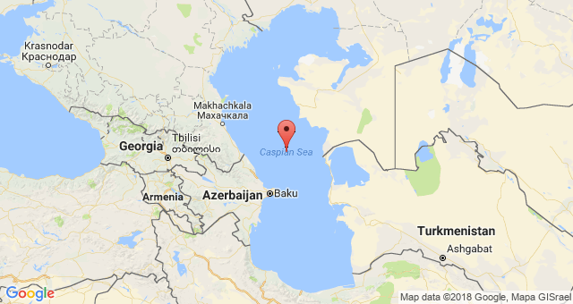
Geographical position

Caspian Sea - view from space.
The Caspian Sea is located at the junction of two parts of the Eurasian continent - Europe and Asia. The length of the Caspian Sea from north to south is about 1200 kilometers (36 ° 34 "-47 ° 13" N), from west to east - from 195 to 435 kilometers, on average 310-320 kilometers (46 ° -56 ° c. d.).
The Caspian Sea is conventionally divided by physical and geographical conditions into 3 parts - the North Caspian, the Middle Caspian and the South Caspian. The conditional border between the North and Middle Caspian runs along the line about. Chechnya - Cape Tyub-Karagan, between the Middle and South Caspian - along the line of about. Residential - Cape Gan-Gulu. The area of the North, Middle and South Caspian Sea is 25, 36, 39 percent, respectively.
Caspian Sea coast

Coast of the Caspian Sea in Turkmenistan
The territory adjacent to the Caspian Sea is called the Caspian region.
Peninsulas of the Caspian Sea
- Ashur-Ada
- Garasu
- Zyanbil
- Hara-Zira
- Sengi-Mugan
- Chygyl
Bays of the Caspian Sea
- Russia (Dagestan, Kalmykia and the Astrakhan region) - in the west and north-west, length coastline about 1930 kilometers
- Kazakhstan - in the north, north-east and east, the length of the coastline is about 2320 kilometers
- Turkmenistan - in the southeast, the length of the coastline is about 650 kilometers
- Iran - in the south, the length of the coastline is about 1000 kilometers
- Azerbaijan - in the south-west, the length of the coastline is about 800 kilometers
Cities on the coast of the Caspian Sea
On the Russian coast there are cities - Lagan, Makhachkala, Kaspiysk, Izberbash and the most Southern City Russia Derbent. Astrakhan is also considered a port city of the Caspian Sea, which, however, is not located on the shores of the Caspian Sea, but in the Volga delta, 60 kilometers from the northern coast of the Caspian Sea.
Physiography
Area, depth, volume of water
The area and volume of water in the Caspian Sea varies significantly depending on the fluctuations in the water level. At a water level of -26.75 m, the area is approximately 371,000 square kilometers, the volume of water is 78 648 cubic kilometers, which is approximately 44% of the world's lake water reserves. The maximum depth of the Caspian Sea is in the South Caspian depression, 1025 meters above its surface. In terms of maximum depth, the Caspian Sea is second only to Baikal (1620 m) and Tanganyika (1435 m). The average depth of the Caspian Sea, calculated according to the bathygraphic curve, is 208 meters. At the same time, the northern part of the Caspian is shallow, its maximum depth does not exceed 25 meters, and the average depth is 4 meters.
Water level fluctuations
Vegetable world
The flora of the Caspian Sea and its coast is represented by 728 species. Of the plants in the Caspian Sea, algae predominate - blue-green, diatoms, red, brown, charovy and others, from flowering plants - zostera and ruppia. By origin, the flora belongs mainly to the Neogene age, however, some plants were introduced into the Caspian Sea by humans deliberately or on the bottoms of ships.
History of the Caspian Sea
Origin of the Caspian Sea
Anthropological and cultural history of the Caspian Sea
Finds in the Khuto cave off the southern coast of the Caspian Sea indicate that people lived in these parts about 75 thousand years ago. The first mentions of the Caspian Sea and tribes living on its coast are found at Herodotus. Approximately in the V-II centuries. BC NS. the tribes of the Saks lived on the coast of the Caspian. Later, during the period of the settlement of the Turks, during the IV-V centuries. n. NS. Talysh tribes (Talysh) lived here. According to ancient Armenian and Iranian manuscripts, Russians sailed in the Caspian Sea from the 9th-10th centuries.
Exploration of the Caspian Sea
The exploration of the Caspian Sea was started by Peter the Great, when, on his order, in 1714-1715, an expedition was organized under the leadership of A. Bekovich-Cherkassky. In the 1720s, hydrographic research was continued by the expedition of Karl von Verden and F.I.Soimonov, and later by I.V. Tokmachev, M.I.Voinovich and other researchers. At the beginning of the 19th century, instrumental survey of the coast was carried out by I.F.Kolodkin, in the middle of the 19th century. - instrumental geographic survey under the direction of N. A. Ivashintsev. Since 1866, for more than 50 years, expeditionary research on the hydrology and hydrobiology of the Caspian has been conducted under the leadership of N.M. Knipovich. In 1897, the Astrakhan Research Station was founded. In the first decades of Soviet power in the Caspian Sea, geological research by I. M. Gubkin and other Soviet geologists was actively carried out, mainly aimed at finding oil, as well as research to study the water balance and fluctuations in the level of the Caspian Sea.
Economy of the Caspian Sea
Mining of oil and gas
Many oil and gas fields are being developed in the Caspian Sea. The proven oil resources in the Caspian Sea are about 10 billion tons, the total oil and gas condensate resources are estimated at 18-20 billion tons.
Oil production in the Caspian Sea began in 1820, when the first oil well was drilled on the Absheron shelf near Baku. In the second half of the 19th century, oil production began in industrial volumes on the Apsheron Peninsula, then in other territories.
Shipping
Shipping is well developed in the Caspian Sea. Ferry services operate on the Caspian Sea, in particular, Baku - Turkmenbashi, Baku - Aktau, Makhachkala - Aktau. The Caspian Sea has a navigable connection with the Azov Sea through the Volga, Don and Volga-Don Canal.
Fishing and seafood production
Fishing (sturgeon, bream, carp, pike perch, sprat), caviar and seal fishing. More than 90 percent of the world's sturgeon catch is carried out in the Caspian Sea. In addition to industrial production, illegal production of sturgeon and their caviar is flourishing in the Caspian Sea.
Recreational resources
The natural environment of the Caspian coast with sandy beaches, mineral waters and curative mud in the coastal area creates good conditions for recreation and treatment. At the same time, in terms of the development of resorts and tourism industry, the Caspian coast is noticeably inferior to the Black Sea coast of the Caucasus. However, in last years the tourism industry is actively developing on the coasts of Azerbaijan, Iran, Turkmenistan and Russian Dagestan. Azerbaijan is actively developing resort area in the Baku region. At the moment, a world-class resort has been created in Amburan, another modern tourist complex is being built in the area of the village of Nardaran, recreation in the sanatoriums of the villages of Bilgah and Zagulba is very popular. A resort area is also being developed in Nabran, in the north of Azerbaijan. but high prices, in general, the low level of service and the lack of advertising lead to the fact that there are almost no foreign tourists in the Caspian resorts. Development tourism industry in Turkmenistan, a long-term policy of isolation interferes; in Iran, there are Sharia laws, which make it impossible for foreign tourists to have a mass rest on the Caspian coast of Iran.
Ecological problems
Environmental problems of the Caspian Sea are associated with water pollution as a result of oil production and transportation on the continental shelf, the influx of pollutants from the Volga and other rivers flowing into the Caspian Sea, the life of coastal cities, as well as flooding of certain objects due to the rise in the level of the Caspian Sea. Predatory hunting of sturgeon and their caviar, rampant poaching lead to a decrease in the number of sturgeon and to forced restrictions on their production and export.
International status of the Caspian Sea
Legal status of the Caspian Sea
After the collapse of the USSR, the division of the Caspian Sea for a long time was and still remains the subject of unresolved disagreements related to the division of the Caspian shelf resources - oil and gas, as well as biological resources. For a long time, negotiations were going on between the Caspian states on the status of the Caspian Sea - Azerbaijan, Kazakhstan and Turkmenistan insisted on dividing the Caspian along the median line, Iran - on dividing the Caspian by one fifth between all the Caspian states.
With regard to the Caspian, the key is the physical and geographical circumstance that it is a closed inland water body that does not have a natural connection with the World Ocean. Accordingly, the norms and concepts of international maritime law should not be automatically applied to the Caspian Sea, in particular, the provisions of the 1982 UN Convention on the Law of the Sea. economic zone "," continental shelf ", etc.
The current legal regime of the Caspian Sea was established by the Soviet-Iranian treaties of 1921 and 1940. These treaties provide for freedom of navigation throughout the sea, freedom of fishing with the exception of ten-mile national fishing zones and a ban on ships flying the flag of non-Caspian states in its waters.
Negotiations on the legal status of the Caspian are ongoing.
Delimitation of sections of the seabed of the Caspian Sea for the purpose of subsoil use
The Russian Federation signed an agreement with Kazakhstan on delimiting the bottom of the northern part of the Caspian Sea in order to exercise sovereign rights to subsoil use (dated July 6, 1998 and the Protocol to it dated May 13, 2002), an agreement with Azerbaijan on delimiting adjacent sections of the bottom of the northern part of the Caspian Sea (dated September 23, 2002), as well as the trilateral Russian-Azerbaijani-Kazakh agreement on the junction point of the delimitation lines of adjacent sections of the Caspian Sea bottom (dated May 14, 2003), which established geographical coordinates dividing lines limiting the seabed areas within which the parties exercise their sovereign rights in the field of exploration and production of mineral resources.
The Caspian Sea is located between Asia and Europe. It is the largest salt sea-lake located in Kazakhstan, Russia, Azerbaijan, Iran and Turkmenistan. At present, its level is 28 meters below the level of the World Ocean. The depth of the Caspian Sea is quite large. The area of the reservoir is 371 thousand square kilometers.
History
About five million years ago, the sea split into small bodies of water, including the Black and Caspian Sea... After these events, they joined and separated. About two million years ago Caspian lake was cut off from the oceans. This period is considered the beginning of its formation. Throughout history, the reservoir has changed its contours several times, and the depth of the Caspian Sea has also changed.
Now the Caspian is the largest inland water body, containing about 44% of the planet's lake waters. Despite the ongoing changes, the depth of the Caspian Sea has not changed very much.
Once it was called the Khvali and Khazar, and the tribes of horse breeders gave it another name - the Caspian. This is the name of the tribe living on the southwestern shore of the reservoir. In total, during its existence, the lake had more than seventy names, here are some of them:
- Abeskunskoe.
- Derbent.
- Saraiskoe.
- Sihai.
- Dzhurdzhanskoe.
- Girkanskoe.
Depth and relief
The relief and features of the hydrological regime divide the sea-lake into northern, middle and southern parts. Over the entire area of the Caspian Sea, the average depth is 180-200 m, but the relief in different parts is different.
The northern part of the reservoir is shallow. Here the depth of the Caspian Sea-lake is approximately 25 meters. In the middle part of the Caspian there is a very deep depressions, continental slopes, shelves. Here the average depth is 192 meters, and in the Derbent depression - about 788 meters.
The greatest depth of the Caspian Sea is in the South Caspian depression (1025 meters). Its bottom is flat, and there are several ridges in the northern part of the depression. It is here that the maximum depth of the Caspian Sea is noted.

Features of the coastline
Its length is seven thousand kilometers. The northern part of the coastline is lowland, the southern and western are mountains, and the eastern is highlands. The spurs of Elbrus and the Caucasus Mountains approach the shores of the sea.
The Caspian has large bays: Kazakh, Kizlyar, Mangyshlak, Kara-Bogaz-Gol, Krasnovodsky.
If you go on a cruise from north to south, the route will be 1200 kilometers long. In this direction, the reservoir has an elongated shape, and from west to east the width of the sea is different. At its narrowest point, it is 195 kilometers, and at its widest - 435 kilometers. The average width of the reservoir is 315 km.
The sea has several peninsulas: Mangyshlak, Buzachi, Miankale and others. There are also several islands here. The largest are Chygyl, Kur-Dashi, Gum, Dash, and Seal Islands.

Reservoir nutrition
About one hundred and thirty rivers flow into the Caspian. Most of them flow in the north and west. The main river flowing into the sea is the Volga. Three large rivers account for about ninety percent of the runoff: the Volga (80%), the Kura (6%) and the Ural (5%). Five percent - to Terek, Sulak and Samur, and the remaining four are brought by small rivers and streams of Iran.
Caspian resources
The reservoir has amazing beauty, a variety of ecosystems and a rich supply of natural resources. When there are frosts in its northern part, magnolias and apricots bloom in the south.
The relict flora and fauna have been preserved in the Caspian Sea, including the largest flock of sturgeon fish. As it evolved, the marine flora changed more than once, adjusting to salinization and desalination. As a result, there are many freshwater species in these waters, but few marine ones.
After the Volga-Don Canal was built, new types of algae appeared in the reservoir, which were previously found in the Black and Azov Seas. Now there are 854 animal species in the Caspian, of which 79 are vertebrates, and over 500 plant species. This unique sea-lake provides up to 80% of all sturgeon catch in the world and about 95% of black caviar catch.
There are five sturgeon species in the Caspian: stellate sturgeon, thorn, sterlet, beluga and sturgeon. Beluga is the largest member of the species. Its weight can reach a ton and its length is five meters. In addition to sturgeon fish, herring, salmon, kutum, roach, asp and other types of fish are caught in the sea.
Of the mammals in the Caspian Sea, only the local seal is found, which is not found in other water bodies of the world. It is considered the smallest on the planet. Its weight is about a hundred kilograms, and its length is 160 centimeters. The Caspian region is the main migration route for birds between Asia, the Middle East and Europe. Each year, approximately 12 million birds fly over the sea during their migration (in the spring to the south, and in the fall to the north). In addition, another 5 million remain in these places for wintering.

The greatest wealth of the Caspian Sea is its huge reserves of oil and gas. Geological exploration in the region has discovered large deposits of these minerals. Their potential puts the local reserves in second place in the world after
The Caspian Sea is one of the largest salt water bodies on Earth, located at the junction of Europe and Asia. Its total area is about 370 thousand square meters. km. The reservoir receives over 100 water streams. The largest rivers flowing into the Volga, Ural, Emba, Terek, Sulak, Samur, Kura, Atrek, Sefidrud.
Volga river - the pearl of Russia
The Volga is a river flowing in the territory of the Russian Federation, partially crosses Kazakhstan. Belongs to the category of the largest and longest rivers on Earth. The total length of the Volga is over 3,500 km. The river originates in the Volgoverkhovye village of the Tver region, located on After that, it continues its movement through the territory Russian Federation.
It flows into the Caspian Sea, but does not have a direct outlet to the World Ocean, therefore it is referred to as internal flows. The watercourse receives about 200 tributaries and has more than 150 thousand drains. Today, reservoirs have been built on the river, which allow regulating the flow, due to which fluctuations in the water level have been sharply reduced.
The fishing of the river is varied. Melon growing prevails in the Volga region: the fields are occupied by grain and industrial crops; table salt is mined. Oil and gas fields have been discovered in the Urals region. The Volga is the largest river flowing into the Caspian Sea, therefore it is of great importance for Russia. The main transport facility that allows you to cross this stream is the longest in Russia.
Ural - a river in Eastern Europe
The Ural, like the Volga River, flows on the territory of two states - Kazakhstan and the Russian Federation. The historical name is Yaik. It originates in Bashkortostan at the top of the Uraltau ridge. The Ural River flows into the Caspian Sea. Its pool is the sixth largest in the Russian Federation, and its area is more than 230 sq. km. An interesting fact: the Ural River, contrary to popular belief, belongs to the inner European river, and only its upper course in Russia belongs to Asia.
The mouth of the watercourse is gradually shallowing. At this point, the river is divided into several branches. This feature is typical for the entire length of the channel. During floods, one can observe how the Ural overflows its banks, in principle, like many other rivers in Russia flowing into the Caspian Sea. This is especially observed in places with a gentle coastline. Flooding occurs at a distance of up to 7 meters from the channel.

Emba - the river of Kazakhstan
Emba is a river flowing in the territory of the Republic of Kazakhstan. The name comes from the Turkmen language, literally translates as "the valley of food". The river basin with an area of 40 thousand square meters. km. The river begins its journey in the Mugodzhary mountains and, flowing along, is lost among the marshes. Asking which rivers flow into the Caspian Sea, we can say that in full-flowing years the Emba reaches its basin.
Natural resources such as oil and gas are being extracted along the river's coastline. The issue of passing the border between Europe and Asia along the Emba watercourse, as in the case of the river. Ural, open topic and today. The reason for this is a natural factor: the mountains of the Ural ridge, which are the main reference point for drawing borders, disappear, forming a homogeneous terrain.
Terek - mountain water stream
Terek - river North Caucasus... The name is literally translated from Turkic as "poplar". Terek flows out of the glacier of Mount Zilga-Khokh, located in the Trusovsky gorge Caucasian ridge... passes through the lands of many states: North Ossetia, Georgia, Stavropol Territory, Kabardino-Balkaria, Dagestan and Chechen Republic... It flows into the Caspian Sea and the Arkhangelsk Gulf. The length of the river is just over 600 km, the basin is about 43 thousand square meters. km. An interesting fact is that every 60-70 years the stream forms a new transit arm, while the old one loses its strength and disappears.
The Terek, like other rivers flowing into the Caspian Sea, is widely used to meet human economic needs: it is used to irrigate arid areas of adjacent lowlands. Also, there are several hydroelectric power plants on the water stream, the total average annual output of which is more than 200 million kWh. In the near future, it is planned to launch new additional stations.

Sulak - water stream of Dagestan
Sulak is a river that connects the Avar Koisu and the Andean Koisu streams. It flows on the territory of Dagestan. It begins in the Main Sulak Canyon and ends its journey in the waters of the Caspian Sea. The main purpose of the river is water supply to two cities of Dagestan - Makhachkala and Kaspiysk. Also, several hydroelectric power plants are already located on the river, it is planned to launch new ones to increase the generated capacity.
Samur - the pearl of South Dagestan
Samur is the second largest river in Dagestan. Literally the name is translated from Indo-Aryan as "abundance of water". It begins at the foot of Mount Guton; it flows into the waters of the Caspian by two branches - Samur and Maly Samur. The total length of the river is just over 200 km.
All rivers flowing into the Caspian Sea are of great importance for the territories through which they flow. Samur is no exception. The main direction of the use of the river is irrigation of lands and provision of residents of nearby cities drinking water... It is because of this that the hydroelectric complex and a number of the Samur-Divichinsky canal were built.
At the beginning of the 20th century (2010), Russia and Azerbaijan signed an interstate agreement requiring both sides to efficiently use the resources of the Samur River. The same agreement introduced territorial changes between these countries. The border of the two states was moved to the middle of the hydroelectric complex.

Kura is the largest river in Transcaucasia
Asking which rivers flow into the Caspian Sea, I would like to describe the Kura stream. It flows on the ground of three states at once: Turkey, Georgia, Azerbaijan. The length of the stream is more than 1000 km, the total area of the basin is about 200 thousand square meters. km. Part of the basin is located on the territory of Armenia and Iran. The source of the river is in the Turkish province of Kars, and flows into the waters of the Caspian Sea. The path of the river is thorny, laid among hollows and gorges, for which it got its name, which in translation from the Mingrelian language means "gnaw", that is, the Kura is a river, "gnawing" itself even among the mountains.
There are many cities on it, such as Borjomi, Tbilisi, Mtskheta and others. It plays an important role in meeting the economic needs of the inhabitants of these cities: hydroelectric power plants are located, and the Mingechevir reservoir created on the river is one of the main reserves of fresh water for Azerbaijan. Unfortunately, the ecological state of the stream leaves much to be desired: the level of harmful substances is several times higher than the permissible limits.

Features of the Atrek River
Atrek is a river located in Iran and Turkmenistan. It originates in the Turkmen-Kharasan mountains. Due to the active use in economic needs for irrigating land, the river became shallow. For this reason, it reaches the Caspian Sea only during the flood period.
Sefidrud - a high-water river of the Caspian
Sefidrud is a large river of the Iranian state. Initially it was formed by the confluence of two water streams - Kyzyluzen and Shahrud. Now it flows out of the Shabanau reservoir and flows into the depths of the Caspian. The total length of the river is over 700 km. The creation of a reservoir has become a necessity. It made it possible to minimize the risks of flooding, thereby protecting the cities located in the river delta. Water is used for irrigation of lands with a total area of more than 200 thousand hectares of land.

As can be seen from the presented material, the Earth's water resources are in an unsatisfactory state. The rivers flowing into the Caspian Sea are actively used by man to satisfy his needs. And this has a detrimental effect on their condition: the watercourses are depleted and polluted. That is why scientists from all over the world are sounding the alarm and conducting active propaganda, calling for saving and conserving water on Earth.
The program of celebration of the Day of the Caspian Sea has begun in Astrakhan today. Such holidays are celebrated in five Caspian states. Although the Caspian does not require so much in modern conditions festive events how much respect from all who inhabit its shores and exploit its wealth.
“Caspian News”, of course, cannot stand aside, because the attitude towards the Caspian Sea is in the very name and ideology of our portal. Our story about a unique reservoir is a kind of tribute to the “hero of the occasion”.
The uniqueness of the Caspian Sea lies, first of all, in the fact that it is not a sea at all, but a real drainless lake. The sea should have access to the World Ocean, which the Caspian does not have, on the other hand, this salt lake has all the sea features, from the ebb and flow and ending with real storms, about which the sailors say: “Anyone who has survived a storm in the Caspian is not afraid of any oceanic storms ". And the oceanic bottom topography is convincing evidence that initially the Caspian, together with the Black and The Azov seas belonged to a single ancient body of water, that is, was part of the oceans.
Where the Caspian Lake is now located, a depression was formed in the earth's crust several tens of thousands of years ago. Today it is filled with the waters of the Caspian. At the end of the 20th century, the water level in the Caspian Sea was 28 meters below the level of the World Ocean. About six thousand years ago, the waters of the Caspian gained independence, parting with the World Ocean. Another feature that distinguishes the Caspian from the sea is that the salinity of the water in it is almost three times lower than the salinity of the sea. This is because the rivers carry their fresh waters to the Caspian Sea. The Volga accounts for the largest contribution: it gives the sea-lake almost 80% of all waters. And it also connects the Caspian with the World Ocean through a system of canals. That is why this lake is still considered the sea!
In terms of its area and volume of water, the Caspian Sea-Lake has no equal on Earth. The volume of water in the Caspian Sea is 44% of the reserve of all lake waters of the planet! If we talk about the depth of reservoirs, their area and volume of water, the lake can compete with the Yellow, Baltic and Black Seas and surpasses the Aegean and Adriatic Seas in the same parameters.
Not every sea can boast of having so many names in its history as the Caspian: as many as seventy! Every traveler, every expedition to the Caspian Sea and the ancient peoples inhabiting its coast, gave him their names. The most famous names are: Dzhurdzhanskoe, Khvalynskoe, Shirvanskoe, Derbentskoe, Sarayskoe and finally, Khazarskoe. In Azerbaijan and Iran, the Caspian Sea is still called the Khazar Sea. And the sea got its modern name because of the tribes of the Caspian horse breeders, who for a long time inhabited the eastern parts of the Caucasus and the steppes of the Caspian territories.
The Caspian Sea is the hero of many legends and traditions in the epic of all peoples living on its shores. Legends, as a rule, tell about the love of the mighty and beautiful hero of the Caspian Sea for some of the beauties named Volga, Kura or Amu-Darya - the choice is huge, since about 130 large and small rivers flow into the sea, nine of which have mouths in the form deltas. Fantasy on the theme of love is about the same for everyone.
The sea water area is divided into three areas: North, Middle and South Caspian. The North Caspian is shallow. The deepest depth of the Middle Caspian in the area of the Derbent depression is about 788 m. The South Caspian begins beyond the Absheron threshold, it is here that the sea is deepest: about 1025 m. For clarity, imagine three Eiffel towers, stacked on top of each other.
There are many secrets and mysteries associated with the Caspian Sea. In 1939, archaeologists-divers found a flooded ancient gostiny dvor (caravanserai) in the Baku bay. Many inscriptions have survived on the walls, indicating that the building was erected in 1234-1235. Perhaps these are leftovers ancient city Sabail. Ancient quarries have been discovered in the sea nearby. And in 1940, when laying a dam on the Absheron Peninsula, an ancient cemetery was discovered at the bottom of the sea. The burials date back to the 1st century BC. It can be assumed that the level of the Caspian in those days was about four meters lower than the present.
It is no coincidence that the inscription on geographic map, compiled in 1320, reads: “The sea comes to one palm every year, and already many good cities flooded "
Instrumental measurement of the level of the Caspian Sea and systematic observations of its fluctuation have been carried out since 1837. The highest water level was recorded in 1882 (-25.2 m), the lowest - in 1977 (-29.0 m), since 1978 the water level has been rising and in 1995 reached -26.7 m, since 1996 Years again began to decline, and since 2001 - to rise again and reached the level of -26.3 m. The reasons for this "behavior" of the Caspian Sea - in climate change, as well as geological and anthropogenic factors.
Another mystery of the unique sea-lake remains the Caspian seal: scientists cannot answer the question of where the animal of northern latitudes came from in the Caspian. In total, 1809 species of various groups of animals live in the Caspian Sea. The Caspian Sea is also famous for its valuable fish species, in particular sturgeon. Their reserves account for up to 80% of the world's resources. The most valuable caviar is not black, as many are accustomed to believe, but white. The albino beluga caviar "Almas" has a color from light gray to white. The lighter, the more expensive: the cost of 100 grams is $ 2,000. This fish is caught in the Caspian Sea off the coast of Iran.
Many oil and gas fields are being developed in the Caspian Sea. The first oil well was drilled on the Absheron Peninsula near Baku back in 1820. In 1949, for the first time, they began to extract oil from the bottom of the Caspian Sea. Salt, limestone, stone, sand and clay are also mined on the coast of the Caspian Sea and the Caspian shelf.
The Caspian Sea washes the shores of five countries: Kazakhstan, Azerbaijan, Turkmenistan, Iran and Russia. For several years now, the Caspian Day has been celebrated in every country, reminding that the Caspian is not just a drinker and a breadwinner for the peoples inhabiting its shores, but a very fragile ecosystem.
By the way, in 1978, the World Maritime Day appeared in the calendar of world events, which belongs to the international days of the UN, designed to draw the attention of mankind to the problems of the hydraulic system. There is also an international day of the Black Sea: in 1996, representatives of Russia, Ukraine, Bulgaria, Romania, Turkey and Georgia signed a strategic action plan to save the Black Sea. In this series, the day of the Caspian Sea is also, rather, not a holiday, but a warning, a warning to people about how everything is interconnected in this world and how it is possible, mercilessly exploiting, to lose what is dear to everyone.
Marina Parenskaya
Caspian Sea is inland and is located in an extensive mainland depression on the border of Europe and Asia. The Caspian Sea has no connection with the ocean, which formally allows us to call it a lake, but it has all the features of the sea, since in past geological eras it had connections with the ocean.
Today Russia has access only to the North Caspian and the Dagestan part of the western coast of the Middle Caspian. The waters of the Caspian Sea wash the shores of countries such as Azerbaijan, Iran, Turkmenistan, Kazakhstan.
The sea area is 386.4 thousand km2, the volume of water is 78 thousand m3.
The Caspian Sea has a vast drainage basin, with an area of about 3.5 million km2. The nature of the landscapes, climatic conditions and types of rivers are different. Despite the vastness of the drainage basin, only 62.6% of its area is in wastewater areas; about 26.1% - for closed drainage. The area of the Caspian Sea itself is 11.3%. 130 rivers flow into it, but almost all of them are located in the north and west (and the eastern bank does not have a single river reaching the sea at all). Largest river the Caspian basin - the Volga, providing 78% of the river waters entering the sea (it should be noted that more than 25% of Russia's economy is located in the basin of this river, and this undoubtedly determines many hydrochemical and other features of the Caspian Sea waters), as well as the Kura River, Zhaiyk (Ural), Terek, Sulak, Samur.
Physically and geographically and by the nature of the underwater relief, the sea is divided into three parts: northern, middle and southern. The conditional border between the northern and middle parts runs along the line of the Chechen island - the Tyub-Karagan cape, between the middle and the south - along the line of the Zhiloy island - Kuuli cape.
The shelf of the Caspian Sea is, on average, limited to a depth of about 100 m. The continental slope, which begins below the edge of the shelf, ends in the middle part at a depth of 500–600 m, in the southern part, where it is very steep, at 700–750 m.
The northern part of the sea is shallow, its average depth is 5–6 m, maximum depths of 15–20 m are located on the border with the middle part of the sea. The bottom relief is complicated by the presence of banks, islands, grooves.
The middle part of the sea is a separate basin, the area of maximum depths of which - the Derbent depression - is shifted to the western coast. The average depth of this part of the sea is 190 m, the greatest is 788 m.
The southern part of the sea is separated from the middle Apsheron sill, which is a continuation of the Greater Caucasus. The depths above this underwater ridge do not exceed 180 m. The deepest part of the South Caspian depression with a maximum depth of 1025 m for the sea is located east of the Kura delta. Several underwater ridges up to 500 m high rise above the bottom of the basin.
The shores The Caspian Sea is diverse. In the northern part of the sea, they are quite indented. Here are the Kizlyarsky, Agrakhansky, Mangyshlaksky bays and many shallow bays. Notable peninsulas: Agrakhansky, Buzachi, Tyub-Karagan, Mangyshlak. Large islands in the northern part of the sea - Tyuleniy, Kulaly. In the deltas of the Volga and Ural rivers, the coastline is complicated by many islets and channels, which often change their position. Many small islands and banks are located on other parts of the coastline.
The middle part of the sea has a relatively flat coastline. On the western coast, on the border with the southern part of the sea, the Absheron Peninsula is located. To the east of it are the islands and banks of the Absheron archipelago, of which the most large island Residential. The eastern coast of the Middle Caspian is more indented, here the Kazakh Gulf with Kenderli Bay and several capes stand out. The largest bay on this coast is Kara-Bogaz-Gol.
The islands of the Baku archipelago are located to the south of the Absheron Peninsula. The origin of these islands, as well as some banks off the eastern coast of the southern part of the sea, is associated with the activity of underwater mud volcanoes lying on the bottom of the sea. On east coast the large bays of Turkmenbashy and Turkmensky are located, and the island of Ogurchinsky is not far from it.
One of the most striking phenomena of the Caspian is the periodic variability of its level. V historical time The Caspian Sea had a level lower than the World Ocean. Fluctuations in the level of the Caspian Sea are so great that for more than a century they have attracted the attention of not only scientists. Its peculiarity is that in the memory of mankind its level has always been below the level of the World Ocean. Since the beginning of instrumental observations (since 1830) over the sea level, the amplitude of its fluctuations was almost 4 m, from –25.3 m in the eighties of the XIX century. to –29 m in 1977. In the last century, the level of the Caspian Sea changed significantly twice. In 1929, it stood at about –26 m, and since it had been close to this mark for almost a century, this level position was considered as mean annual or secular. In 1930, the level began to decline rapidly. By 1941, it had dropped by almost 2 m. This led to the drying up of vast coastal bottom areas. The decrease in the level, with its small fluctuations (short-term insignificant rises in the level in 1946-1948 and 1956-1958), continued until 1977 and reached -29.02 m, that is, the level took the lowest position in the last 200 years.
In 1978, contrary to all forecasts, the sea level began to rise. As of 1994, the level of the Caspian Sea was at –26.5 m, that is, in 16 years the level rose by more than 2 m. The rate of this rise is 15 cm per year. The increase in the level in some years was higher, and in 1991 it reached 39 cm.
The general fluctuations in the level of the Caspian Sea are superimposed on its seasonal changes, the mean multiyear of which reaches 40 cm, as well as on surges. The latter are especially pronounced in the Northern Caspian. The northwestern coast is characterized by large surges created by the prevailing storms of the eastern and southeastern directions, especially during the cold period of the year. A number of large (more than 1.5–3 m) surges have been observed here over the past decades. An especially large surge with catastrophic consequences was noted in 1952. Fluctuations in the level of the Caspian Sea cause great damage to the states surrounding its water area.
.gif) |
Climate. The Caspian Sea is located in the temperate and subtropical climatic zones... Climatic conditions change in the meridional direction, since from north to south the sea stretches for almost 1200 km.
In the Caspian region, various systems of atmospheric circulation interact, however, during the year, the winds of the eastern points prevail (the influence of the Asian maximum). The position in rather low latitudes provides a positive balance of heat inflow, therefore the Caspian Sea serves as a source of heat and moisture for the passing air masses for most of the year. The average annual air temperature in the northern part of the sea is 8–10 ° С, in the middle - 11–14 ° С, in the southern part - 15–17 ° С. However, in the northernmost regions of the sea, the average January temperature is from –7 to –10 ° С, and the minimum during the invasions of the Arctic air is up to –30 ° С, which determines the formation of the ice cover. In summer, the entire region under consideration is dominated by rather high temperatures - 24–26 ° С. Thus, the North Caspian is subject to the sharpest temperature fluctuations.
The Caspian Sea is characterized by a very small amount of precipitation falling per year - only 180 mm, and most of it falls on the cold season of the year (from October to March). However, the North Caspian Sea differs in this respect from the rest of the basin: here the average annual precipitation is less (for the western part, only 137 mm), and the distribution over the seasons is more even (10–18 mm per month). In general, we can talk about proximity climatic conditions to arid.
Water temperature. Distinctive features of the Caspian Sea (large differences in depths in different parts of the sea, the nature of the bottom topography, isolation) have a certain impact on the formation of temperature conditions. In the shallow North Caspian, the entire water column can be regarded as homogeneous (the same applies to shallow bays located in other parts of the sea). In the Middle and South Caspian, surface and deep masses can be distinguished, separated by a transitional layer. In the North Caspian and in the surface layers of the Middle and South Caspian, the water temperature varies over a wide range. In winter, temperatures change from north to south from less than 2 to 10 ° С, the water temperature near the western coast is 1–2 ° С higher than that of the east, in the open sea the temperature is higher than at the coasts: by 2–3 ° С in the middle part and by 3–4 ° С in the southern part of the sea. In winter, the temperature distribution is more uniform with depth, which is facilitated by the winter vertical circulation. During moderate and severe winters in the northern part of the sea and shallow bays on the east coast, the water temperature drops to freezing point.
In summer, the temperature changes in space from 20 to 28 ° C. The highest temperatures are observed in the southern part of the sea; temperatures are also quite high in the well-warmed shallow North Caspian. The zone of distribution of the lowest temperatures is adjacent to the eastern coast. This is due to the rise to the surface of cold deep waters. Temperatures are also relatively low in the poorly warmed deep-water central part. In the open areas of the sea, in late May – early June, a layer of temperature jump begins, which is most pronounced in August. Most often, it is located between the horizons of 20 and 30 m in the middle part of the sea and 30 and 40 m in the southern part. In the middle part of the sea, due to the drive off the east coast, the shock layer rises close to the surface. In the bottom layers of the sea, the temperature throughout the year is about 4.5 ° C in the middle and 5.8–5.9 ° C in the southern part.
Salinity. Salinity values are determined by such factors as river runoff, water dynamics, including mainly wind and gradient currents, the resulting water exchange between the western and eastern parts The North Caspian and between the North and Middle Caspian, bottom topography, which determines the location of waters with different salinity, mainly along the isobaths, evaporation, providing a shortage of fresh water and inflow of more saline ones. These factors collectively affect seasonal differences in salinity.
The North Caspian can be considered as a reservoir of constant mixing of river and Caspian waters. The most active mixing occurs in the western part, where both river and Middle Caspian waters directly flow. In this case, the horizontal salinity gradients can reach 1 ‰ per 1 km.
The eastern part of the North Caspian is characterized by a more uniform salinity field, since most of the river and sea (Middle Caspian) waters enter this sea area in a transformed form.
According to the values of the horizontal salinity gradients, it is possible to distinguish in the western part of the North Caspian a river-sea contact zone with water salinity from 2 to 10 ‰, in the eastern part from 2 to 6 ‰.
Significant vertical salinity gradients in the North Caspian Sea are formed as a result of the interaction of river and sea waters, the decisive role in this is played by the runoff. The intensification of vertical stratification is also facilitated by the unequal thermal state of the water layers, since the temperature of the surface desalinated water arriving in summer from the seaside is 10–15 ° C higher than that of the bottom water.
In the deep-water basins of the Middle and South Caspian, salinity fluctuations in the upper layer are 1–1.5 ‰. The largest difference between the maximum and minimum salinity was noted in the Apsheron sill area, where it is 1.6 ‰ in the surface layer and 2.1 ‰ at the 5 m horizon.
The decrease in salinity along the western coast of the South Caspian in the 0–20 m layer is caused by the Kura river runoff. The influence of the Kura runoff decreases with depth; at the horizons of 40–70 m, the range of salinity fluctuations is no more than 1.1 ‰. Along the entire western coast to the Absheron Peninsula, there is a strip of desalinated waters with a salinity of 10–12.5 ‰ coming from the North Caspian.
In addition, in the South Caspian, an increase in salinity occurs when saline waters are carried out from bays and bays on the eastern shelf under the influence of southeastern winds. Subsequently, these waters are transferred to the Middle Caspian.
In the deep layers of the Middle and South Caspian, salinity is about 13 ‰. In the central part of the Middle Caspian, such salinity is observed at horizons below 100 m, and in the deep-water part of the South Caspian, the upper boundary of waters with increased salinity drops to 250 m. It is obvious that in these parts of the sea, vertical mixing of waters is difficult.
Surface water circulation. The currents in the sea are mainly wind-driven. In the western part of the Northern Caspian, the currents of the western and eastern quarters are most often observed, in the eastern part, the southwestern and southern ones. The currents caused by the runoff of the Volga and Ural rivers are traced only within the estuarine seashore. The prevailing velocities of currents are 10–15 cm / s, in the open regions of the Northern Caspian the maximum velocities are about 30 cm / s.
In the coastal areas of the middle and southern parts of the sea, in accordance with the wind directions, currents of the north-west, north, south-east and south directions are observed, along the east coast currents of the east direction often take place. Along the western coast of the middle part of the sea, the most stable currents are southeastern and southern. The velocities of the currents are on average about 20–40 cm / s, the maximum ones reach 50–80 cm / s. Other types of currents also play a significant role in the circulation of sea waters: gradient, seiche, inertial.
Ice formation. The North Caspian is covered with ice annually in November, the area of the freezing part of the water area depends on the severity of winter: in severe winters, the entire North Caspian is covered with ice, in soft ice it is kept within the 2-3 meter isobath. The appearance of ice in the middle and southern parts of the sea occurs in December-January. On the east coast, ice is of local origin, on the west coast - most often brought from the northern part of the sea. In severe winters near the eastern coast of the middle part of the sea, shallow bays freeze, near the coast, coastlines and fast ice form, near the western coast, drifting ice in abnormally cold winters extends to the Absheron Peninsula. The disappearance of the ice cover is observed in the second half of February – March.
|
Oxygen content. The spatial distribution of dissolved oxygen in the Caspian Sea has a number of regularities. The central part of the Northern Caspian is characterized by a fairly uniform oxygen distribution. An increased oxygen content is found in the areas of the pre-estuarine seaside of the Volga River, a lower one - in the southwestern part of the North Caspian. In the Middle and South Caspian, the highest oxygen concentrations are confined to coastal shallow areas and pre-estuarine coastal areas of rivers, with the exception of the most polluted areas of the sea (Baku Bay, Sumgait region, etc.). In summer, due to significant heating of water masses and activation of photosynthesis processes, the leading factors in the formation of oxygen regime in surface waters are photosynthetic processes, in bottom waters - biochemical oxygen consumption by bottom sediments. Due to the high temperature of the waters, stratification of the water column, a large inflow of organic matter and its intense oxidation, oxygen is rapidly consumed with minimal input to the lower layers of the sea, as a result of which an oxygen deficiency zone forms in the North Caspian. Intensive photosynthesis in open waters of deep-water areas of the Middle and South Caspian covers the upper 25-meter layer, where oxygen saturation is more than 120%. |
- The North Caspian, which is a vast area of mixing of river and sea waters, is characterized by significant spatial gradients in the distribution of nutrients;
- in the Middle Caspian, the cyclonic nature of the circulation contributes to the rise of deep waters with a high content of nutrients into the overlying layers of the sea;
- in the deep-water areas of the Middle and South Caspian, the vertical distribution of nutrients depends on the intensity of the convective mixing process, and their content increases with depth.
On the dynamics of concentrations nutrients During the year, the Caspian Sea is influenced by such factors as seasonal fluctuations in biogenic runoff in the sea, seasonal ratio of production and destruction processes, the intensity of exchange between soil and water mass, ice conditions in winter in the North Caspian, processes of winter vertical circulation in deep-water areas seas.
In winter, a significant water area of the North Caspian is covered with ice, but biochemical processes are actively developing in sub-ice water and in ice. The ice of the North Caspian, being a kind of accumulator of nutrients, transforms these substances entering the sea with river runoff and from the atmosphere.
As a result of the winter vertical circulation of waters in the deep-water regions of the Middle and South Caspian in the cold season, the active layer of the sea is enriched with nutrients due to their supply from the underlying layers.
Spring for the waters of the Northern Caspian is characterized by a minimum content of phosphates, nitrites and silicon, which is explained by the spring outbreak of phytoplankton development (silicon is actively consumed by diatoms). The high concentrations of ammonium and nitrate nitrogen, characteristic of the waters of a significant water area of the North Caspian during floods, are due to intensive washing by the river waters of the Volga delta.
.gif) In the spring season, in the area of water exchange between the North and Middle Caspian in the subsurface layer, at the maximum oxygen content, the phosphate content is minimal, which, in turn, indicates the activation of the photosynthesis process in this layer.
In the spring season, in the area of water exchange between the North and Middle Caspian in the subsurface layer, at the maximum oxygen content, the phosphate content is minimal, which, in turn, indicates the activation of the photosynthesis process in this layer.
In the South Caspian, the distribution of nutrients in spring is basically similar to their distribution in the Middle Caspian.
V summer time redistribution of various forms of biogenic compounds is found in the waters of the Northern Caspian. Here, the content of ammonium nitrogen and nitrates significantly decreases, at the same time there is a slight increase in the concentration of phosphates and nitrites and a rather significant increase in the concentration of silicon. In the Middle and South Caspian, the concentration of phosphates decreased due to their consumption in the process of photosynthesis and the difficulty of water exchange with the deep-water accumulation zone.
In autumn in the Caspian Sea, due to the cessation of the activity of some phytoplankton species, the content of phosphates and nitrates increases, while the concentration of silicon decreases, as there is an autumn outbreak of the development of diatoms.
More than 150 years on the shelf of the Caspian Sea oil.
Currently, large reserves of hydrocarbons are being developed on the Russian shelf, the resources of which on the Dagestan shelf are estimated at 425 million tons of oil equivalent (of which 132 million tons of oil and 78 billion cubic meters of gas), on the shelf of the North Caspian - 1 billion tons of oil ...
A total of about 2 billion tons of oil have already been produced in the Caspian Sea.
Losses of oil and products of its processing during extraction, transportation and use reach 2% of the total volume.
Main sources of income pollutants, including oil products, into the Caspian Sea - this is the outflow with river runoff, the discharge of untreated industrial and agricultural wastewater, municipal wastewater from cities and towns located on the coast, shipping, exploration and exploitation of oil and gas fields located at the bottom of the sea, transportation of oil by sea. Places of entry of pollutants with river runoff are 90% concentrated in the Northern Caspian, industrial effluents are mainly confined to the area of the Absheron Peninsula, and increased oil pollution of the South Caspian is associated with oil production and oil exploration drilling, as well as with active volcanic activity (mud volcanism) in the zone of oil and gas structures.
From the territory of Russia, about 55 thousand tons of oil products are annually supplied to the North Caspian, including 35 thousand tons (65%) from the Volga River and 130 tons (2.5%) from the Terek and Sulak rivers.
Thickening of the film on the water surface up to 0.01 mm disrupts the processes of gas exchange, threatens the death of the hydrobiota. Toxic for fish is the concentration of oil products 0.01 mg / l, for phytoplankton - 0.1 mg / l.
The development of oil and gas resources of the bottom of the Caspian Sea, the predicted reserves of which are estimated at 12-15 billion tons of standard fuel, in the coming decades will become the main factor of anthropogenic pressure on the ecosystem of the sea.
.gif)
Caspian autochthonous fauna. The total number of autochthons is 513 species or 43.8% of the entire fauna, which include herring, gobies, molluscs, etc.
Arctic species. The total number of the Arctic group is 14 species and subspecies, or only 1.2% of the entire fauna of the Caspian Sea (mysids, sea cockroach, white fish, Caspian salmon, Caspian seal, etc.). The basis of the Arctic fauna is made up of crustaceans (71.4%), which easily tolerate desalination and live on great depths The Middle and South Caspian (from 200 to 700 m), since the lowest water temperatures are kept here throughout the year (4.9–5.9 ° C).
.gif) Mediterranean views. These are 2 types of mollusks, needle-fish, etc. At the beginning of the 20s of our century, the mithielastr mollusk penetrated here, later 2 types of shrimp (with mullet, when acclimatized), 2 types of mullet and flounder. Some Mediterranean species entered the Caspian after the opening of the Volga-Don Canal. Mediterranean species play an essential role in the food supply for fish in the Caspian Sea.
Mediterranean views. These are 2 types of mollusks, needle-fish, etc. At the beginning of the 20s of our century, the mithielastr mollusk penetrated here, later 2 types of shrimp (with mullet, when acclimatized), 2 types of mullet and flounder. Some Mediterranean species entered the Caspian after the opening of the Volga-Don Canal. Mediterranean species play an essential role in the food supply for fish in the Caspian Sea.
Freshwater fauna(228 species). This group includes anadromous and semi-anadromous fish (sturgeon, salmon, pike, catfish, carp, as well as rotifers).
Marine species. These are ciliates (386 forms), 2 types of foraminifera. There are especially many endemics among higher crustaceans (31 species), gastropods (74 species and subspecies), bivalve molluscs (28 species and subspecies) and fish (63 species and subspecies). The abundance of endemics in the Caspian Sea makes it one of the most original brackish water bodies of the planet.
The Caspian Sea provides over 80% of the world's catches sturgeon fish, the bulk of which is in the North Caspian.
To increase catches of sturgeon, which sharply decreased during the years of falling sea level, a set of measures is being carried out. Among them is a complete ban on fishing for sturgeon in the sea and its regulation in rivers, an increase in the scale of factory sturgeon breeding.
.gif) |


