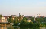
The largest peninsula on Lake Baikal. Baikal
Hello, friends! The sights of Olkhon Island on Lake Baikal impress not only beginners, but also experienced tourists. This year my friends and I decided to repeat our trip around Olkhon on a motor boat, I wanted to see unique places and sights again. The trek around the island lasted for three days. During this time, we saw much more than we planned. In this article I suggest you travel around Olkhon together with our team, you can watch a lot of videos and photos of Olkhon Island on Lake Baikal.
Around Olkhon by motor boat
Summer is the time for vacations. Despite our busy schedule and a large amount of work, we find time to relax and make our dreams come true. It happened this year as well. At first there was a short vacation, which, and then 5 days were allocated for organizing a hike around Olkhon Island on Lake Baikal.
This year marks 10 years since our trip around Lake Baikal on a motor boat. To get around Lake Baikal, we needed to walk more than 2000 km on water and spend 21 calendar days on it. This year we could not spend 3 weeks hiking, it is a great luxury in terms of work.
Therefore, it was decided to see the sights of Olkhon Island, which is on Lake Baikal, from the water. To do this, it was necessary to go around Olkhon in a motor boat. In addition, such a trip took only 3 days, plus two days for the road to Lake Baikal and back.

As you can see, there are not a single tree on the southern part of the island.
I must say that there are a lot of attractions on the island. It will not be possible to list them in this article. There are natural attractions such as Shamanka Rock, Cape Khoboy, and there are historical monuments and archaeological sites, of which there are 143. Of course, visiting all sites in one trip is simply unrealistic.
In the future, I plan to write a book where I will talk about Olkhon Island in more detail, where it will be possible to describe the main attractions, attach their photos.
So, first things first. To organize the trip, we decided on the participants. It so happened that only 50% of the previous team - Anatoly Korobkin, me and my son Vanya - managed to go on a hike. There were no difficulties with the organization. We wrote a list of necessary things and products, decided on the date of the hike, the route and more! The start of the campaign was scheduled for July 13th. July is warm enough, and the risk of getting into a big storm is minimal.
For those who are not in the know, let me remind you that a ferry goes to Olkhon Island from the village of Sakhyurta (popularly also called MRS). In this place, the distance from the mainland to the island is minimal and is only 3 kilometers. We don't need a ferry, but we need to get to Baikal, to the MRS. The distance from Sayansk to MRS is 550 km, so we left at dawn, and at three o'clock in the afternoon we were already in place, in the village of Sakhyurta. Taking into account the stops, this is a good result.
All the cargo was unloaded on the shore of Lake Baikal, and there was a lot of it. Judge for yourself - the boat is 114 kg, the outboard motor (forty strong Yamaha) is 80 kg. In addition, canisters, battery, spare propeller, oils, tents, sleeping bags, groceries and so on. While the guys were assembling the boat, I went to a local gas station and bought 100 liters of fuel, it should have been enough to complete the entire route. The car was left in the MRS with our old friend, whose name is Vasily. Thanks to him for the safety of the car!
Small sea on the map of Baikal, Olkhon island
Olkhon Island is the largest island on Lake Baikal, it is inhabited. There are 26 islands in Baikal in total. There are several villages on the island, the largest village in Olkhon is Khuzhir. The population of the island (excluding tourists) is over 1600 people.
Olkhon Island is located in the middle part of Lake Baikal, closer to the western coast. The island is 73.5 km long and up to 15 km wide. Olkhon in translation from the Buryat language (oy-khon) means "a little wooded". It is so - the southern and northern parts of the island are mountainous-steppe territory.
On the side of the western part of the island is the so-called Small Sea. If you look at the Maloye More on the map of Lake Baikal, you can see the presence of deep bays and many protruding capes. The distance from Olkhon Island to the mainland ranges from 3 to 22 km. The Small Sea on Baikal is relatively shallow, its average depth is within 120 meters, but in the northern part, the depth increases to 210 meters.

The sunsets on Lake Baikal are always mesmerizing
Distance from east coast Olkhon Island to the eastern shore of Lake Baikal is about 60 km. In the northern part of Olkhon Island, the width of Lake Baikal is 79.5 km. From the eastern part of Olkhon Island there is maximum depth Baikal - 1637 meters, this will be discussed below.
I will not talk about the climate of the island, I will only say that there are more sunny days on the island than in Sochi. I often observed the situation when it rains on the mainland, and the sun shines on the island.
If you look at the Maloye More on the map of Lake Baikal, you can easily see that the length of the coastline is much greater than the length of Olkhon Island. In reality, our route around the island was more than 200 kilometers. After all, it is not interesting to follow the shortest route from cape to cape at a distance of 4-5 km from the coast, in this case it will be impossible to see the sights of Olkhon Island. Sometimes we passed from the coast only 20-30 meters.
Baikal MRS, Olkhon Gate, the beginning of our trek
At the very beginning of the hike, the route was determined, we decided to go along Olkhon west coast along the Small Sea from south to north. Then it was necessary to go around Cape Khoboy and turn south along the Big Sea and return to the starting point. The length of the route is just over 200 km. Theoretically, this route can be completed in one day, but this is subject to good weather and the absence of the excitement of Lake Baikal.
We know from experience that Baikal is calm in the morning and in the evening, which means that it is quite possible to walk around the island in three days. On such a trip, you can afford to relax and admire the sights of Olkhon Island.

View of the Olkhon Gate, the narrowest point between MRS and Olkhon
As it was written above, the boat was assembled and loaded with things at Baikal in the MRS by 18 o'clock. It was a sin to sit on the shore. And so we moved away from the shore of Baikal MRS, lowered the engine and went along the waves of the Olkhon Gate. Olkhon Gate is a strait that separates Olkhon Island and the mainland. By the way, in 2005 a high-voltage cable was laid along the bottom of the Olkhonskiye Vorota Strait and electricity was supplied to the island for the first time.
The Olkhon Gate Strait is the most dangerous place for shipping. The fact is that opposite the Olkhon Gate is the Sarma Gorge, from where a strong wind called Sarma suddenly breaks out, the wind speed can reach 40-60 meters per second, and the wind appears suddenly.
The Olkhon Gate connects the Small and Big Sea, there is always a wave here. In windy weather, the wave height can reach 5 meters. At the time of the start of our trip, the wave was quite acceptable and allowed the boat to go at a decent speed. In 15 minutes we were already at Cape Kobylya's head. This cape is very interesting, historical and tragic events are associated with it, but I will tell about this in the pages of a future book.
At the helm, we will go to the Small Sea and forward to Khuzhir

Cape Kobylya's head close up

Cape Kobylya head, lighthouse
A beautiful view of the Olkhon Gate opens from Cape Kobylya Golovaya, in the video above you can see a ferry that transports cars to the island. We did such shots before from water and from ice, but they are always beautiful.
Having skirted Cape Kobylya's head, we went out into the vastness of the Maloye More. The excitement abruptly decreased, and our boat cut small ripples in the water of Lake Baikal. We walked at a decent speed, admiring the beauty of the Olkhon banks. We were accompanied by various birds on Lake Baikal - gulls, cormorants, scoops and ducks, one might say, competed with them in speed.
Imperceptibly we approached the island of Ogoy, on which the Buddhist Stupa of Enlightenment is installed. The length of Ogoy Island is about 3 km, with a width of only 600 meters.

Ogoy Island, Buddhist Stupa of Enlightenment

Rocks of the Small Sea
Many tourists come to Ogoy Island - in summer on water, in winter on ice. And you can see enough ahead big Island Castle. In a few minutes we drew level with the island of Zamoga, which remained on the left, and on the right a wonderful view of the large Tagay Bay and Lake Khankhoy opens up.

Such stones sometimes fall into the water.
Tagay Bay is famous for excellent fishing. In the old days, we fished there many times, caught Baikal grayling and even omul. As for Lake Khankhoi, the people call it Ilga, apparently due to the fact that there is a village nearby called Yalga. Calling it a lake is also not entirely correct. The fact is that Khankhoi is separated by a wide sandy beach spit, but there is still a strait with Baikal 6-8 meters wide. Through this strait, water is exchanged in the lake and fish enter. There are always a lot of tourists on the lake, because the water in it warms up well, there are a lot of fish in the lake.
We successfully passed Cape Khungai and approached the Small Tagay Bay, the vastness of the rather large Khuzhir Bay opened before us. Despite the evening time, the wind intensified and Barguzin blew. The front of the wave became steep, the waves began to overwhelm the boat. Reducing the speed to 10 km per hour did not help much. It was decided to stay for the night near the village of Malomorsk, which is 4 kilometers from the village of Khuzhir.
We promptly unloaded the boat and set up tents. We whipped up dinner and enjoyed the sound of the evening surf from the intensifying Barguzin. Anyway, we were able to walk more than 40 kilometers along the picturesque bays of the Small Sea.
Olkhon Khuzhir, Kharantsy
The next morning, Barguzin died down, there was no a big wave but it was inside the bay, off the coast the wave was decent. Despite this, it was decided to go out into the vastness of the Small Sea of Baikal. We quickly loaded the boat, pumped it up and set off. And here in the distance Olkhon, Khuzhir. The village of Khuzhir was clearly visible from the Khuzhir Bay. From a distance we recognized the buildings we were familiar with, because we had been to Khuzhir dozens of times.

We entered the waters of the Khuzhir Bay, ahead of Cape Burkhan (Shamanka)

This is the main village of the island, the village of Khuzhir. Wooded mountains are visible on the island, and behind them the Big Sea

Cape Burkhan (Shamanka), this is a visiting card of Olkhon and Baikal, the picture is often shown on TV

Saraisky Bay begins behind Cape Burkhan
It was impossible to raise the speed of the boat above 15 km per hour. The wave was short with a steep front. When the bow of the boat hit it, water got into the boat, I had to go at the engine speed slightly below average. We slowly approached Cape Burkhan (Shamanka), rounded the cape. The places are very beautiful. The rocks look completely different from the water than you look at them from the shore. We shot photos and videos - impressive.
After Cape Burkhan begins Saraisky Bay with its many kilometers of sandy beach. Despite the early morning, the beach is already full of tourists and vacationers. The wave became smaller, which made it possible to increase the speed of the boat. Admiring the beauty of the coast, we imperceptibly approached the village of Kharantsy. It is a small village with a population of about 100 people.
There are several camp sites in Kharantsy. On the steep bank of the village we see a children's camping, and ahead of the course is the island of the same name with the village - the island of Kharantsy.
Kharantsy Island is connected to the coast by an underwater spit, which is intuitively easy to guess. Slow down just in case. So it is, the screw clings to the bottom, I had to go through this section by oars. And in 5 minutes our motor already hums merrily over the Baikal surface and carries us to the Edor Island. We know for sure that there is a bird colony on the island.
Birds (cormorants) on Lake Baikal. Bird market on the island of Edor
Approaching the island of Edor (popularly called Belenky), they turned off the engine. There was a desire to listen to the birds that live there. Birds live on Baikal everywhere, but they still prefer secluded places far from humans. Now cormorants on Lake Baikal are the predominant species, and five or seven years ago there was no cormorant. At that time, the seagull was the main bird on Lake Baikal.
We rowed to the island. The birds were indignant with a loud cry, but did not fly away, which allowed us to make good shots. After the end of the photo session, we started the engine, and went on, towards Peschanka. The coast of Olkhon in this place is steppe - not a single tree, but in the middle of the island you can see a dense forest of larch and pine.
The village of Ulan-Khushin (Khalgai) with a population of 46 people remained on the right, and a wonderful view of Cape Budun opens ahead along the course. By the way, the name of the village in Buryat means Red Cape, which justifies the view of the coast.
Cape Budun rises 100 meters above the mirror of Lake Baikal, from here a magnificent panoramic point opens onto the Maloye More (previously checked from land). When approaching closer to the coast, numerous caves and grottoes are visible, which the Baikal water has made in the stone for thousands of years.
After passing the Ulan-Khushinsky Bay, the majestic Nyurgansky Cape opens in front of us. We walked close to the coast and at the bottom were visible huge boulders. Some of the stones reached the size of a three-room apartment - impressive, a must see. Having rounded the cape, we found ourselves in the waters of the Nyurgan Bay (bay). There are always a lot of tourists here. Still would! The bay is relatively shallow, the water warms up well, excellent sand beach and the forest comes right up to the water.

At the bottom of the cape there are cobblestones the size of a three-room apartment.
Tourists feel very comfortable here. In the shade of the forest, you can put a car and a tent, here you can swim and fish, and the view of the Small Sea is simply mesmerizing. We ourselves often come here to rest as families.
Small sea bays on Baikal, Darlatinsky gulf
Despite such beauty, we move on. Barguzin began to intensify, the wave became larger, we had to come closer to the shore, it was a little quieter there. The ancient Peschanka appeared ahead. It's hard to believe, but at the end of the 30s, Correctional Facility, which was part of the GULAG system.
Ahead we saw a destroyed pier (only pillars remained), because here they used to overload fish. Go ahead. Ahead opens up a view of Cape Sasa, and the wind intensifies and makes our movement almost impossible. I had to dock on one of the beaches near Cape Sasa. Surprisingly, there were holidaymakers here, despite the terrible roads in the area.
While the sea was stormy, I had to take up the preparation of dinner and rest. By 16-00 the wind had subsided a little, and we decided to move on, but after walking only 5 kilometers, we had to look for shelter in the bays again. By that time, we entered the waters of the Darlatin Gulf.
It was risky to go further, after 8 kilometers the Small Sea ended, and the waves of the Big Sea were many times larger, in addition, it was more difficult to find a place for a safe stay there. So it was decided to moor and spend the night on the shores of the Darlatin Gulf.
I already wrote that the bays of the Maloye More are very beautiful, each bay is beautiful in its own way. And the Darlatin Gulf looks very beautiful. The bay was filmed and photographed, you yourself can appreciate its beauty. Beautiful rocks, forest, the energy of this place is simply off scale. I really liked it here.

One of the most beautiful bays of the Maloye More

Despite the remoteness, the place is equipped for recreation. There is a table, a stove, a bathhouse and just a platform for setting up a tent.

Small pebbles in the waters of the bay

Workers in the wild on Olkhon
We quickly unloaded the boat, organized drying of clothes (after all, we got wet with waves). As it turned out, the bay was chosen by local fishermen. There was a table with benches, a bathhouse was built, there was a winter quarters in the forest. After setting up the tents, we decided to go fishing a little, because the places here are haryuz. Not far from the coast, a seal periodically emerged, which means there is fish here.
It was beginning to get dark, we were here completely alone, when suddenly a motor boat began to approach the shore. It turned out that this place was chosen by a tourist from Italy named Fabrizio. He rented a boat in Khuzhir and agreed to rent a winter house. In the evening we sat together and talked in English over a bottle of good wine.
In the morning we got up early, Baikal was like large mirror, not a single wave, it's a sin not to walk on such a surface. We quickly packed our things, loaded the boat. And here Fabrice came to see us off. He arrived in Darlatin Gulf for 5 days. Only 8 kilometers remained to the northern tip of Olkhon Island, and maybe less. The speed of the boat is 30 kilometers per hour and after 15 minutes we are already rounding Cape Sagan-Khushur. Ahead is visible the spire of Cape Khoboy, at full steam, cutting the Baikal surface, we rush to it.

Northern part of the island, cliffs Three brothers
Olkhon, Cape Khoboy, Uzury pad
Cape Khoboy Olkhon is the border of the Small and The great seas Baikal. Here shallow depths end, here calmness and smooth water ends. There is always a wave on the Big Sea. I must say that the wave is gentle, which does not prevent the boat from going at a decent speed, such a wave does not overwhelm the boat.

A fang is visible in the distance, this is Cape Khoboy itself north point islands
If you watched the video and photos, then you noticed a natural spire at Cape Khoboy. For this reason, Khoboy, translated from Buryat, means fang. This cape is the northern tip of Olkhon Island. From the water, one of the rocks resembles the face and bust of a woman - this is the Virgo rock.

Deva rock at Cape Khoboy
If you paid attention, the rocks in front of Cape Khoboy are orange in color, this is not the color of the stone, this is the color of the lichen that covers the rocks. Of course, you can tell a lot about Khoboy. Plants of the pre-glacial period are present on Khoboi, there is a kind of magnetic field here, a powerful outlet of astral energy is noted on the cape. It is not for nothing that shamans gather at Khoboi. It is noted that mirages and flying saucers often appear on Khoboi. In general, this is an amazing place and it is impossible to tell everything about it in this article.
So, the boat carries us along the eastern coast of Olkhon Island. You can feel the energy of something big, the water is dark blue. This indicates a great depth in these places.
We are walking about a hundred meters from the shore. We are accompanied by steep and high cliffs, if there is a storm, then there is nowhere to stick. And here on the horizon is Cape Left Shunte. This is an interesting cape along with the Rock of Love, but I will not talk about it now, this is a separate story. Grayling splashes on the water surface, but there is no time to fish, you need to go forward.


These are such bizarre rocks, you can see how the magma solidified.


Quickly enough we reached the Haga-Yaman Bay, from where a beautiful view of the Uzury pad opens. This is the only place on the eastern coast of Olkhon Island where people live. Several families live here. In Uzury there is an operating meteorological station and a laboratory from the Siberian Institute of the Earth's Crust. In Uzury, in summer period, there are always vacationers. The bathing water is very cold, but it pays off with a beautiful view of Lake Baikal, the surrounding mountains and good fishing.

View of Uzury from the Haga-Yaman Bay, in the distance you can see a windmill and a solar battery

Anatoly prepares lunch and tea on a gas stove

View of Uzury, from the side of the site for vacationers

We went ahead, and the Uzurs stayed behind the cape.
Uzury is very ancient settlement... Archaeological finds say that people lived here as early as 4-2 millennia BC. By the way, the energy in Uzury is also anomalous. It is not for nothing that even on the maps, UFOs often visit the waters of the Haga-Yaman Bay. My close friends saw a saucer flying out of the waters of the bay with their own eyes three years ago.
So, back to our trip. Since in the morning we were in a hurry to pass the maximum on smooth water, we did not even have time to drink tea. For this reason, we decided to go to Uzury, make breakfast and hot tea, which was done. And after an hour and a half we are back on the water. Under the even hum of the engine, the boat carried us to Cape Shunte-Pravy and Cape Izhimei.

Each part of the coast was beautiful in its own way. There were rocks where the geological past was reflected - it was visible how magma solidified in layers, caves were visible that washed out the Baikal storms. Were sheer cliffs, which steeply went into the depths of the lake. In one place there was a balcony - a part of the rock fell into Lake Baikal, and from above there was a floor as flat as a table. It's a pity the photo of this balcony did not work!
Mount Zhima and Cape Izhimey
Observing the beauty of the eastern part of the island, quickly enough, we come to Cape Izhimey. Mount Zhima is visible, this is the highest point of Olkhon Island, its height is 1274 meters above sea level. The weather began to deteriorate, the wave intensified. I had to slow down the boat a little. In a few minutes we are already at Cape Izhemey. Opposite us, five kilometers from the coast, the maximum depth of Lake Baikal is 1637 meters.

On the way to Cape Izhimey. We see high mountains.

It's amazing how this lonely tree grows in such a place
We wanted to record the interview from the point where the maximum depth is, but after moving a little more than a kilometer from the coast, we realized that this was not so easy to do. There was a big wave, the boat was flooded with water. The interview was recorded when the depth of a kilometer and a tail was under the boat, this is also impressive.
Much has been written and told about Mount Zhima. This place is considered sacred and is visited by shamans. They write that in the Izhimei area there is an increased radioactive background, obviously, there are deposits of uranium ore. Many different legends are associated with Cape Izhimei. By the way, the energy in the area of Cape Izhimei is amazing and you can feel it.
There would have been more time, it would have been possible to stop at Cape Izhimei, but we had to go further.
Baikal seal, video and photo
In the area of Cape Izhimei, we again came closer to the coast, there was acceptable sea waves and went further towards Cape Wuhan. We were surprised by the huge number of seals, which rested and basked on the stones. At each rookery there were tens and hundreds of them, and the rookery stretched for kilometers.
When approaching the rookery, the seal immediately dived into the water, shoot a normal video and take a photo good quality did not work. Even if we were rowing, the seal would not let the seal get close, it has good eyesight and good hearing. I had to shoot with zoom, and this led to the fact that the camera jerked. In addition, the wave rocked the boat, and it was unrealistic to catch the seal in focus in the zoom mode. But filmed, as filmed, something can be seen.
I have been to Lake Baikal many times, I have been to various parts of Lake Baikal, but this is the first time I have seen such a number of seals. It takes tons of fish to feed thousands of seals. This means that there are a lot of fish on the Big Sea. On the way, we meet the birds of Lake Baikal - gulls, scooters with a brood of young goslings and cormorants.

We see dozens of seals that fled into the water, but some remained lying on the stones, they are not shy
Cape Wuhan, Tashkinaya pad and end of the hike
The third day of the hike turned out to be productive, we covered more than 80 km of the way, despite the serious excitement in the area of Cape Izhimei. There are literally 2-3 kilometers left to Cape Wuhan, we saw a good place and decided to make a stop. There were only 35-40 kilometers left to the final destination, but there was no point in storming this distance, because we still had a whole day in reserve. We could walk it on flat water in one and a half, two hours.
Having chosen a good place, we moored. We unloaded the boat, set up tents, rested and went fishing. It's nice to sit a meter away from the water in the evening and listen to the sound of the surf. Everything was fine, but in the morning there was a strong wind. Far from the coast, the wave was strong, with white lambs. Nevertheless, it was decided to go to Lake Baikal, because today it is necessary to cover the remaining distance.

Cape Wuhan, Baikal storms
Our hopes were not justified, the speed was reduced to 5 km per hour, the boat was flooded with splashes, we had to look out for the bay and wait out the bad weather. The day was hot but windy. Taking this opportunity, Anatoly and I went to the local lighthouse on an excursion, took photos and videos, noted the beauty of Lake Baikal and the coast. There was no fishing, the grayling simply did not see our flies on the waves.
The storm subsided only closer to 19-00. It was impossible to hesitate, loaded quickly and off you go! And two hours later we were already at the target - on the mainland of Lake Baikal in the MRS area. On the way, we passed the Tashkinaya pad, where there were already people, we went through a fishing winter hut. In this part of the island, there were already roads to the Big Sea.

A couple of kilometers from the Tashkinei valley there is a winter quarters for local fishermen.

This is how the rocks of the southern part of the island look like - no grass, no trees

Here it is the finish line, a couple of kilometers left to the coast. View of the Olkhon Gate from the Big Sea
I will not describe the beauty of mountains, creeks and bays, this is all shown in the video presented. But it can be seen that the landscape of the island has changed dramatically - the trees have disappeared, the mountains have become bald. There was practically no place for a berth, the rocks immediately went into the depths of Lake Baikal. These places are not well suited for tourism and recreation, but they are beautiful in their own way.
Conclusion
Friends, this article is long enough. I think you made this journey with us, saw the beauty of Baikal, its mountains and bays. Even in a long article, it is impossible to show all the sights of Olkhon Island, only what we saw from the water is shown here. Olkhon is just a small part of the whole Baikal. Baikal is huge, its coastline is thousands of kilometers long and they are all different.
My blog has already published a report on the trip around Olkhon Island, these were my first articles. If you wish, you can see them - and. The articles also contain a map of Olkhon Island.
Later, I plan to write a book about Olkhon Island and tell about it many times more than can be done in an article. Despite the fact that this is not my topic, I like to share with readers my impressions and experiences while traveling. And the topic of my blog, the topic of Infobusiness, the topic of making money on the Internet just helps me to realize my dreams. Thank you friends for your patience, thank you for having the strength to read this article to the end. Good luck to you!
Receive new blog articles directly to your inbox. Fill out the form, click the "Subscribe" button
Olkhon Island is the only one inhabited island Baikal. Its area is 730 square kilometers... Its landscapes are known for their beauty and varied landscape: steppes, sand dunes, coniferous groves, hills, spruce forests, dense forests and rocks. There are almost no cloudy days on the island - there are about 48 of them a year.
There are eight settlements here, which are mainly concentrated in the western part of the island. The largest is the village of Khuzhir; more than 1200 people live in it. The main occupation of the local population is fishing.
According to Buryat folklore, the formidable spirits of Baikal live on Olkhon. Khan-Khoto Babai, sent to Earth by the highest gods, descended from heaven to this island. Olkhon is the home of the bald eagle-golden eagle Khan-Khubuu Noyon, the son of Babai, who has the gift of shamans. There is a place of worship for spirits - burkhan. In general, Olkhon is considered a sacred corner of the northern shamanic world.
Peninsula Holy Nose "Markov Mountain
This is the only peninsula on Lake Baikal and is a narrow mountain range- 53 km long, up to 20 km wide, and its area is 598 km & sup2. The peninsula rises more than 1000 m above the level of Lake Baikal. Most high peaks reach absolute height 1,651 m in the north and 1,877 m in the south. The slopes of the Holy Nose are covered with forests of pine, larch, fir, cedar with an admixture of aspen, birch, alder up to the middle of the height. In the undergrowth there are Daurian rhododendron, dushekia and dwarf cedar. 47 rivers and streams flow from the peninsula.
The Svyatoy Nos Peninsula is an isolated mountain range stretching for 53 km along the lake shore in a northeastern direction from Cape Nizhneye Izgolovye to Cape Verkhneye Izgolovye. The area of the peninsula is 598 km & sup2. The maximum height is 1877 m (Markov Mountain) in the central part of the ridge. The mountain peaks of the peninsula reach a height of 1420 m above the level of Lake Baikal, and above the level of the World Ocean the height is 1876 m. The slopes of the Svyatoi Nos Peninsula are distinguished by a rather strong dissected surface. They are cut by numerous short valleys. In the direction of the capes Verkhnee and Nizhnee Izgolovye, its heights gradually decrease to 1400 m. 47 rivers and streams flow from the peninsula.
Initially, Svyatoy Nos was an island, later joined to the mainland by an alluvial isthmus. According to calculations by the migration layer formation method, this could have happened 3-15 thousand years ago.
Ferry crossing to Olkhon island
Olkhon is the largest, the only inhabited island of Lake Baikal. The reserved nature of the island attracts tourists from Russia and foreign countries.
Travel to Olkhon Island can be done via a ferry crossing operating from May to November. The ferry, crossing the Olkhonskiye Vorota strait, runs from the Malaya Kurgutskaya bay to the Perevoznaya bay on Olkhon.
There are two ferries operating at the crossing, a large and a small one. "Dorozhnik" (small ferry) can accommodate about 6 cars, a large ferry, named the same as the strait - about 17. The ferry operates in summer all daylight hours, the interval is about an hour. There is no carriage charge.
From July to August 2013, an environmental patrol will be organized at the crossing, which is part of the project to keep the shores of Lake Baikal clean.
In winter, you can cross here along a natural ice road - when the strait freezes over, and during freeze-up, passengers are transported by a Khius hovercraft.
Ushkany Islands
Wikipedia: "The Ushkany Islands are a small archipelago with rocky shores in the middle of Lake Baikal near the Svyatoy Nos Peninsula (Buryatia), which is the summit of the underwater Ushkany Rapid or Academic Range.
The islands are composed mainly of ancient (Precambrian) crystalline limestones.
The archipelago includes 4 islands:
Bolshoi Ushkaniy Island or Bolshoi Ushkan - an area of 9.4 km & sup2, highest height above the level of Baikal - 216 meters, and the Small Ushkany Islands: Dolgiy (1.25 km in length), Thin (17 meters above the level of Baikal) and Krugly.
Covered with larch forest. On the banks there are rookeries of the Baikal seal.
Human influence on the islands is minimal; they are part of the Zabaikalsky National Park. A landing permit is required to visit the Ushkany Islands.
Attractions of Baikal


Olkhon Island
Among the three dozen Baikal islands, Olkhon Island, surrounded by many ancient myths and legends, stands out especially for its size, variety of landscapes, and the grandeur of natural monuments. Olkhon is located on the territory of the Pribaikalsky National Park and is deservedly considered one of the most beautiful places in Lake Baikal. The island is especially beautiful in autumn, when the coast is almost deserted. Covered with a golden carpet of grasses, with forests touched by the fiery colors of autumn, Olkhon obediently freezes under the mighty blows of the Baikal waves and mountain winds in anticipation of the harsh Siberian winter ...
Olkhon geography
Olkhon, the most large island Baikal, located in the middle of the lake, near the western coast. The island stretches along the coast of Lake Baikal, the length of Olkhon is 73 km (between the Khoboy and Umysh-Tame capes), the width reaches 15 km. The area of Olkhon Island is about 700 sq. Km, the length of the coastline is about 210 km.
The part of Baikal, enclosed between the western coast of the lake and Olkhon Island, is a unique body of water with a special microclimate and is called Maloye More, which speaks of exclusivity and well-known independence. The southwestern tip of Olkhon is separated from the coast of Lake Baikal by the Olkhonskiye Vorota Strait, which has a reputation as the most treacherous place on Lake Baikal.
There are at least two versions of the origin of the island's name, both stemming from the language of the indigenous inhabitants of Olkhon - the Buryats. According to the first, the name of the island comes from the word "oikhon" - "wooded", according to the second - from "olkhan" - "dry". Both are quite consistent with the appearance of Olkhon - it is both dry and wooded, so it is difficult to give preference to any one option.
The western coast of Olkhon Island, washed by the waters of the Maloye More, is mostly gentle, with rocky capes and bays deeply protruding into the coast. The eastern one, on the contrary, is mountainous, rocky, drops abruptly into Baikal, there are no deep bays here. It is on the southern coast of Olkhon that the highest point of the island is located - Mount Zhima (1274 m), towering 818 meters above Lake Baikal. And just 11 kilometers from highest point Olkhon is the most deep place Baikal - an elevation of 1637 m. In these places, the steepness of the underwater slope near the island reaches 30-40 degrees.
The southern part of Olkhon and, in part, the northern extremity of the steppe, in the rest of the space grow pine, larch and birch forests. In the middle part of the western coast of the island, from Cape Khuzhirsky to Cape Sasa, the shores are sandy. Overgrown with pines and larch trees, dissected by rocky headlands, they leave an unforgettable impression.
Olkhon is large enough to have its own lakes. The largest and most famous: Nurskoe, merging with the Zagli Bay at high level water in Baikal; Khankhoi, with a whole necklace of archaeological sites; Shara-Nur, the only one salt Lake on Olkhon; Nuku Nur, with an incredible number of aquatic living organisms.
There are no rivers on Olkhon, only a couple of small streams are known that reach Lake Baikal. In the forested part of the island, there are small springs that feed a few swamps. Despite the lack of water, new streams appear on Olkhon. In September 2004, I discovered a stream at the northern end of Saraisky Bay. It was only slightly weaker than the stream flowing near the village of Kharantsy. Having walked upstream along the channel, I found that the stream flows out of a small ravine, which, apparently, washed the stream itself. The length of the stream is 100-150 meters.
Olkhon climate
The warmest months on Olkhon are July and August. Winters are rather mild and have little snow, but longer than on the mainland. Spring and summer come later than on the mainland. Olkhon Island receives very little rainfall, about 200 mm per year - the norm for semi-deserts. The southern and southwestern parts of the island are the driest places not only on Olkhon, but throughout Baikal. The reason for this is the Primorsky ridge, through which air masses pass on the way to Olkhon. Overcoming the ridge and sliding into the Baikal basin, they heat up, which leads to a drop in relative humidity. As a result, the rains intended for Olkhon fall on the eastern coast of Lake Baikal. The usual Olkhon rain is ten drops per hour, but very heavy rains and prolonged bad weather happen on Olkhon.
The wind on Olkhon blows often and for a long time, while the winds of the northwest direction prevail. The average number of days with a wind of more than 15 m / s is 148. Due to the fact that Olkhon is stretched along the Primorsky ridge, being its spur itself, the island experiences the full force of the mountain wind, including its most ferocious variety - Sarma.
Olkhon island population
People settled on Olkhon a long time ago - a site of an ancient man of the Paleolithic era was found in the Saraysky Bay, its age is estimated at more than 13 thousand years. Currently Olkhon is the only inhabited island on Lake Baikal. Several small villages are home to about 1,500 people, mainly indigenous population- Buryats. Occupation - fishing and cattle breeding. The largest village on the island is Khuzhir with a population of about 1200 people. Here is the only industrial enterprise on Olkhon - the largest fish factory on Lake Baikal.
Fauna and flora
The wildlife of Olkhon has largely suffered from the powerful anthropogenic impact. Even the Olkhonsky reserve, created in 1977, does not help, covering almost the entire forest zone of the island. In recent decades, due to human fault, the great cormorant, bustard, wolf, red deer, roe deer, and balaban falcon have disappeared from Olkhon. Back in the 18th century, the sable was completely consumed on the island. The seal became a rarity, adoring to bask in the sun on the coastal stones. It is now possible to meet this unique animal only on the eastern bank of Olkhon. In the most last years from Olkhon, the sun eagle nesting here completely disappeared (it is also the imperial eagle, the burial eagle). The same sacred Bald Eagle, the hero of many ancient Baikal legends, the son of the Master of Olkhon, the progenitor of the Olkhon shamans, to whom sacrifices are still offered.
Currently, the island is home to 135 species of birds (sandpiper, duck, black grouse, wood grouse, Daurian jackdaw, horned lark, white-belted swift, wheatear, wagtail, etc.). Twenty species of mammals (lynx, fox, hare, squirrel, polecat, weasel, etc.), including the endemic animal - the Olkhon vole, found only in the Baikal steppes; three kinds of reptiles and one kind of amphibians. Of the large predators, occasionally in winter there are solitary wolves that penetrate the island over the ice. It is extremely rare for wolf packs to enter the same way. There are no bears on Olkhon.
Archeology
The history of Olkhon is deeply rooted in antiquity. The island has given rise to many amazing legends and stories. The rich history of Olkhon is confirmed by numerous historical monuments and archaeological finds made over more than 200 years of studying the island. There are 143 known archaeological sites on Olkhon, many of which are under state protection, these are rock paintings, ancient settlements, sites, burials, religious and defensive structures. Unfortunately, many archaeological sites were destroyed, including the most expressive of them - ancient stone walls, the purpose of which is still unknown. But the purpose for which the walls were destroyed in 1963 is well known - the quarried stone was used to strengthen the pier in the village of Khuzhir.
Natural attractions of Olkhon
On the territory of Olkhon Island there are several natural monuments protected by the state, although it is high time to declare the whole of Olkhon a natural monument and begin to really protect it.
Most famous monument nature of Baikal - Shamansky cape, also known as cape Burkhan, belongs to natural and historical monuments. Burkhan is located in the middle part of the northern coast of Olkhon on the outskirts of the village of Khuzhir. The image of the cape has actually become business card Baikal.
Landscape monuments of nature are no less picturesque: Cape Sagan-Khushun - a magnificent white marble cape in the northern part of Olkhon, and Cape Khoboy, crowning the northern tip of the island.
The spectacular Cape Kobylya Golova, washed on one side by the waters of the Maloye More, and on the other by the waters of the Olkhonskiye Vorota Strait, has been declared a geological and geomorphological natural monument.
Botanical monuments are represented by a relict spruce forest on the western slope of Mount Zhima. Yelnik was discovered in 1965 by Nikolai Mikhailovich Revyakin, a local historian and teacher of geography at the Khuzhir school. The uniqueness of the spruce forest lies in the fact that it survived from the Ice Age and survived, despite the arid climate of Olkhon, thanks to the presence of subsoil waters.
Other monuments of scientific importance are also protected: geological and geomorphological monuments - Kharansa and Kharaldayskaya bays, Sasa cape, Peschanka tract, landscape natural monuments - Zagli and Tagai bays, Bayan-Shungen tract.
How to get to Olkhon
: list, description.
Baklaniy, island
Bolshoy Baklaniy Island is included in the list of state natural monuments (landscape monument). Its shores on the north side are rocky massifs and are cut by numerous wave-breaking grottoes, with south side there is a convenient gentle slope and a small beach. Once this island was one of the most big places nesting cormorants.
Island Bolshoy Baklaniy (Shimai) is the largest of the islands of the Chivyrkuisky Bay. It is located in the northeastern part of the Chivyrkuisky Bay on the territory of the Zabaikalsky National Park. The area of the island is 0.33 square kilometers, the width is on average 250 m, and the height is about 25 m above the water level of the bay.
Larch forest grows on the island, which descends from the ridge to the very edge of the water. In places the forest is interrupted by glades, and a steep cliff rises in the south-western part of the island. Rock - a cliff from the side looks as if isolated and resembles a foreign body of the island. Previously, cormorants nested on the island, but now it is a habitat for wood grouses, who, with the onset of spring, arrange their passionate grouse currents.
A multilayered Bronze Age - Neolithic settlement has been discovered on the island. There are ID serifs. Chersky (1878) and V.V. Lamakin.
The distance from the village of Katun to the island is 6 km. You can visit the island with the permission of the ZNP administration. The time spent on the island is very limited to 30 minutes.
Cormorant stone, island
The only island in the southern part of Lake Baikal. In the past - the largest cormorant nesting colony. The Baklaniy rock rock 15 m high lies 160 m from the coast on the edge of a shallow with a depth of less than 5 m. The rock is devoid of vegetation, the top of its eastern part looks like a tower. The passage of ships with a draft of up to 2 m is possible between the rock and the mainland.
Very a nice place- it can often be seen in photographs dedicated to Lake Baikal, in the paintings of artists. Until the middle of the twentieth century, this rock was a favorite place for cormorants.
White Stone, island
White Stone Island is located in the Chivyrkuisky Bay. It is a natural monument and is declared a protected area of the Trans-Baikal National Park, so access to it is limited.
Bokuchan, island
Bokuchan Island is located in the northern part of Lake Baikal. The island is rocky and rather high. The island is rarely visited, when you go down to the ground, you get the feeling as if no one has ever been here. No traces of fires, tents. No rubbish! And the glades are completely covered with flowers, very different: daisies, cornflowers, bells ...
Borakchin Island is one of the small satellite islands. Oltrek is the second name of Borakchin island, on modern maps the island is named so. There used to be Borakchin. The island looks like a huge reptile that gave the name to the people "Crocodile". The remains of the Kurykan (ritual site of the Kurykans, the founders of the most ancient Baikal civilization) structures have survived on the island. The island is one of the few islands in the Small Sea, favored by gulls, where they hatch their chicks.
Borga-Dogan, rock-island
Skala-island Borga-Dogan is located in the Small Sea, in the region of the island. The alternative name of the island is Borgodagon.
Boulder, peninsula
The Valunny Peninsula is located in the northern part of Lake Baikal. 8 km from Ayaya Bay there is a picturesque glacial Mountain Lake Frolikha. The lake is located in the depths of the coast among the wild taiga. You can only get to it on foot. From the southeast, two rivers flow into Lake Frolikha: Levaya Frolikha and Davatchan, flowing in parallel in the same valley. In the northeastern part of the lake, from where the Frolikha River flows out, there are two small forest-covered islands and a wide Valunny peninsula, a picturesque panorama of which opens up when approaching the lake through the pass from Ayaya Bay.
Upper, island
The Verkhniy Island is located in the northern part of Lake Baikal.
Long island
The Ushkaniy archipelago consists of four islands: Bolshoy Ushkaniy, Tonky, Krugly and Dolgiy. The islands are located in the middle part and represent the peaks of the Akademichesky Ridge towering above the water surface. The islands are made of marble rocks of the most unusual shades.
The territory of Dolgiy Island is reserved, like all other islands of the archipelago, it is the habitat of seals, so the huntsmen closely monitor those who come to the islands on ships. Visitors will be greeted, taken along the path to a place from where the seal rookery can be seen, they will be allowed to take pictures and - back.
Thus, only 200-300 people during the summer can admire seals on Dolgiy Island.
Edor, island
Yedor is a small rocky island in the Small Sea, as if sticking out of the water. Edor (Buryat) - "stick out".
Yedor Island is located in the Small Sea. Bypassing the grottoes of the Kharantsy island, the boat goes to the neighboring bay, where the islands of Edor and Modoto, better known as Belenky and Krokodilchik, are located. Many birds breed chicks on these islands. On Belenky, almost under every stone, in every crevice or rock, you can find a nest. When the boat approaches, the whole island starts to move: adults take off and start circling with a cry, and kids, waddling from side to side, escape in the thickets of grass.
Elena, island
Elena Island is located in the area of the Svyatoy Nos peninsula (the Buryat name of the peninsula "Khilmen-Khushun" means "sturgeon snout (nose)") in the Trans-Baikal national park.
Isohoy, island
The small rocky island of Isohoy (Elenka) is located in the middle of the Small Sea. Anchorage is possible from either side of the island at 5–8 meters. There are large boulders near the island, further from the island the bottom is stone with boulders overgrown with sponges. The island is a permanent nesting place for herring gulls.
Castle, island
Zamogoy Island is the third largest island in the Small Sea. It lies 10 kilometers south of Khuzhir, behind the island of Ogoy. Here, in spite of all the storms and winds, trees grow. In the past, patients with leprosy settled on Zamoga. Now an absolutely empty island, no one bothers there, no one goes there. Tourists sometimes ask to leave them at Zamogoye for a couple of days.
Izhilkhey, island
Izhilkhei Island is located in the Olkhon region. The island is a small rock.
Karga, peninsula
The Karga Peninsula is of alluvial origin, located in the Middle Baikal region. The peninsula separates Sor from Lake Baikal.
Posolskiy Sor is the largest of the shallow bays of Lake Baikal, separated from the main water area by sandy spits. Ambassadorial sand spits, North and South, have common name- Karga Peninsula. The length of the peninsula is about 5 km, the width is from 50 to 200 m. The southern spit is the longest young spit on. Its width varies from 30 to 200 m. The Northern Spit, after the rise in the water level in Lake Baikal, caused by the backwater of the Irkutsk Hydroelectric Power Station, is intensively eroded and dies off.
Mare's Head, peninsula
The Kobylya Golova Peninsula is located on the western tip of the northern coast of Olkhon Island in the Pribaikalsky National Park. The historical Buryat name is Khorin-Irgi. The name of the peninsula comes from the fact that one of the capes in profile resembles a horse's head. The Kobylya Golova Peninsula is a very remarkable landscape and historical phenomenon, and it was deservedly awarded the status of a state natural monument in 1981. The peninsula includes several beautiful rocky headlands, bays and even a small, but quite unusual lake... Numerous archaeological finds have been made on the peninsula. Traces of people staying on the Mare's Head can be traced back centuries for five thousand years. In the old days, this place was a cult place among the inhabitants of the island. Mare Golova separates the waters of the Maloye More from the Hoole Bay, which goes into the Olkhonskie Vorota Strait.
Kopeshka Peninsula
The Kopeshka Peninsula is located in the Svyatoy Nos region in the Trans-Baikal National Park.
Round, island
The territory of the island Kruglyi Reserve, like all other islands of the archipelago, is the habitat of the seal, so the huntsmen closely monitor those who come to the islands on ships.
Big Kyltygei, island
"Kheltege" in Buryat means "inclined". Unlike Maly Kyltygei, Bolshoi is covered with dense forest and rich in grass, in which a new species of poppy with large white flowers was found, recognized as a mysterious endemic of Shaggy Kyltygei by herbs.
Small Kyltygei, island
There are 7 islands in the Chivyrkuisky Bay: Bolshoy Baklaniy, Bolshoy Kyltygei, Maly Kyltygei, Bely Kamen, St. Helena, Pokoinitskiy Kamen and Kovrizhka.
Near the headlands in the middle of the bay there are beautiful islands: Big Kyltygei (or Shaggy) and Maly Kyltygei (or Naked, treeless).
"Kheltege" in Buryat means "inclined". Unlike Bolshoi Kyltygei, Malyi is not covered with forest.
There are bird colonies of herring and gray gulls on the island. The island is a natural monument, therefore it has been declared a protected area of the Trans-Baikal National Park, and access to it is limited.
Millionniy, island
Millionniy Island is located in the northern part of Lake Baikal, next to Yarki Island. Yarki is an island stretched along the northern coast of Lake Baikal in the form of an alluvial sandy spit with low, but in places steeply falling into the lake, shores. The end of Yarkov - Millionniy Island is the beginning of an ornithological reserve protecting birds in the Upper Delta. The river is the second most important tributary of Lake Baikal. 4 km above the mouth, the Vlasikha channel separates from the river, which, when it flows into Lake Baikal, forms a vast, low Millionniy Island.
Modoto, island
Modoto Island is located in the Small Sea. Bypassing the grottoes of the Kharantsy island, the boat goes to the neighboring bay, where the islands of Edor and Modoto, better known as Belenky and Krokodilchik, are located. Many birds breed chicks on these islands. The main population of Crocodile is seagulls. When the boat approaches, the whole island starts to move: adults take off and start circling with a cry, and kids, waddling from side to side, escape in the thickets of grass. The screams and shouts of seagulls will be remembered for a long time.
Lower, island
Nizhny Island is located in the northern part of Lake Baikal, in the Okunevoy Bay of Lake Frolikha.
Ogoy, island
Ogoi Island, stretching 6 km from the air in a narrow winding strip of land from south to north, strongly resembles a dancing dakina with outstretched arms, directed to the north: the outline of the head with shoulders in the northern part of the island and arms spread apart and bent at the elbows are clearly visible. The contour of the island can also be compared to the image of a fairytale genie released from Aladdin's lamp, when a winding snake of smoke appears from the lamp, expanding at the top to the contour of the head. The stupa, built at the highest elevation of the island (512 m), at an altitude of 60 m above the level of Lake Baikal, was located just in the chest area, in the place of the heart, the contour of the island. Ogoy Island, with its elongated outlines, strongly resembles Olkhon Island, which in turn resembles the crescent shape of Lake Baikal. Olkhon Island is located in the center of Lake Baikal, Ogoy Island in the center of the Small Sea. In poetic images, Baikal is called the blue heart of Siberia, the island of Olkhon, the abode of the formidable spirits of the lake, the heart of Lake Baikal, and the island of Ogoy can probably become revered as a "mother island". The pronounced symbolism of the triple similarity in the sacred language means that the chosen place is fertile for the construction of a Buddhist stupa. To this it should be added that Ogoy Island, in contrast to the nearby Zamogoy Island, to which patients with leprosy settled in the past, at all times remained clean. Apart from constantly nesting gulls, humans have never lived on it, i.e. this area is free from the negative energies of the past deeds of a person and can be considered "pure land".
30–100 pairs of herring gulls nest on the island annually. Ornithologists say that several years ago more gulls nested on the island, but after a fox got into the habit of entering the island on the ice in the spring and ruining the nests, nesting sites remained only on the rocky cliffs of the island inaccessible to the fox. For some reason, Ogoy Island was not included in the territory of the Pribaikalsky National Park and does not have the status of specially protected areas. Scientists have noted a very vulnerable biocenosis of the island, i.e. a collection of herbs and animals. The island has preserved relict herbs, larks and ground squirrels live.
Olkhon Island
The Russian land is rich and inexhaustible with great beauties. You can endlessly talk about them, but it is still worth dwelling on one pearl separately. Lake Baikal is not only a magnificent natural creation, but also a place that is unique in its capabilities. And in the very heart of the lake is the largest island of Baikal -. The microclimate that has developed here over many centuries is particularly mild, which is why the bathing season is longer than usual. The island's bays are beautiful during calm periods and represent the perfect azure surface.
The island itself is located in the middle part of Lake Baikal and stretches 73 kilometers in length, and reaches 10-14 kilometers in width. The total area is 729 sq. kilometers. Olkhon is separated from the mainland by a narrow strait, which is called "".
The achievements of the modern and dynamic world have little penetrated the local wonderful places, therefore, nature has retained all its splendor and naturalness. Baikal water is still considered the most delicious and clean in the whole world.
Island structure - mountain range, which is divided by narrow bays and stretches in a northeastern direction. The eastern coast of the island is mountainous and drops abruptly into the water with sharp rocks, while the north-western coast, on the contrary, is flat and strewn with small coves with a perfect sandy bottom. Although there is very little vegetation on Olkhon Island and the northern part is covered with a small forest, the whole island is mostly covered with sparse grass, interspersed with stones and sand.
The northern shores of the island, facing the Small Sea, are constantly being hit by waves, which destroys coastline... Therefore, there are a large number of different grottoes, caves and niches. By the way, Olkhon Island is the only inhabited island on Lake Baikal, and since ancient times, the remains of an ancient man who lived in the Paleolithic era were discovered in local caves. According to experts, the age of the finds is estimated at more than 13 thousand years.
Various archaeological values are often found on the island. In terms of the number that have already been discovered (and there are already more than 140 of them), Olkhon has no equal in the entire Baikal region. Among them: ancient settlements, remains of stone walls, burial grounds. The most famous of them: the ancient Kurykan protective wall, which blocked the isthmus of Cape Khorgoy.
Pokoynitsky Stone, island
Rock Island Pokoinitsky Kamen is located in the Chivyrkuisky Bay in the area of Svyatoy Nos. On the eastern coast of Svyatoy Nos there is the Pokoiniki cape, and next to it there is a rock-island Pokoinitsky Kamen. The alternative name of the island is Kurbuliksky. The exact origin of the name is unknown. One of the versions is that once upon a time, a group of fishermen died in these places, from poisoning with sturgeon. It turns out that a vein similar to soft cartilages runs along the sturgeon ridge. This is a viziga. In fresh fish, it is completely harmless, but if the sturgeon falls asleep in the water, then poison is actively released into its body. To remove the vizig, you need to cut off the sturgeon's head, and then carefully cut the tail in a circle and carefully, so as not to break, pull out the vizig.
Holy Nose, peninsula
The Svyatoy Nos Peninsula is located in the Trans-Baikal National Park. The Buryat name of the peninsula "Khilmen-Khushun" means "muzzle (nose) of a sturgeon". The peninsula was cult place Buryat shamanists. This is the largest peninsula on Lake Baikal, connected to the mainland by an isthmus barely rising above the water level. According to geological standards, quite recently, just a few millennia ago, the Svyatoi Nos Peninsula was an island and was not connected to the mainland. The island was separated from the eastern coast by a narrow strait, and two rivers - Maly Chivyrkuy and Barguzin, flowing into Baikal south of the island, little by little filled the strait with sand and silt. Baikal storms completed the business, reliably connecting the island to the mainland with a sand spit. The island has turned into the largest peninsula on Lake Baikal - Svyatoy Nos, and the strait - into a bay with many deep cozy bays, which we now call Chivyrkuisky. Only the lakes on the Myagkaya Karga isthmus, bordering Chivyrkuy from the south, serve as a reminder of the once existing strait. settlements- Monakhovo, Katun, Karbulik. At the top of the peninsula there is a mountain plateau (high-mountain tundra zone), from where a picturesque circular panorama of the isthmus of Svyatoy Nos, Chivyrkuisky and Barguzinsky bays, Ushkany islands opens up. The western slopes of the Svyatoi Nos, densely overgrown with taiga, are the very pristine nature, on the opposite side the slopes abound with many cozy bays and capes, this part of the peninsula is attractive for hiking along the trail.
Toinak island
An alternative name for the island of Toinak is Toinik. This island is located in the Small Sea. The name of this island, like the other two islands of the Small Sea (Big Toinak and Small Toinak), comes from the Buryat word "toinog", which means "kneecap". Indeed, these small islands protrude slightly above the surface of the water - like kneecaps.
Big Toinak, island
This island is located in the Small Sea. The Khuzhir-Nugaysky bay juts out into the coast between the Ulirba capes and the river delta. Sarma. In the middle of the entrance to the bay are the rocky islands of Maly Toinak and Bolshoi Toinak, bordered by shoals. The islands serve as a nesting place for herring gulls. The name of this island comes from the Buryat word "toyog", which means "patella". Indeed, these small islands protrude slightly above the surface of the water - like kneecaps.
Small Toinak, island
This island is located in the Small Sea. The Khuzhir-Nugaysky bay juts out into the coast between the Ulirba capes and the river delta. Sarma. In the middle of the entrance to the bay are the rocky islands of Maly Toinak and Bolshoi Toinak, bordered by shoals. The islands serve as a nesting place for herring gulls.
The name of this island comes from the Buryat word "toyog", which means "kneecap". Indeed, these small islands protrude slightly above the surface of the water - like kneecaps.
Slim, island
The Ushkaniy archipelago consists of four islands: Bolshoy Ushkaniy, Tonky, Krugly and Dolgiy. The islands are located in the middle part of Lake Baikal; they represent the peaks of the Akademichesky ridge towering above the water surface. The islands are made of marble rocks of the most unusual shades.
The territory of the Tonky Island is a protected area, like all other islands of the archipelago, it is the habitat of the seal, so the huntsmen strictly monitor those who come to the islands on ships.
Bolshoi Ushkaniy, island
The Ushkaniy archipelago consists of four islands: Bolshoy Ushkaniy, Tonky, Krugly and Dolgiy. The islands are located in the middle part of Lake Baikal; they represent the peaks of the Akademichesky ridge towering above the water surface. The islands are made of marble rocks of the most unusual shades.
The Ushkany Islands archipelago is the main rookery of the Baikal seal. This route is for lovers wildlife, here you can go ashore and see the animals that have become the symbol of the lake in the immediate vicinity.
The Russians, who came from the European North, having seen on these islands a lot of the Baikal freshwater seal - seals, called the islands Hare (the Pomors called the seal "bearded seal"). Later, the islands began to be called Ushkany: ushkans - in Old Siberian "hares". Here is the name and remains.
On the island of Bolshoy Ushkanye, in three caves, the sites of a person who lived 2000-3000 years BC were discovered, a pristine larch and pine forest has been preserved. Larch here has a bottle-like thickening at the base, black bark on birches, and flag-like crowns of trees. All this is inherent only in the Ushkany Islands.
There are many anthills on the island, there are more than 5000 of them. There are 19 on each hectare! And the height of the anthills themselves is up to 170 cm, the diameter is up to 3 m.
In a word, a protected area. Only seals swim, but people occasionally drop in. The gamekeepers keep a close eye on those who come to the islands on ships. Visitors will be greeted, taken along the path to a place from where the seal rookery can be seen, they will be allowed to take pictures and - back.
Small Ushkany Islands
The Ushkaniy archipelago consists of four islands: Bolshoy Ushkaniy, Tonky, Krugly and Dolgiy. The islands are located in the middle part of Lake Baikal; they represent the peaks of the Akademichesky ridge towering above the water surface. The islands are made of marble rocks of the most unusual shades.
Small Ushkany Islands are three small islands: Tonky, Krugly and Dolgiy. Compared to the Big Ushkany Island, they are quite small.
Kharantsy, island
Kharantsy Island is located in the Small Sea, in the region of Olkhon Island. In ancient times, this island was used as a sentry, observation post, therefore the name "Kharansa" in Buryat means a lookout.
Khubyn Island
The small rocky island of Khubyn is located in the middle of the Small Sea. "Khubyn" in Buryat means "baby". The island is a permanent nesting place for herring gulls.
Hunuk, island
Hunuk Island is located in the Small Sea, opposite the Sarma delta. The island is one of the ten zoological natural monuments located in the Maloye More, these are rocky tower-type islands with steep shores characteristic of Lake Baikal: Shokhoi, Borgodagon, Oltrek, Shargodegan, Zumugoy, Urungoi, Khubin, Khunuk, Bolshoi Tainik. All islands are places of mass nesting of herring gulls.
Sharga-Dogan, rock-island
Sharga-Dogan Island is located in the Small Sea, in the region of Olkhon Island. An alternative name for the island is Shargodagan.
Yarki, island
Yarki Island is located in the northern part of Lake Baikal. This is a very peculiar island. This island, stretched almost along the entire northern coast of Lake Baikal, is in the form of an alluvial sandy spit with low, but in places steeply falling into the lake, banks. After Kichera, a river near Nizhneangarsk, the surface of the island is a bare grassy plain, then a birch forest appears, then a cedar elfin. The length of the middle part of the island, the spit, is about 15 km, the average width is about 100 m, the maximum is up to 400 m. The island rises 5-10 meters above the lake level and separates Baikal from the deltas of the Verkhnyaya Angara and Kichera rivers / Severo-Baikalsky sor.
TIP: Press the double arrow and select a presentation mode !:Olkhon Island is not as famous as the lake itself, although it can rightfully be considered its heart. This island can be considered both its historical and geographical and cultural center... Its nature is interesting and animal world, but no less surprise and interest are the legends that are associated with this island, they give it an indescribable charm. It is with him that the legend about the origin of the Buryats is associated, thus, it is he who can be considered the place that is dear to every local resident. These legends are very beautiful and poetic - the Buryat peoples themselves believe that their ancestors were noble birds - swans and eagles.
That is why this island remains attractive to everyone who knows and appreciates the legends. Everyone should know the name of the largest island of the great Lake Baikal. Although there are more than one island on this lake. In total, there are 22 islands and islets in the water area. The dimensions of Olkhon are really impressive - it is 71 km long and 12 km wide, it has an elongated shape, and its area is 730 square kilometers. This island is located near the western shore of the lake, from which it is separated by the Maloye More and the Olkhon Gate. It is also noteworthy that the name of this island is forever inscribed in history, as the first place on Lake Baikal, where the Russian traveler Kurbat Ivanov set foot with 75 Cossacks. These pioneers saw an island not far from the coast and immediately decided to cross to it.
How to buy an island is not the survey that travelers were interested in. It was important for them to know the history of the origin of the name. The origin of the name of the island is very simple, it is translated from the Buryat language as "dry", this is what Olkhon means. And this name suits the island as well as possible, since the amount of precipitation that falls here every year is negligible. And its slopes, on which there is no forest, are given over to the unpretentious vegetation of the steppe belt. And this is the only island that has been mastered by people since ancient times, therefore it has become the concentration of many historical and cultural monuments people. So tourists may be interested in the stone buildings of a thousand years ago, which are made of the stones of the lake.
There are no questions about the name of the island, but there are riddles associated with the "Mongol" buildings, stone walls, which have survived, for example, at Cape Shebei. It is assumed that these walls served as a good defense against the Mongol nomads who sought to conquer the island in the 6-11 centuries. Its location is really, very good. It is located almost in the center of Lake Baikal at its deepest mark of 1637 meters, and it is located almost in the middle of the lake, if you look along the axis from the server to the south. It is in it that almost all landscapes are concentrated for which the Baikal shores are famous. And even in its outlines, the forms of the progenitor lake are guessed
In any case, every person needs to know the name of the islands, which have such amazing landscapes and incredible history. And visiting Olkhon has recently become more and more popular with connoisseurs of history and those who want to take away photos of incredible beauty from here. Nowhere else is there such a number of historical monuments as on this, the largest and famous island Baikal (in 1993 there were 143 archaeological sites). Among the most famous and interesting finds are the remains of masonry, ancient burial grounds and buildings with a long history. At the same time, the population of the island is only 1,500 people, most of whom chose the settlement of Khuzhir for life. Knowledge interesting places Russia, allows you to visit unexplored parts of the planet and get an unforgettable experience!